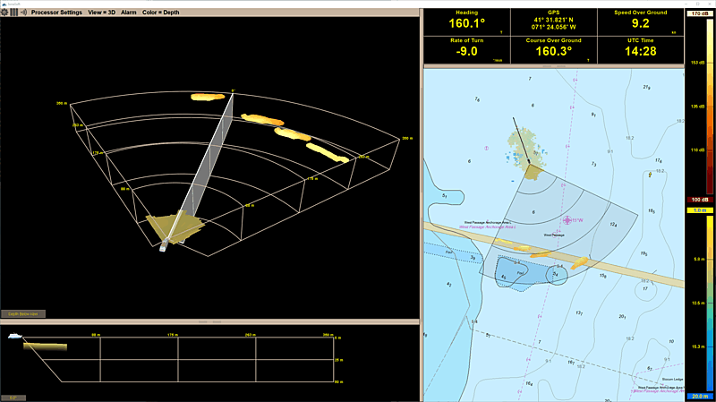
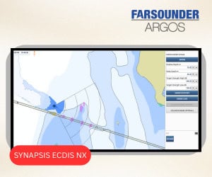
Using an Argos 500 to perform a short anchor survey north the Pell Bridge between Jamestown and Newport, Rhode Island.
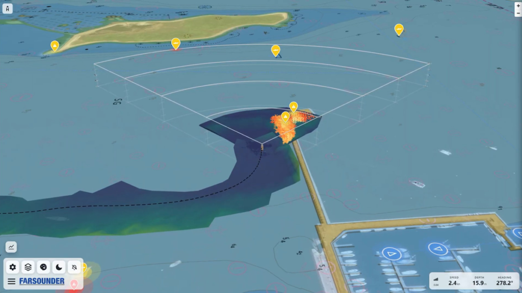
Astern of the bow and vessel, Local History Mapping data comprised of the previously recorded and averaged seafloor depths is show in both a 2D top down representation on a nautical chart in the Chart View, and in a 3D perspective view in the 3D Omni View.