Trimble Applanix, working alongside Yellowscan, discusses the delivery of a UAV solution to L’Avion Jaune for comprehensive landslide detection.
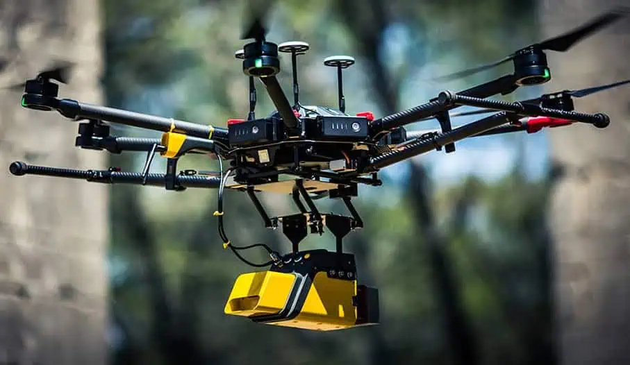
The integrated M600/YellowScan VX-20 system, featuring Trimble’s APX-20 Direct Georeferencing technology, provides an advanced approach to geohazard assessment.
Challenge
Limestone cliff degradation poses significant risks, generating unpredictable landslides and debris falls that threaten surrounding infrastructure, roadways, and human populations. Traditional risk management primarily relies on trajectory simulations, calculating potential rock mass movements based on material characteristics. However, this approach lacks the precision required for comprehensive risk evaluation.
Solution
Challenging terrain and safety constraints render ground-based surveying methods impractical. A specialized UAV LiDAR system offers unprecedented advantages:
- Rapid, cost-effective data acquisition
- Highly accurate digital terrain models
- Safe operational capabilities
- Access to previously unreachable areas
- Consistent site monitoring
L’Avion Jaune, an environmental survey specialist in France, deployed an advanced unmanned aerial platform to address these challenges.
Mission Parameters
Technical specifications included:
- Exceptional point density collection
- Centimeter-level geospatial accuracy (5 cm X, Y, Z)
- Penetration through dense vegetation
- Rapid deployment in hazardous zones
Mission Execution
The comprehensive survey involved:
- Four strategic flight missions
- 75-hectare coverage area
- Total operational duration: 6 hours
- Precision flight parameters:
- Speed: 5 meters/second
- Altitude: 60 meters, conforming to topographical contours
Strategically conducted at sunrise to minimize road traffic interference, the mission incorporated differential GPS checkpoint verification. Data processing, including trajectory computation, flight line alignment, and point cloud classification, was completed within two days.
Results
This collaborative effort between L’Avion Jaune, YellowScan, and Applanix advances geohazard mapping. The team successfully generated:
- Dense point clouds (100 points/m²)
- Precise, comprehensive digital terrain models
- Actionable insights within 72 hours
The advanced UAV LiDAR approach enables:
- Optimized material selection
- Best-practice data collection methodologies
- Comprehensive risk assessment
Ultimately, this technological partnership provides crucial insights for developing robust safety and prevention strategies, protecting critical infrastructure, traffic flow, pedestrian zones, and local ecological systems.
Read the full article here, or visit the Trimble Applanix website to find out more.