

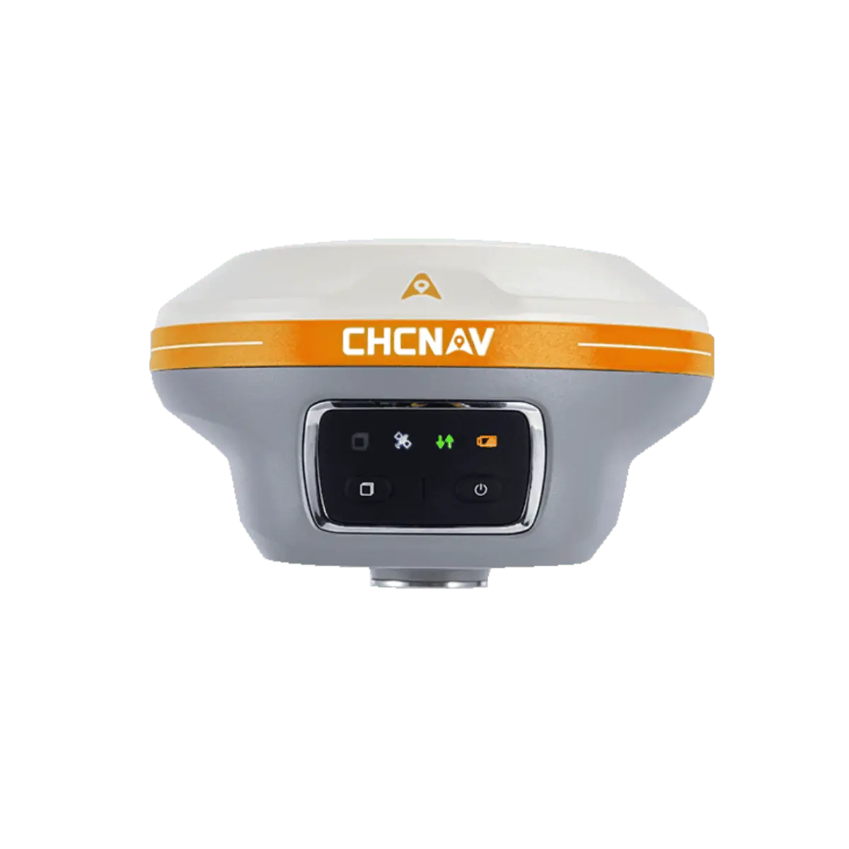


The i89 Visual IMU GNSS is a compact surveying tool equipped with a 1408-channel GNSS module, which enhances RTK availability, even in challenging environments. Its CHCNAV iStar2.0 software incorporates advanced ionospheric modeling algorithms, achieving high integrity RTK fix rate, particularly critical in regions of intense solar activity. The implementation of AUTO-IMU technology eliminates the need for manual initialization, streamlining field operations for increased efficiency. In addition, the i89 offers an impressive 16.5 hours of battery life and a lightweight 750g design, ensuring optimal productivity throughout various day-to-day surveying tasks.
The i89 features Visual Surveying capabilities, providing accurate 3D coordinate extraction from real-world video and simplifying measurements in locations with signal obstructions, limited accessibility, or safety concerns. The combination of panoramic capture mode and integrated IMU significantly improves the accuracy and efficiency of photogrammetric surveys. In addition, the integrated AR visual navigation and stakeout features can cut the operator’s workload by half, regardless of their experience level in the field.
| Size (LxWxH) | Φ133 mm x 87 mm (Φ 5.24 in × 3.43 in) |
| Weight | 750 g (1.65 lb) |
| Channels | 1408 channels with iStar2.0 |
| GPS | L1C/A, L2C, L2P(Y), L5 |
| GLONASS | L1, L2, L3 |
| Galileo | E1, E5a, E5b, E6 |
| BeiDou | B1I, B2I, B3I, B1C, B2a, B2b |
| QZSS | L1C/A, L1C, L2C, L5, L6 |
| NavIC/ IRNSS | L5 |
| PPP | B2b-PPP |
| SBAS | EGNOS (L1, L5) |
| Real time kinematic (RTK) | H: 8 mm + 1 ppm RMS V: 15 mm + 1 ppm RMS Initialization time: 99.9% |
| Post-processing kinematic (PPK) | H: 3 mm + 1 ppm RMS V: 5 mm + 1 ppm RMS |
| PPP | H: 10cm | V: 20cm |
| High-precision static | H: 2.5 mm + 0.1 ppm RMS V: 3.5 mm + 0.4 ppm RMS |
| Static and rapid static | H: 2.5 mm + 0.5 ppm RMS V: 5 mm + 0.5 ppm RMS |
| Code differential | H: 0.4 m RMS | V: 0.8 m RMS |
| Autonomous | H:1.5 m RMS | V: 2.5 m RMS |
| Visual stakeout | H: 8 mm + 1 ppm RMS V: 15 mm + 1 ppm RMS |
| Visual survey | Typical 2~4 cm, range 2~15 m |
| Positioning rate | 1 Hz, 5 Hz and 10 Hz |
| Time to first fix | Cold start: < 45 s, Hot start: < 10 s Signal re-acquisition: < 1 s |
| IMU update rate | 200 Hz, AUTO-IMU |
| Till angle | 0-60° |
| RTK tilt-compensated | Additional horizontal pole-tilt uncertainty typically less than 8 mm + 0.7 mm/° tilt |
| Temperature | Operating: -40°C to +65°C (-40°F to +149°F) Storage: -40°C to +85°C (-40°F to +185°F) |
| Ingress protection | IP68 (according to IEC 60529) |
| Waterproof and breathable membrane | Prevent water vapor from entering under harsh environments |
| Cameras Sensor pixels | Dual-camera, global shutter with 2 MP & 5 MP |
| Operating time on internal battery | UHF/ 4G RTK Rover w/o camera: up to 16.5 h Visual Stakeout/Visual Survey: up to 9.5 h UHF RTK Base: up to 10 h Static: up to 22 h |


