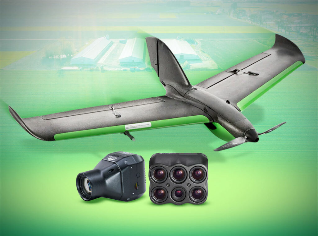
Drone Nerds has partnered with Sentera to expand its range of agricultural and industrial drone solutions, adding Sentera's PHX fixed-wing drone and multispectral sensors to its offerings
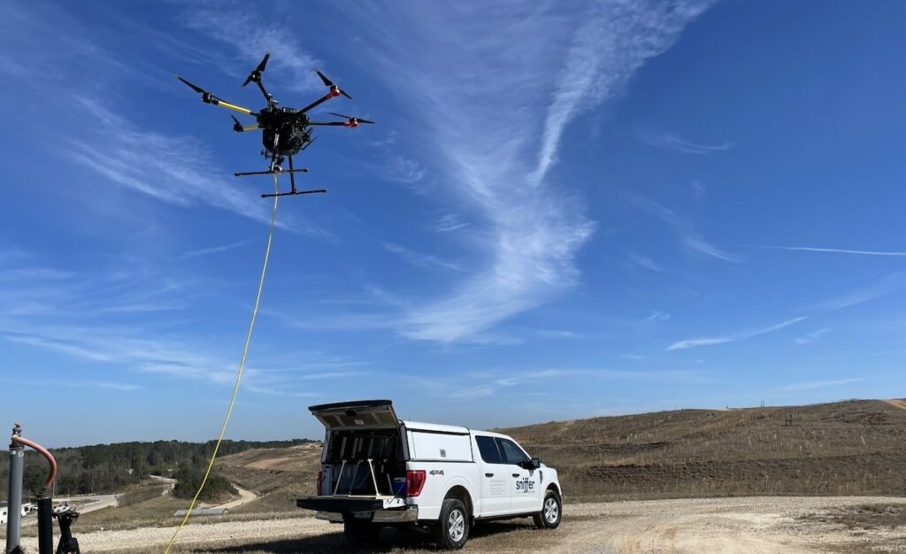
The SnifferDRONE™ performs inspections 50% faster and reduces technician's exposure to hazards, while improving the effectiveness of detecting methane emissions and the sources of land-based leaks
Verizon Frontline will provide the UAS platform, sensor, and personnel resources needed to rapidly respond and collect aerial imagery of storm-damaged areas identified by the NOAA
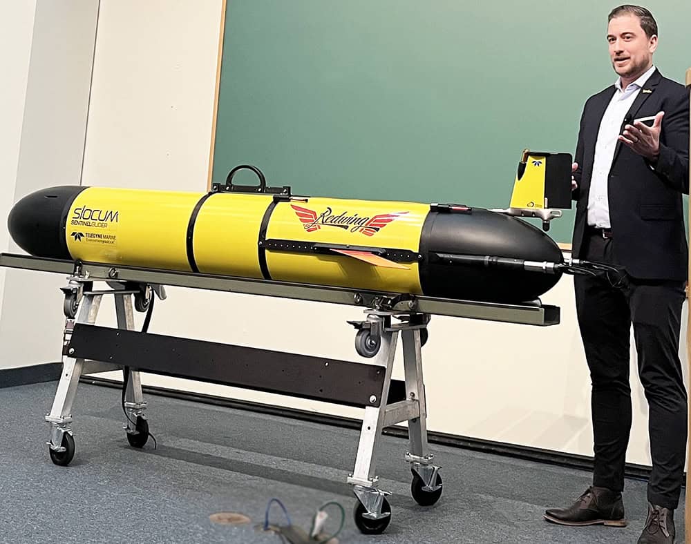
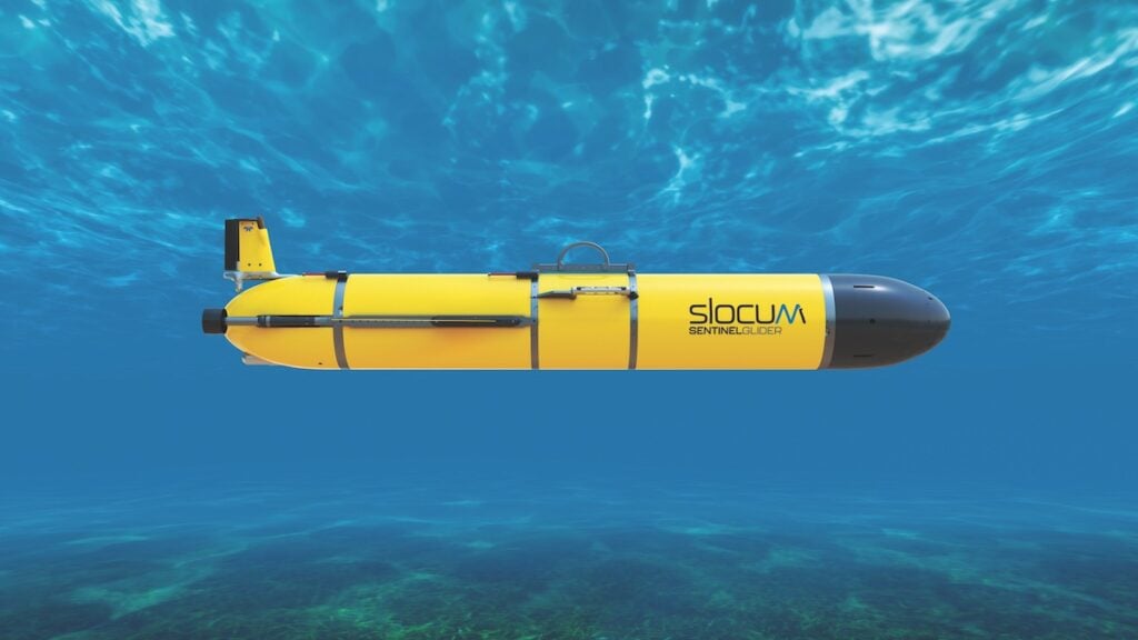
The Sentinel Mission from Teledyne Webb Research and Rutgers University will send Teledyne’s Slocum Glider around the world to contribute to human understanding of the oceans
On 15-16 May, Messe Frankfurt is hosting the first edition of Disaster Expo Europe, a summit of disaster management experts aiming to mitigate the consequences of the most costly disasters
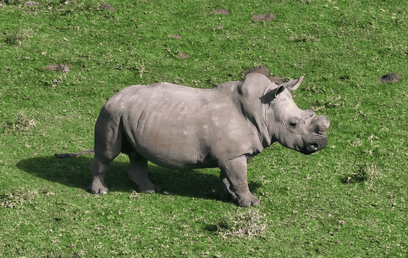
NatureEye and Jackson Wild have united to inspire schoolchildren to become environmental stewards, using real-time drone flights to enable virtual field trips above endangered species and impressive natural landscapes
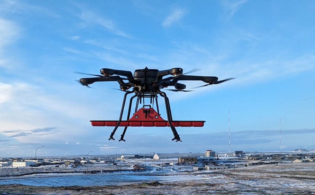
Acecore Technologies is deploying sophisticated hybrid drone technology with ground-penetrating radar to assess the aftermath of volcanic eruptions around Grindavik in Iceland
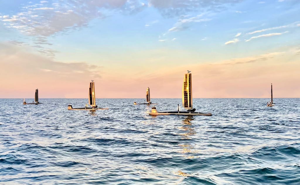
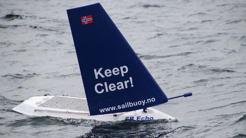
Robosys’ Voyager AI is a maritime artificial intelligence software, which delivers autonomous navigation and remote control for USV control systems at various levels of autonomy
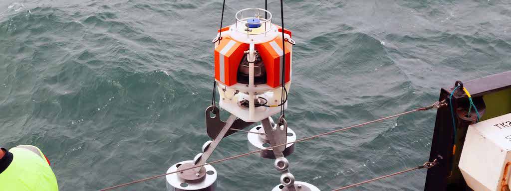
Teledyne Webb Research will debut the new Slocum Sentinel Glider at Oceanology International, an autonomous underwater vessel 13 inches in diameter, over 8 feet long, and with a standard glide speed of 0.75 knots
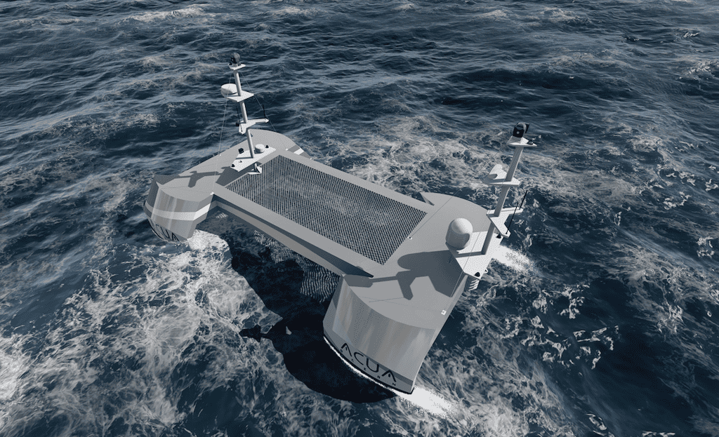
Ocean Aero’s Triton provides a tangible & dynamic hardware-software solution to many maritime concerns in Saudi Arabia, including defense, offshore oil and gas, and the environment
NBOSI’s sensors cater to autonomous underwater and surface ocean vehicles, measuring ocean parameters, tracking oil spills, and acting as a communication relay for subsea instrumentation
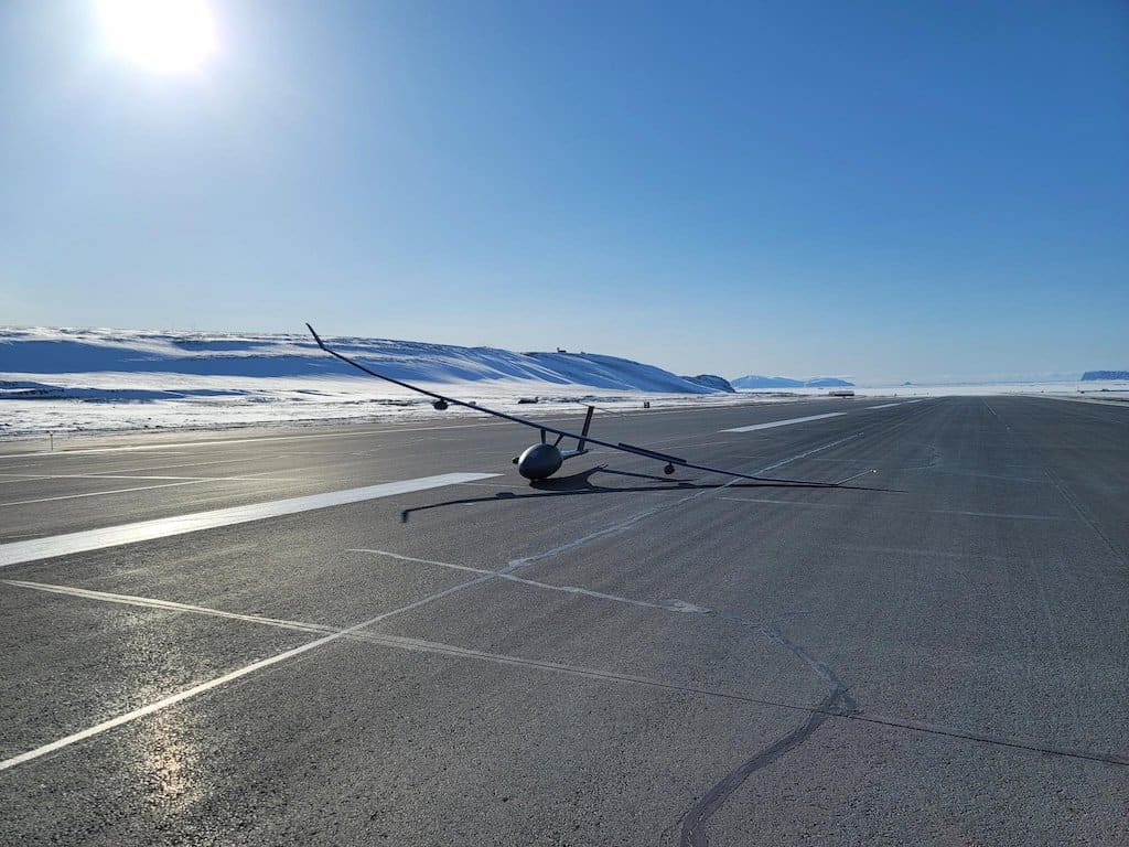
Designed for extreme environments like Antarctica, the Windracers ULTRA UAV is a fully autonomous, twin-engine, 10m fixed-winged aircraft, capable of carrying 100kg up to 1000km
Teledyne FLIR has introduced the Neutrino LC OGI mid-wave infrared imaging module to provide rapid leak detection of methane and other hydrocarbons in a SWaP-optimized package suited to drone integration
To forecast weather in the mid & lower atmosphere at a high degree of precision, the company collects data using its Meteodrones, weather drones capable of flying up to 20,000ft
Platform Aerospace tested environmental hardening technologies to operate the Vanilla UAV in subfreezing conditions, such as testing an anti‐icing coating on the propeller
Skyports Drone Services and Makutu have completed test flights for a drone inspection service to monitor quality of river and coastal water, and are now launching a pilot study with Northumbrian Water
The China-made uncrewed weather vessel’s first voyage was 110 nautical miles and lasted 16 hours, with a total potential endurance of 400 nautical miles
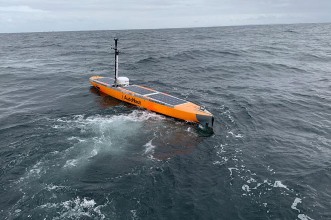
AutoNaut’s USV remotely collected data from the Sonardyne Fetch AZA BPR, changing how oceanographic data is collected and reducing reliance on ships for deep sea fieldwork
POLLi supports data collection and analysis by utilizing automated drone operations for image collection, and utilizing machine-learning cloud computing for object detection
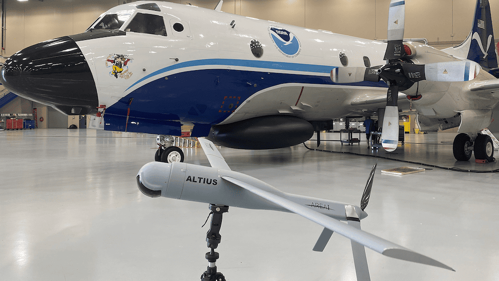
The first Black Swift Technologies’ S0 drone launch into a hurricane, along with other instruments and technology, has collected data on how storms form, build, and intensify
The sensors on board the AutoNaut USVs will provide scientists at BMS with humidity, conductivity, temperature, depth, wind and wave data to assist with Hurricane tracking
Over 1,100 Teledyne Marine Slocum AUVs have been deployed worldwide, equipped with sensors to measure various ocean parameters, including temperature, salinity, and depth-averaged currents
Advancing Unmanned Systems Through Strategic Collaboration
UST works with major OEMs to foster collaboration and increase engagement with SMEs, to accelerate innovation and drive unmanned systems capabilities forward.