


Drone LiDAR
Discover cutting-edge solutions from 4 leading global suppliers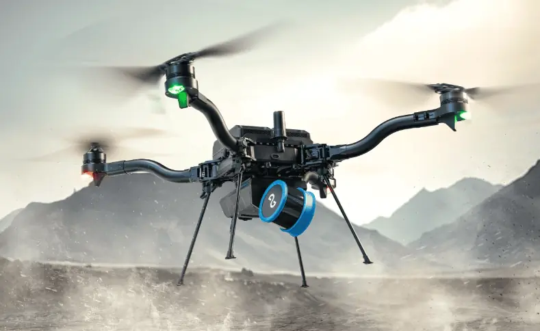
Emesent, the Australian makers of the Hovermap LiDAR mapping and autonomy payload, have integrated with the American Freefly Astro drone.
Integration with the Astro drone offers Emesent clients a new option for airborne survey missions.
“We’re extremely excited by the performance of the Astro platform, and keen to see how Emesent Hovermap users leverage the combination of Emesent technology and the Astro drone’s capabilities,” said Emesent co-founder and Chief Strategy Officer Dr Stefan Hrabar. “The latest release of our mission planning app Commander, and newly enhanced Hovermap Autonomy, will offer pilots an even easier and stress-free approach to 3D LiDAR mapping in challenging environments.”
“Professional customers have depended on Freefly Systems for the most reliable technology products for over a decade. Our goal is to create the world’s most productive drone ecosystem. Tight integration of the Emesent Hovermap on Astro raises the bar again, providing unmatched autonomy and mapping capabilities even in the most challenging environments,” said Matt Isenbarger, CRO, Freefly Systems.
Designed for physically challenging and GPS-denied environments, Emesent Hovermap captures survey-grade data, quickly and safely, providing surveyors with a high-definition 3D scan of the environment.
The insightful 3D visualizations generated from Hovermap scans enable critical decisions that impact the safety and continuity of business operations across high-risk industries such as mining, construction and public safety.


