ESA Radar Supports First Ever BVLOS UAS Flight Without Human Observers

By Mike Ball / 05 Aug 2019

Smart Sourcing for Unmanned Systems

Discover cutting-edge solutions from leading global suppliers
SUPPLIER SPOTLIGHT
Alaska BVLOS drone flight
Follow UST

Alaska BVLOS drone flight

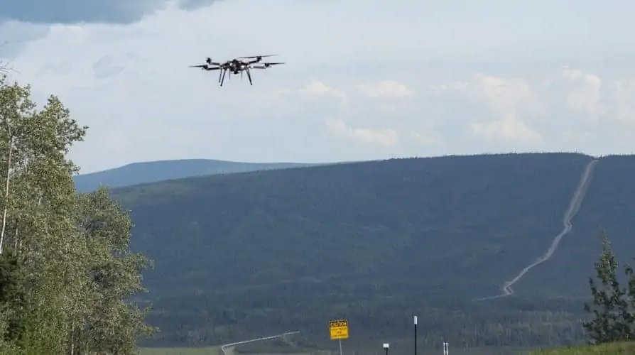
Echodyne has announced that its EchoGuard airspace management radars were the ground-based sensor for the first-ever UAS (unmanned aerial system) mission to operate beyond-visual-line-of-sight (BVLOS) flight without ground observers. The ground-based electronically scanning array (ESA) radar sensors worked in coordination with Iris Automation’s onboard detect-and-avoid system. The demonstration of a nearly four-mile linear inspection mission along the Trans-Alaska pipeline was designed and conducted by The University of Alaska’s Unmanned Aircraft Systems Integration Pilot Program (UASIPP) and the Alyeska Pipeline Service Company and is a true first for the UAS industry. All other BVLOS missions have required ground observers, which is too logistically complex and costly for business applications.

“Alaska Fairbanks’ team has shown the future of UAS missions for industrial and commercial companies,” said Eben Frankenberg, Echodyne CEO. “There are many applications that require operation beyond the operator’s sight. This practical demonstration of detect-and-avoid technologies for a real-world inspection application helps aviation authorities define the sensors and tools necessary to ensure UAS safety for dozens of industries and applications.”

Led by the University of Alaska Fairbanks (UAF) team, the test deployment consisted of Echodyne radars along the pipeline path to provide airspace situational awareness and Iris Automation’s computer vision collision avoidance technology onboard Skyfront’s long-range hybrid multicopter drone.

The U.S. Department of Transportation’s UASIPP is conducted in multiple locations across the US, and Echodyne’s sensor technology is a key part of these programs. The program encourages government authorities at all levels to cooperate with drone operators and sensor technology manufacturers to accelerate the safe adoption of drones into the nation’s airspace. The UAF team proposed several ways to pioneer safe drone use in Alaska — to deliver medical devices to remote areas, help searches and rescues, survey fish and wildlife, and monitor pipelines, roads and other infrastructure.

Operating in coordination with ground-based systems, like Echodyne radar, the Casia system from Iris Automation directs the UAS to avoid airspace collisions and assures mission safety. “The mission parameters defined by UAF really push the industry to increase sensor technology’s effectiveness,” said Iris Automation CEO and Co-founder Alexander Harmsen. “Our Casia system performed well and demonstrated that leveraging onboard detect and avoid systems is critical to mission safety and produces the results businesses are seeking.”

Posted by Mike Ball Mike Ball is our resident technical editor here at Unmanned Systems Technology. Combining his passion for teaching, advanced engineering and all things unmanned, Mike keeps a watchful eye over everything related to the unmanned technical sector. With over 10 years’ experience in the unmanned field and a degree in engineering, Mike’s been heading up our technical team here for the last 8 years. Connect & Contact

Latest Articles

High-Energy Density Batteries for Drones & Robotic Vehicles

The SCIO Brick® platform offers industry-leading energy density in a compact and lightweight footprint, and can be scaled to meet high-voltage requirements

Jul 12, 2025
Most Read Articles on UST This Week

Here’s our round-up of the five most read articles on UnmannedSystemsTechnology.com this week

Jul 11, 2025
Vertiq Speed Firmware v0.1.1 Now Available with Bug Fixes

Vertiq has released firmware v0.1.1 to correct a parameter bug affecting telemetry and 3D mode settings on select G1 and G2 modules

Jul 11, 2025
The Role of ROVs in Unmanned Marine Operations

Oceanbotics has answered the most common questions about ROVs, covering how they work, where they're used, and key capabilities

Jul 11, 2025
LiveU File Transfer Speeds Up Drone Data Delivery for Critical Missions

LiveU’s File Transfer enables rapid transmission of large drone data files, reducing delays and supporting faster decision-making in public safety and infrastructure operations.

Jul 11, 2025
Exploring Differences Between M9PLUS & M9 GNSS Antennas

Discover the key upgrades in Maxtena’s new M9PLUS GNSS antenna, including improved performance, signal purity, and multipath mitigation over the original M9

Jul 11, 2025

Featured Content

USAF Uses Inertial Labs Drone Lidar for Tree Obstruction Survey

The US Air Force successfully used Inertial Labs drone Lidar and cloud software to quickly map tree obstructions at Joint Base Lewis-McChord (JBLM), improving airfield safety

Jul 11, 2025
New UAV to Combine Solar Hydrogen & Battery Power for Extended Flight

XSun and H3 Dynamics are developing the first UAV powered by solar, hydrogen, and batteries, aiming to deliver zero-emission, long-endurance unmanned flight

Jul 07, 2025
Enhancing Mangrove Restoration Through 3D Printed Drone Design

Explore how Inverto Earth, in collaboration with HP Additive, is using sustainable 3D printing and drone technology to drive large-scale mangrove restoration and protect vulnerable coastal ecosystems

Jul 03, 2025
Advancing Unmanned Systems Through Strategic Collaboration UST works with major OEMs to foster collaboration and increase engagement with SMEs, to accelerate innovation and drive unmanned systems capabilities forward.