L3 ASV to Conduct Autonomous Vessel Navigation Research

By Mike Ball / 30 Oct 2018

Autonomous Vessels

Discover cutting-edge solutions from 8 leading global suppliers
SUPPLIER SPOTLIGHT
L3 ASV autonomous vessel research
Follow UST

L3 ASV autonomous vessel research

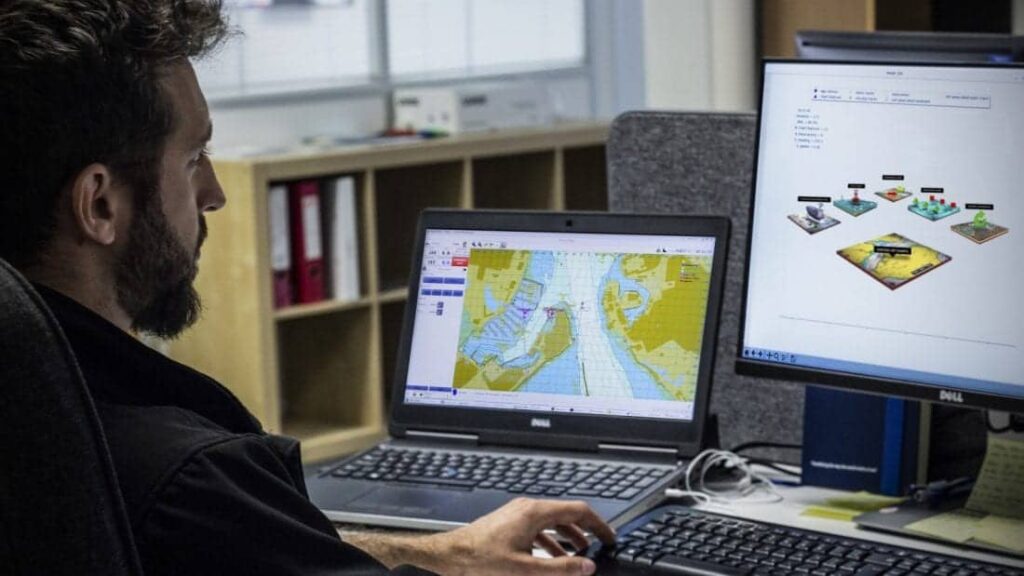
L3 ASV has announced that it has received United Kingdom government funding for a pioneering project on autonomous navigation of maritime vessels.

The company will conduct a study with its partners in the Maritime & Coastguard Agency (MCA) and United Kingdom Hydrographic Office (UKHO), focusing on the future of marine navigational data and charts. The project is funded by the Department for Transport’s Transport Technology Research Innovation Grant (T-TRIG) and aims to promote early-stage science, engineering or technology innovations with the potential to advance the U.K.’s transport system.

L3 ASV’s T-TRIG project will begin by exploring the characteristics of navigational data and charts in terms of what they comprise, their structure and how they are updated.

“Current navigational data and charts have been developed over centuries to be read and interpreted by humans,” said Dan Hook, Senior Director of Business Development at L3 ASV. “Today, and over the coming decade, more and more marine vessels will be operating unmanned, and the charts will be read by computers.”

The project will identify the technical data requirements to enable the development of a Smart Chart system, which will then provide information to autonomous vessels to enable safer navigation.

Tim Wilkes, Product Manager for the MCA, said; “Understanding the data requirements of autonomous vessels is going to be hugely important for the MCA if we are to continue to ensure the safety of navigation in U.K. waters to save lives and combat pollution. This project will help us identify some of the regulatory issues that accompany a shift to smart and autonomous shipping, and will highlight how the MCA can use its wealth of bathymetric and ship movement data to support this growing industry.”

Shipping Minister Nusrat Ghani said; “As we move through the 21st century, technology will continue to transform the U.K.’s world-leading maritime sector. Innovations such as Smart Charts pave the way for automation and Smart Shipping, and we are keen to support British companies making the most of new technologies, giving our vibrant sector a competitive edge. Technology and innovation are a key part of our Maritime 2050 initiative, which will set a vision for the growth and success of our maritime sector over the next 30 years.”

Mark Casey from the UKHO commented; “A wealth of marine geospatial data, from bathymetry depicting the seafloor to the speed and direction of the tides, supports navigation across our oceans. For over 200 years, the UKHO has supplied this information to shipping and defence to help keep mariners safe at sea. And we have developed our expertise in sourcing and processing this location-based information to help others better understand the marine environment. With this expertise and knowledge, we are well placed to help our partners identify the data requirements and standards needed to support autonomous vessels of the future.”

Posted by Mike Ball Mike Ball is our resident technical editor here at Unmanned Systems Technology. Combining his passion for teaching, advanced engineering and all things unmanned, Mike keeps a watchful eye over everything related to the unmanned technical sector. With over 10 years’ experience in the unmanned field and a degree in engineering, Mike’s been heading up our technical team here for the last 8 years. Connect & Contact

Latest Articles

Most Read Articles on UST This Week

Here’s our round-up of the five most read articles on UnmannedSystemsTechnology.com this week

Jun 13, 2025
Advanced Navigation’s Micro AUV Reveals Coral Bleaching at Remote Southern Reef

Using autonomous underwater technology, Advanced Navigation and O2 Marine have documented severe coral bleaching at Hall Bank, revealing climate impacts on one of Earth’s southernmost reefs

Jun 13, 2025
D-2 CTD Sensors Displayed at Combined Naval Event 2025

D-2 Inc. highlighted its latest underwater sensor technologies and mobile fuel testing system during Combined Naval Event 2025, held May 20–22 in Farnborough, UK

Jun 13, 2025
Deep Trekker ROVs Support Inland Demining Efforts

Deep Trekker has delivered sixteen REVOLUTION ROVs to the State Emergency Service of Ukraine, supporting underwater EOD missions through a UNDP initiative

Jun 13, 2025
Systork Launches Upgraded Linnet Mosaic-X5 GNSS Module

Systork introduces the Linnet Mosaic-X5, featuring enhanced thermal performance, microSD logging, and full GNSS support for drones and robotics in challenging environments

Jun 13, 2025
Wave Relay Devices Receive NSA Approval for Classified Communications

Persistent Systems’ Wave Relay® devices have received NSA approval for CSfC use, offering secure, commercial alternatives to legacy classified communication solutions

Jun 13, 2025

Featured Content

MEMS DC Accelerometers from SDI Deliver Superior Performance for Unmanned Systems

SDI's MEMS DC accelerometers offer a robust solution for unmanned aerial, ground, and underwater vehicles, providing precise static and dynamic motion sensing, crucial for autonomous navigation, attitude feedback, and structural monitoring

Jun 12, 2025
Calian GNSS Unveils New Anti-Jamming CRPA with XF+ Filtering

Calian GNSS has introduced the CR8894SXF+, a compact CRPA antenna with in-band null forming and XF+ filtering for resilient GNSS performance in interference-prone environments

Jun 06, 2025
Honeywell Introduces HG3900 Tactical-Grade IMU with Enhanced Sensor Accuracy

Honeywell has introduced the HG3900 IMU, a MEMS-based device with tactical-grade accuracy, offering significant SWaP advantages for precision navigation systems

Jun 05, 2025
Advancing Unmanned Systems Through Strategic Collaboration UST works with major OEMs to foster collaboration and increase engagement with SMEs, to accelerate innovation and drive unmanned systems capabilities forward.