National Agricultural Aviation Association Launches UAV Safety Campaign

By Mike Ball / 31 Jul 2015

Smart Sourcing for Unmanned Systems

Discover cutting-edge solutions from leading global suppliers
SUPPLIER SPOTLIGHT
Follow UST

Agricultural droneThe National Agricultural Aviation Association (NAAA) has announced that it has launched a UAV safety campaign to raise awareness and prevent accidents between UAV operators and low-altitude manned aircraft.

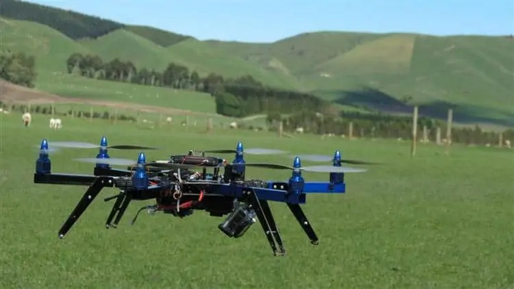
The first public outreach tool in the safety campaign is a leaflet designed for aerial applicators to share with farmers and other agricultural stakeholders. The double-sided insert illustrates the safety concerns agricultural pilots have about hard-to-see UAVs and provides recommendations for safe and responsible UAV operations in rural areas. NAAA has also produced a short video titled “Safe UAV Operations Around Low-Flying, Manned Aircraft.”

The Association for Unmanned Vehicle Systems International expects agriculture to make up 80 percent of the potential market for commercial UAVs once the Federal Aviation Administration finalizes its rules regulating the commercial use of unmanned aircraft systems. That notion has been reinforced by media reports chronicling a fervor among farmers eager to purchase their own UAV to use for crop-sensing and aerial imaging. However, NAAA is concerned that the widespread use of UAVs, without safe and proper integration, will create conditions ripe for low-level aviation accidents.

“When agricultural aviators cannot see objects they will very likely collide with them,” NAAA Executive Director Andrew Moore said. “Sadly, accidents from collisions with wires and unmarked towers have taken the lives of agricultural pilots. These kinds of accidents generally occur because of an inability by the ag pilot to see the obstacles or lack of information of their whereabouts. There’s no doubt that UAVs will have a similar jeopardizing safety effect on us if ag pilots are unable to see or locate them.”

In addition to lobbying Congress and the Federal Aviation Administration for UAV regulations that protect agricultural aviators and other low-flying manned aircraft, NAAA has enlisted its members and state association partners to help educate farmers, crop consultants, agriculture retailers and the public about safe and responsible UAV operations in rural areas. The UAV safety leaflets are one component of this.

The leaflet recommends several practices to protect manned and unmanned aircraft operating in low-level airspace, such as obtaining certification in operating UAVs, equipping UAVs with strobe lights and tracking technology such as ADS-B Out, and co-ordination with local aircraft operators.

The NAAA has also joined a coalition of aviation and UAV stakeholders in backing the “Think Before You Launch” campaign, a cooperative effort between UAV stakeholders and low-altitude aviation groups to prevent accidents by providing detailed safety information to all potential users operating in low-altitude airspace.

The coalition began as a state initiative between the Colorado Agricultural Aviation Association, the Colorado General Aviation Alliance, Avian LLC, the Colorado Pilots Association, UAS Colorado and Agribotix. With the addition of NAAA, the North Carolina Agricultural Aviation Association, the Nebraska Aviation Trades Association and other organizations, Think Before You Launch has expanded into a broader, national coalition.

Posted by Mike Ball Mike Ball is our resident technical editor here at Unmanned Systems Technology. Combining his passion for teaching, advanced engineering and all things unmanned, Mike keeps a watchful eye over everything related to the unmanned technical sector. With over 10 years’ experience in the unmanned field and a degree in engineering, Mike’s been heading up our technical team here for the last 8 years. Connect & Contact

Latest Articles

Low- & Zero-Emission Propulsion & Power Generation Solutions for UAVs

NEX Power's hybrid propulsion technologies are designed to enable next-generation applications such as UAM and heavy-lift cargo drones

Feb 07, 2025
Most Read Articles on UST This Week

Here’s our round-up of the five most read articles on UnmannedSystemsTechnology.com this week

Feb 07, 2025
Project OPTIMAS to Utilize Schiebel VTOL UAS for Advanced Optical Laser Communications

Project OPTIMAS and Schiebel are set to develop a secure, high-speed optical communication system using quantum encryption and laser technology for multi-domain defence and satellite connectivity

Feb 07, 2025
Gemini 1200id High-Resolution Sonar Optimized for Unmanned Underwater Operations

Tritech's Gemini 1200id sonar offers high-resolution imaging, advanced noise reduction, and dual-frequency capability, enhancing performance for unmanned underwater systems and mission-critical ROV operations

Feb 07, 2025
Dockstr to Offer SubC Imaging’s Underwater Cameras & Software Solutions

SubC Imaging has announced Dockstr as its new agent, extending access to its advanced underwater cameras, DVRs, and remote operation systems across key offshore sectors worldwide

Feb 07, 2025
New NDAA-Compliant FPV Drone Camera Released 

Unusual Machines has launched the NDAA-compliant Fat Shark Aura FPV Camera, offering high-performance, first-person view capabilities for commercial and defense applications

Feb 07, 2025

Featured Content

Vertiq’s 81-08 G2 Module Added to DIU’s Blue UAS Framework

Vertiq's 81-08 G2 servo motor and control system for Group 2 sUAS has become the first motor and ESC combination to be approved under the U.S. government's Blue UAS Framework

Feb 05, 2025
Compact Remote ID Receiver Released for Enhanced Drone Safety

Dronetag has introduced RIDER, a pocket-sized, drone-agnostic Remote ID receiver designed to improve airspace situational awareness and support commercial and public safety applications

Jan 30, 2025
New GCS Software Released for C100 Quadcopter

Performance Drone Works introduces PDW CORE, a comprehensive software bundle enhancing the C100 quadcopter's capabilities with a new UI, flight simulator, mission planner, ATAK integration, and fleet management tools

Jan 29, 2025
Advanced Signal Mapping Tool Released for Effective UAV Flight Planning

Elsight has launched HeatSight, a signal strength mapping tool that provides UAV operators with reliable cellular coverage data, improving flight planning efficiency and safety for BVLOS missions

Jan 28, 2025
Doodle Labs Unveils Mobile App for Managing Mesh Networks

Doodle Labs is introducing the Mesh Rider® Mobile App, providing intuitive tools for managing wireless mesh networks across devices such as ground control stations (GCS) and UAVs

Jan 23, 2025
Advanced FOG-Based Inertial Sensing Solutions for Drones & Robotics

Aegiverse's products feature a multi-layered architecture that combines multiple elements into a compact module, providing significant, size, weight and cost reductions

Jan 21, 2025