Optech Announces New HydroFusion Turbid Water Module for CZMIL

By Caroline Rees / 13 Mar 2014

Smart Sourcing for Unmanned Systems

Discover cutting-edge solutions from leading global suppliers
SUPPLIER SPOTLIGHT
Follow UST

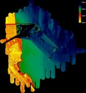
Turbid Water Enhanced Depth ResultsOptech, the world leader in the development, manufacture and support of high accuracy lidar 3D survey systems and productivity-enhancing workflow software, has released the HydroFusion Turbid Water Module, a powerful new tool that enables the Optech CZMIL Coastal Zone Mapping and Imaging Lidar to collect bathymetry data in water conditions that were previously impossible to capture.

Based on Optech’s extensive experience in lidar bathymetry waveform analysis, the Turbid Water Module is an addition to the Optech CZMIL HydroFusion workflow specifically designed to detect and extract bathymetry measurements from turbid, shallow waters and muddy, less reflective seafloors, areas where previous lidar bathymeters could not extract depth measurements. Combined with the advanced hardware of the Optech CZMIL, the Turbid Water Module has successfully made seafloor measurements from very shallow waters (depth <1-2 m) in highly turbid conditions with dark, muddy bottoms (reflectance = 3-5%)

“The new HydroFusion Turbid Water Module represents a dramatic step forward for the world of lidar bathymetry”, said Max Elbaz, President of Optech, Inc. “Up until now, lidar bathymeters were restricted to the few parts of the world with clear waters and reflective seafloors, leaving large areas unsurveyed. With the Turbid Water Module, users of the Optech CZMIL can venture into vast new areas with high water turbidity and low seafloor reflectance, and even survey right up to the edge of the shoreline for a seamless transition from bathymetry to topography.”

Posted by Caroline Rees Caroline co-founded Unmanned Systems Technology and has been at the forefront of the business ever since. With a Masters Degree in marketing Caroline has her finger on the pulse of all things unmanned and is committed to showcasing the very latest in unmanned technical innovation. Connect & Contact

Latest Articles

Exploring Differences Between M9PLUS & M9 GNSS Antennas

Discover the key upgrades in Maxtena’s new M9PLUS GNSS antenna, including improved performance, signal purity, and multipath mitigation over the original M9

Jul 11, 2025
USAF Uses Inertial Labs Drone Lidar for Tree Obstruction Survey

The US Air Force successfully used Inertial Labs drone Lidar and cloud software to quickly map tree obstructions at Joint Base Lewis-McChord (JBLM), improving airfield safety

Jul 11, 2025
UAVOS’ Rotor Blades Complete Advanced Overload & Environmental Testing

UAVOS, in partnership with ALTER, conducted overload and environmental testing on helicopter rotor blades, displaying blade reliability, structural integrity and safety

Jul 11, 2025
Robosys’ Voyager AI Autonomy Suite Integrated Onboard New USV

Robosys Automation’s Voyager AI Autonomy Suite has been integrated onboard Uncrewed Survey Solutions' new USS Accession USV, enhancing autonomous marine operations for survey and monitoring

Jul 10, 2025
Textron USV Demonstrates MUM-T Capability in FLEX25 Exercise

Textron Systems demonstrated its TSUNAMI™ USV during FLEX25 in El Salvador, supporting SOUTHCOM and regional partners in counter-narcotics operations

Jul 10, 2025
OceanAlpha’s L25 USV Showcases Successful Autonomous Marine Survey Capabilities

OceanAlpha’s L25 USV has demonstrated innovative autonomous survey operations during the vessel's first Malaysian public display at Port Klang, June 2025

Jul 10, 2025

Featured Content

New UAV to Combine Solar Hydrogen & Battery Power for Extended Flight

XSun and H3 Dynamics are developing the first UAV powered by solar, hydrogen, and batteries, aiming to deliver zero-emission, long-endurance unmanned flight

Jul 07, 2025
Enhancing Mangrove Restoration Through 3D Printed Drone Design

Explore how Inverto Earth, in collaboration with HP Additive, is using sustainable 3D printing and drone technology to drive large-scale mangrove restoration and protect vulnerable coastal ecosystems

Jul 03, 2025
Partnership Combines Drone Swarms & Situational Awareness to Boost Wildfire Response

Kongsberg Geospatial and FireSwarm Solutions have partnered to integrate autonomous drone swarms with real-time situational awareness for faster, smarter wildfire response

Jun 30, 2025
Advancing Unmanned Systems Through Strategic Collaboration UST works with major OEMs to foster collaboration and increase engagement with SMEs, to accelerate innovation and drive unmanned systems capabilities forward.