What is an INS? An introduction to OxTS’ Inertial Navigation Systems (INS)

Webinar Details
  • Hosted by
  • July 1, 2021 , 15:15 (UTC)
  • what is an INS

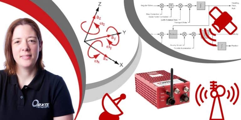
    Join Caroline Oakes, Support Manager at OxTS, for an introduction into our Inertial Navigation System (INS) technology; how it works and what it can be used for.

    We recommend this session for anyone who is new to working with an OxTS RT device (the market leading INS), or how the technology works.

    After attending, you’ll:

    • Understand how an Inertial Navigation System works
    • Appreciate the benefits and limitations of different positioning technologies (Inertial Measurement Units (IMU) and GNSS)
    • See the value of OxTS combining an IMU with GNSS when capturing precision position, orientation and dynamics measurements

    There is no charge for this service, and we will share a recording of the webinar with everyone who has registered.

    Posted by Oxford Technical Solutions Connect & Contact

    Featured Content

    Compact Remote ID Receiver Released for Enhanced Drone Safety

    Dronetag has introduced RIDER, a pocket-sized, drone-agnostic Remote ID receiver designed to improve airspace situational awareness and support commercial and public safety applications

    Jan 30, 2025
    New GCS Software Released for C100 Quadcopter

    Performance Drone Works introduces PDW CORE, a comprehensive software bundle enhancing the C100 quadcopter's capabilities with a new UI, flight simulator, mission planner, ATAK integration, and fleet management tools

    Jan 29, 2025
    Advanced Signal Mapping Tool Released for Effective UAV Flight Planning

    Elsight has launched HeatSight, a signal strength mapping tool that provides UAV operators with reliable cellular coverage data, improving flight planning efficiency and safety for BVLOS missions

    Jan 28, 2025
    Doodle Labs Unveils Mobile App for Managing Mesh Networks

    Doodle Labs is introducing the Mesh Rider® Mobile App, providing intuitive tools for managing wireless mesh networks across devices such as ground control stations (GCS) and UAVs

    Jan 23, 2025
    Advanced FOG-Based Inertial Sensing Solutions for Drones & Robotics

    Aegiverse's products feature a multi-layered architecture that combines multiple elements into a compact module, providing significant, size, weight and cost reductions

    Jan 21, 2025
    “Surveillance as a Service” UAV Solution Launched

    Volatus Aerospace’s “Surveillance as a Service" solution will use drone technology to provide secure, multi-modal surveillance for faster response times and actionable intelligence

    Jan 16, 2025