Using UgCS Mapper to Create 2D maps & elevation Offline

Webinar Details
  • Hosted by
  • June 18, 2020 , 10:00 (UTC)
  • Join the webinar to learn about the freshly re-launched UgCS Mapper as stand-alone software.

    During the webinar you will learn:

    How to start:

    – install and activate UgCS Mapper
    – create a 2D map and export into UgCS as a map overlay

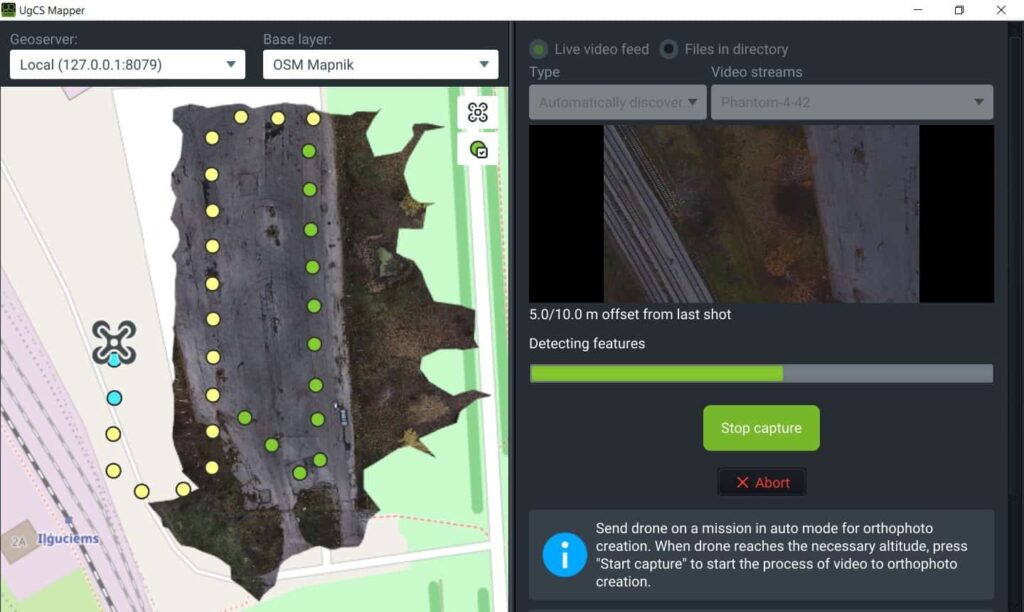
    Advanced feature for UgCS ENTERPRISE
    – Live mapping from a video stream
    – How to start: install and activate all components
    – Plan & fly
    – Georeferencing
    – Map preview
    Q&A.

    Posted by Caroline Rees Caroline co-founded Unmanned Systems Technology and has been at the forefront of the business ever since. With a Masters Degree in marketing Caroline has her finger on the pulse of all things unmanned and is committed to showcasing the very latest in unmanned technical innovation. Connect & Contact

    Featured Content

    Product Spotlight: Durable Lightweight Lithium-Ion Batteries for UAVs

    American Lithium Energy (ALE)'s energy-dense lithium-ion battery cells combine high power output with built-in safety features, ideal for UAV and eVTOL applications in challenging environments

    May 14, 2025
    SAE Media Group Releases Agenda for Counter UAS Middle East & Africa 2025

    The inaugural Counter UAS Middle East & Africa 2025 will gather global defense leaders in Amman to explore threats, technologies, and strategies shaping regional drone defense

    May 13, 2025
    New Tactical Grade IMU from Inertial Labs for UAVs & Guided Munitions

    Inertial Labs has launched the IMU-H100, a compact, tactical-grade MEMS IMU designed to enhance precision navigation for UAVs and guided systems

    May 08, 2025
    Advancing Unmanned Systems Through Strategic Collaboration UST works with major OEMs to foster collaboration and increase engagement with SMEs, to accelerate innovation and drive unmanned systems capabilities forward.