


Fixed-Wing Mapping Drones
Discover cutting-edge solutions from 4 leading global suppliers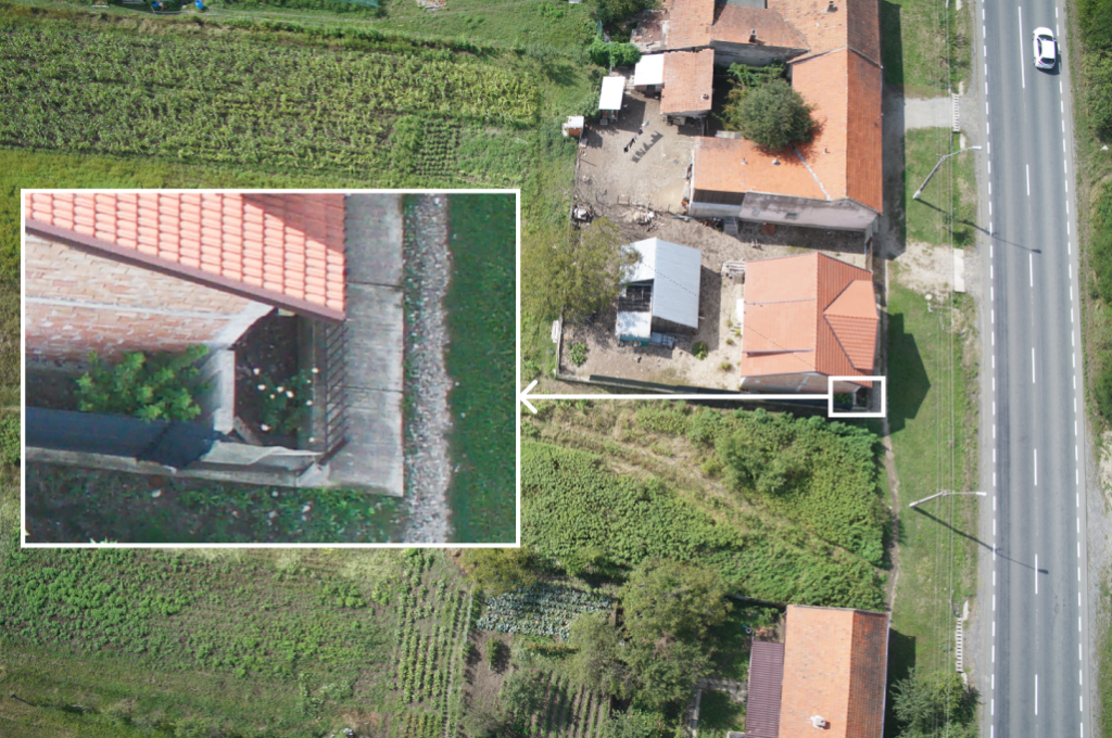
Atmos discusses the integration of mapping drones into land administration processes, with a focus on revolutionizing cadastral boundary surveys and land administration.

Unmanned aerial vehicles are reshaping traditional processes and expediting land management procedures that have historically been slow and resource-intensive.
Aerial surveying drones like the Marlyn Cobalt offer georeferenced aerial imagery that can be processed into point clouds and orthophotos. These data sources enable the identification and delineation of cadastral boundaries corresponding to physical features like fences, walls, and roads.
Beyond spatial information, aerial imagery also provides insights into land utilization, infrastructure, and buildings, facilitating urban planning and development.
In the article Modernizing Land Administration with Mapping Drones: Accelerating Boundary Surveys Atmos discusses:
- The Imperative for Enhanced Land Administration
- The Fit-for-Purpose Approach
- Mapping Drones: Enabling Efficient Cadastral Surveys
- Harnessing Drone Technology for Cadastral Surveys
- Vectorization of Drone Data
- Automated Tools and Precise Results
- Conclusion
Innovations like the FFPLA approach, combined with advanced drone technology, hold the potential to expedite land use and infrastructure development. As technology continues to evolve, the collaboration between modern methodologies and mapping drones will undoubtedly redefine the landscape of land administration.


