


Drone LiDAR
Discover cutting-edge solutions from 4 leading global suppliersIn this article, OxTS discusses using navigation data for video game development, specifically for a project one of its partners worked on to create a 3D pointcloud of Transylvania Ring racetrack.
The possible applications for 3D pointclouds are almost endless. When you think of LiDAR, the mind naturally wanders to autonomous vehicle navigation or geospatial survey type applications. In fact, navigation and LiDAR data are useful for all manner of applications. But, how is navigation data used for video game development?
When a new technology, such as LiDAR, is first brought to market, a number of factors affect the price. Initially, the cost-per-unit is likely to be high to account for the the recovery of research and development costs. However, as technology ages and manufacturers innovate and bring out new versions, price invariably comes down over time.
As this process occurs it puts the technology into the hands of a much wider audience. As a result, the number of new and innovative use cases also increases.
To create a 3D pointcloud, users must combine the position, navigation and timing measurements from an Inertial Navigation System (INS) with raw LiDAR data. Without accurate INS data it is impossible to create a pointcloud. This is because the LiDAR sensor needs to know where it is, when in time it is and its orientation.
To avoid complicated software engineering work, simple to use software, such as OxTS Georeferencer, is available to georeference the LiDAR data. Once georeferencing is complete, OxTS Georeferencer will create a PCAP file that users can view in many pointcloud viewer software applications.
Pointclouds are useful for many wide and varied reasons. Autonomous vehicle developers may use pointclouds to aid object detection and avoidance, while geospatial surveyors may want to use a pointcloud to determine road degradation over time or monitor the rate of coastal erosion.
But how can navigation data be used in applications such as video game development? Let’s first look at how navigation data works alongside LiDAR.
LiDAR and Inertial Navigation
To create a 3D pointcloud, raw LiDAR data needs to be georeferenced (combined) with the position, navigation and timing measurements from an INS. Without accurate INS data it is impossible to create a pointcloud as the LiDAR sensor needs to know where it is, its orientation, and when in time the scan took place.

Once a pointcloud is created it can be used in any number of ways. Autonomous vehicle developers may use pointclouds to aid object detection and avoidance, while geospatial surveyors may want to use a pointcloud to determine road degradation over time or monitor the rate of coastal erosion.
These are however some of the more common use cases. As LiDAR technology becomes more accessible, new and inventive ways to use pointclouds are coming to light.
Wide and varied applications
OxTS partner Dronezone is one such company finding this.
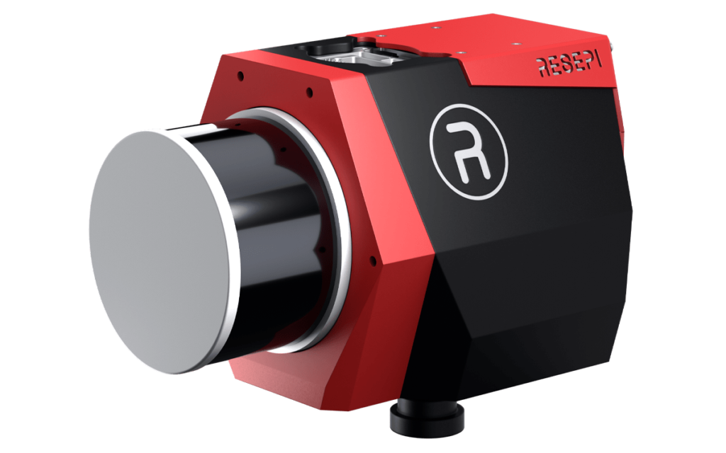
Dronezone builds and hires out professional Unmanned Aerial Vehicles (UAV). They build UAV payloads comprising of Velodyne VLP-16 LiDAR sensors and OxTS INS devices that they then sell or rent to customers who wish to undertake a LiDAR survey.

Dronezone tends to get involved with geospatial mapping projects, however they are seeing an increasing need to cater for more niche applications.
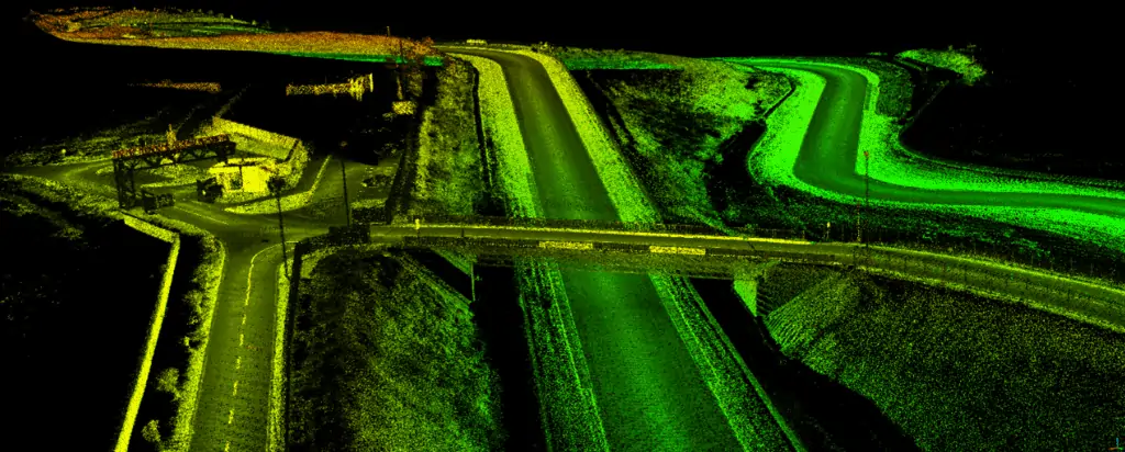
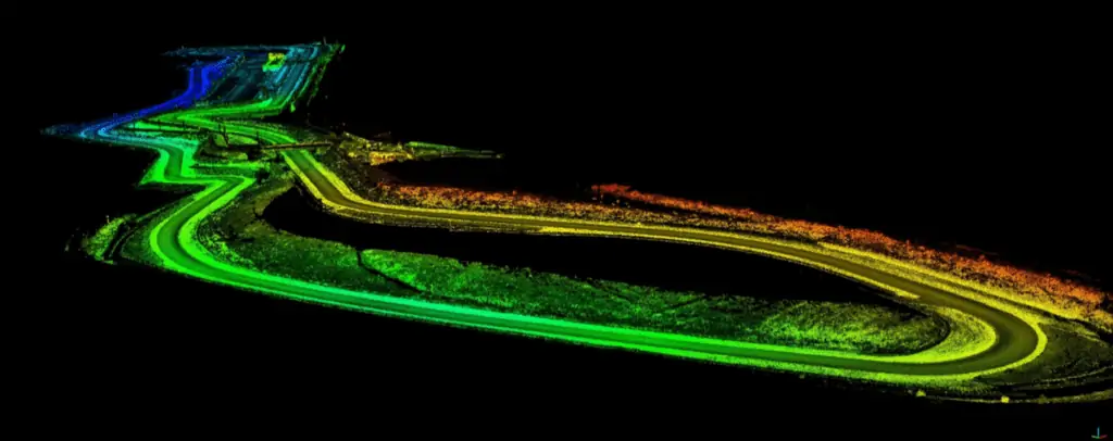
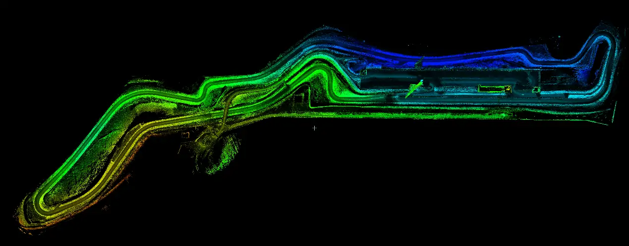
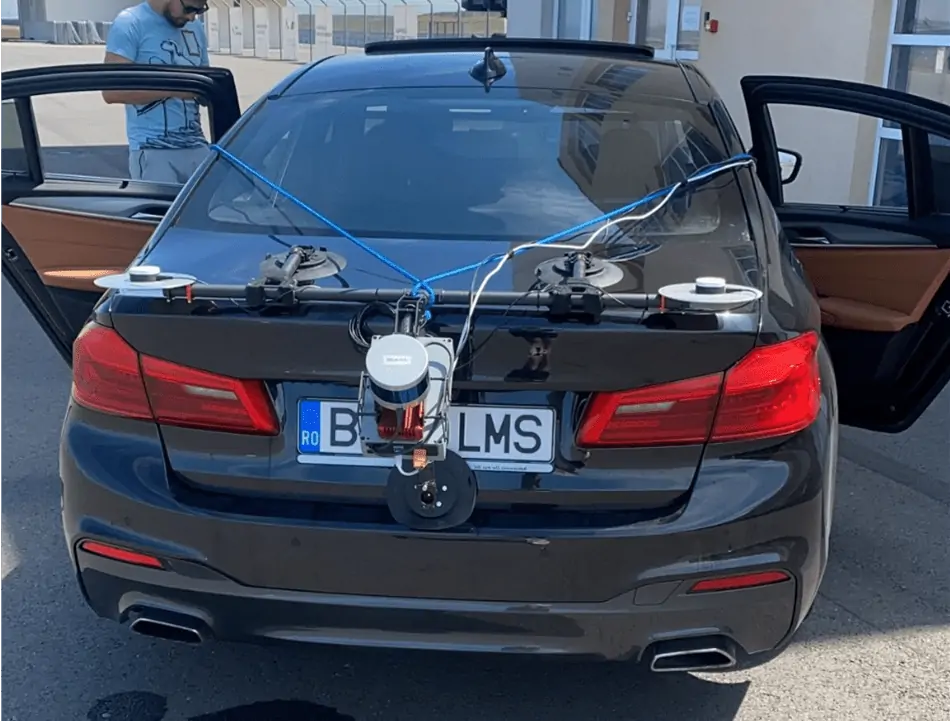
A unique project Dronezone recently undertook involved surveying Transylvania Ring racetrack. The customer, a video games developer responsible for developing the racing simulator “Assetto Corsa”, wanted an accurate digital representation of the track contours as a basis to begin their work.
They reached out to Dronezone to assist and the results, as you can see from the video and screenshots, are particularly impressive.
For this project, Dronezone decided to move away from traditional UAV based mapping. To survey the track precisely, they took advantage of the flexibility of their UAV payload by repurposing the hardware for use on a car. With many off-the-shelf solutions this wouldn’t have been possible.
This set-up enabled Dronezone to complete multiple laps of the track and create a high density pointcloud as seen here in this article.
“Using different components to build a UAV payload meant that Dronezone could reuse the hardware and build a different set-up suitable for use on a car. It’s this flexibility that allows Dronezone to serve multiple applications”
Paris Austin, Head of Product – New Technology, OxTS
To further improve results, Dronezone used the Boresight Calibration feature within OxTS Georeferencer to calibrate the coordinate frames of the LiDAR sensor and INS. This process, which involves a short survey of two retroreflective targets, increases the clarity of the final results and eliminates blurring and double-vision.
You can find out more about the boresight calibration module within OxTS Georeferencer here – OxTS Boresight Calibration
The quality of the data produced has given Dronezone confidence that they can win more business from the same customer to map further tracks for the game.
This is just one example of the new and unique applications we’re currently working on alongside our customers.
OxTS LiDAR Surveying Brochure
OxTS Boresight Calibration Brochure


