


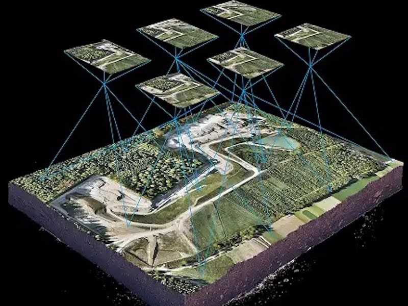
Terrain & Elevation Modeling
DaaS offers pay-per-project drone surveying services that generate centimeter-accurate terrain models and DEMs (digital elevation models) that provide actionable insights for civil engineering and land and infrastructure development.
This topographic analysis reveals information that may be hidden to traditional surveys, reducing development risks and costly issues. Applications include project documentation, earthwork operations and volume calculations, and change detection and monitoring.


