


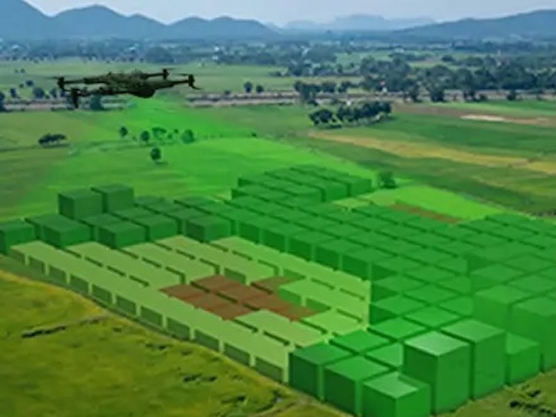
Multispectral Terrain Mapping
DaaS drones can use multispectral imaging to gather data and insights from beyond the visible spectrum, supporting a wide variety of applications such as terrain mapping, conservation, and underground water detection.
Digital terrain models provided by these services can be used to detect early signs of plant stress, analyze topographical features, and monitor the environment in hazardous or remote areas.


