FAA Trials Drone Detection Radar to Strengthen Airspace Security

The FAA is testing advanced drone detection systems nationwide, with Robin Radar’s IRIS radar participating in trials to enhance airspace safety and security By Summer James / 07 May 2025

Drone Detection Radar

Discover cutting-edge solutions from 6 leading global suppliers
SUPPLIER SPOTLIGHT
FAA Trials Drone Detection Radar to Strengthen Airspace Security
Follow UST

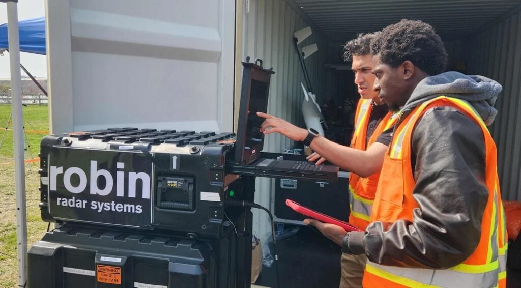
A two-week testing program in Cape May, New Jersey, evaluated drone detection technologies, with Robin Radar Systems supporting the event using its 3D drone detection radar, IRIS.

The extensive testing assessed various systems designed to detect, classify, and mitigate unmanned aircraft systems (UAS), or drones, efforts that reinforce national security and promote operational transparency.

IRIS by Robin Radar Systems.

IRIS is Robin’s flagship drone detection radar, designed to provide teams with the earliest possible warning of drones through accurate, day-and-night tracking, without relying on UAS to emit a signal. It delivers 360° coverage in 3D, combining a 60° elevation angle and a 3-mile instrumented range to cover a total area of 48 square miles. Weighing just 64 pounds, IRIS integrates micro-Doppler classification, deep neural network (DNN) technology, and on-the-move (OTM) capability in a compact, deployable package.

In addition to being part of the technology consortium under evaluation, IRIS gained national attention during a major news broadcast highlighting a surge in drone activity over New Jersey last December.

As drone technology becomes increasingly accessible and capable, the FAA is prioritizing detection and mitigation efforts. This testing initiative focused on advanced systems as the agency works to safeguard the national airspace, reduce operational disruptions, and support broader security measures.

A recent rise in drone sightings near airports and related incidents underscores the importance of this project, which is focused on integrating drone detection and mitigation technologies into the U.S. airspace system. The initiative is active at both airports and off-airport locations nationwide. This FAA event included tests involving large unmanned aircraft and over 100 commercially available drones.

Christian Bach, a retired U.S. Secret Service Agent and Account Manager for commercial and government clients at Robin Radar Systems, stated, “We recognize the complexity of the FAA’s mission. It’s a challenge faced the world over, and that’s why we are committed to contributing tools and insights that elevate and uphold aviation safety.

“IRIS combines 360° coverage with 3D information and accurate real-time tracking, all in a deployable system that sets up within 15 minutes. IRIS even performs at speeds of up to 60 mph, if needed. Radar is also an active sensor; it doesn’t rely on drones emitting a signal to be detected.”

Kristian Brost, a Marine Veteran and General Manager of North America at Robin Radar Systems, added, “With over 400 systems deployed across over 35 countries, Robin Radar has built a trusted name in detecting small flying objects. From supporting Ukrainian Armed Forces in active conflict zones to helping secure the Paris Olympics and protecting critical infrastructure right here in the United States, our solutions are proven in complex, high-stakes environments.”

Posted by Summer James Edited by Summer James, Junior Editor and Copywriter with an interest in digital content creation and writing about new technology. Connect & Contact

Latest Articles

SightLine Software & Hardware Advancements for Enhanced ISR Applications

SightLine Applications LLC introduces the 3.9.2 update, enhancing the 4100 video processor and unveiling the ultra-compact 1710 processor for advanced ISR applications

Jul 16, 2025
Silicon Sensing’s MEMS Technology Enhances Vehicle Localization for Autonomous Driving

The University of Toronto investigated approaches to determining spatial awareness in autonomous vehicles, with Silicon Sensing's DMU41 IMU succeeding in cost-effectiveness, reliability and accuracy

Jul 16, 2025
CHC Navigation Launches AU20 MMS for Precision LiDAR Mapping of Infrastructure

CHC Navigation (CHCNAV) has unveiled the AU20 MMS, a vehicle-mounted mobile mapping system designed for accurate and efficient collection of 3D spatial data

Jul 16, 2025
ZIYAN to Highlight UAV Coordination & Unmanned Helicopter Solutions at IDEF 2025

ZIYAN Tech will unveil its latest combat UAV technologies at IDEF 2025, highlighting advanced swarm coordination, ISR systems, and unmanned helicopter capabilities

Jul 16, 2025
Boosting First Responder Drones with Advanced BVLOS Technology

DroneSense and MatrixSpace partner to enhance BVLOS capabilities, accelerating the safe, scalable use of drones in public safety and Drone as First Responder missions

Jul 16, 2025
TEKEVER Advancing Defense & Civil Security Drones with Cahors Centre of Excellence

Tekever will establish a new dual-use Centre of Excellence in Cahors, France to develop, test, integrate and industrialize autonomous defense and security technologies

Jul 16, 2025

Featured Content

SBG Systems Evaluates INS Performance in GNSS-Denied Marine Applications

SBG Systems evaluates the performance of its INS solutions in GNSS-denied marine environments, comparing system accuracy with and without DVL and warm-up support

Jul 14, 2025
USAF Uses Inertial Labs Drone Lidar for Tree Obstruction Survey

The US Air Force successfully used Inertial Labs drone Lidar and cloud software to quickly map tree obstructions at Joint Base Lewis-McChord (JBLM), improving airfield safety

Jul 11, 2025
New UAV to Combine Solar Hydrogen & Battery Power for Extended Flight

XSun and H3 Dynamics are developing the first UAV powered by solar, hydrogen, and batteries, aiming to deliver zero-emission, long-endurance unmanned flight

Jul 07, 2025
Advancing Unmanned Systems Through Strategic Collaboration UST works with major OEMs to foster collaboration and increase engagement with SMEs, to accelerate innovation and drive unmanned systems capabilities forward.