A strategic partnership between Nokia Drone Networks and YellowScan is expected to transform industrial operations through the incorporation of the YellowScan Surveyor Ultra Lidar scanner into the Nokia Drone Networks solution.
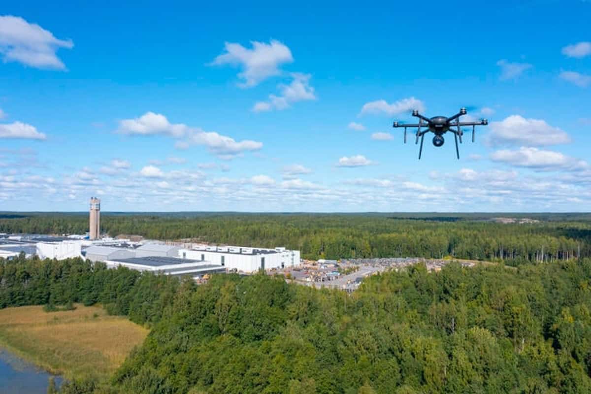
Automation of 5G-based LiDAR scanning on drones for telecommunications tower, utilities inspections, and mining use cases are where this collaboration is focused as they require paramount precision, safety, and efficiency. The joint development plan of the two companies sees the potential to reduce operational costs by over 60% for industrial inspections in the selected verticals.
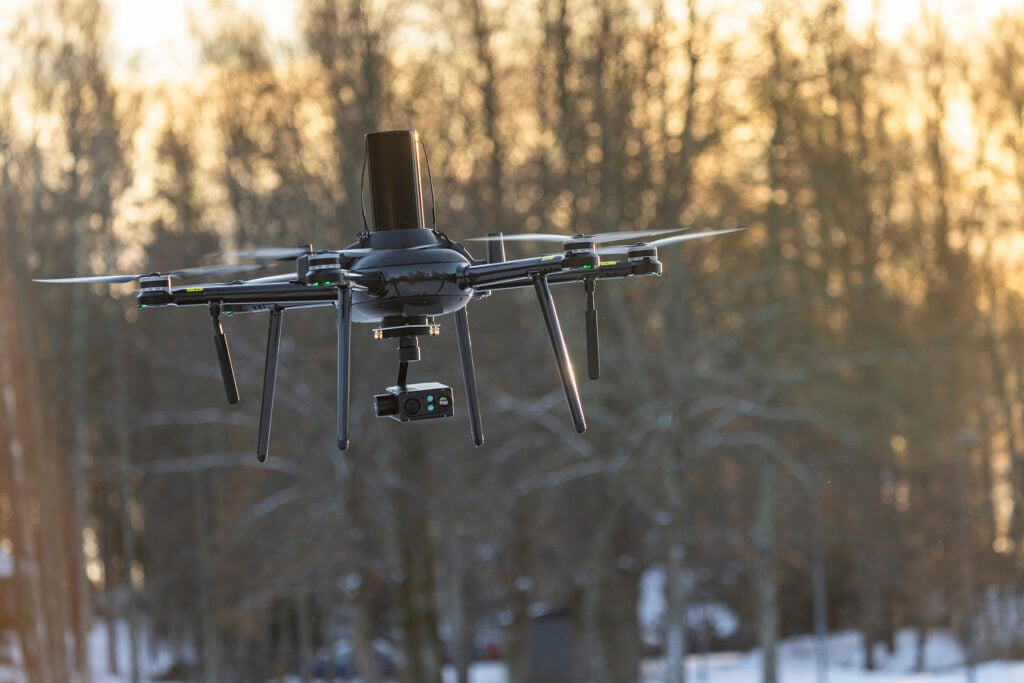
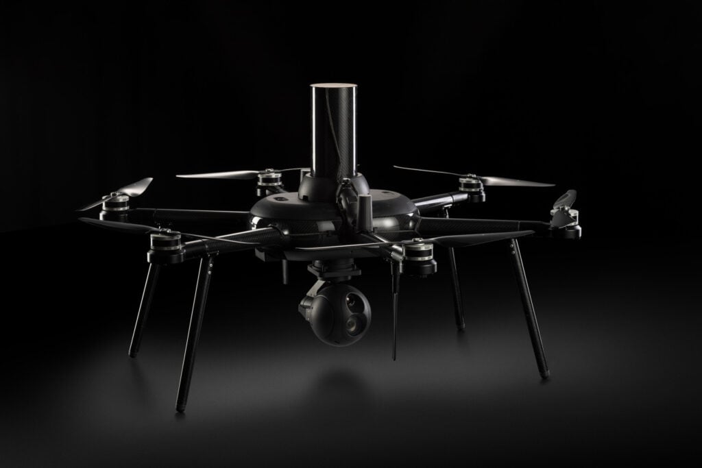
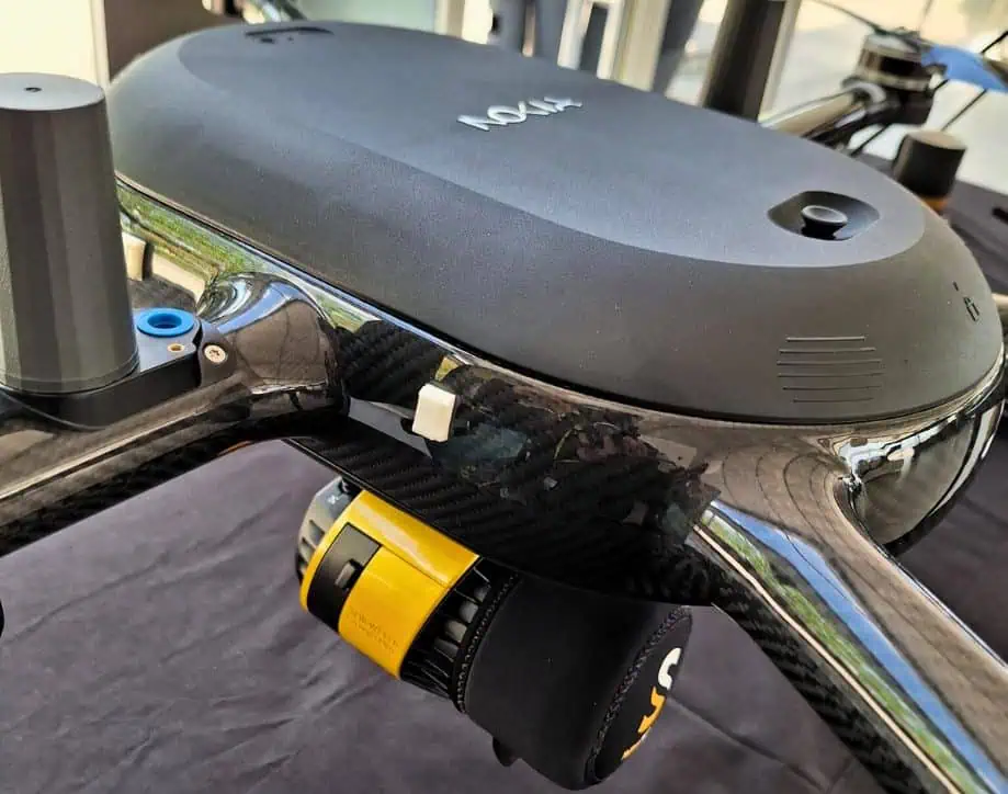
The Nokia drone-in-a-box solution paired with Yellowscan’s LiDAR scanners are expected to significantly enhance the capabilities of Nokia drones, allowing for automated, high-resolution scans and the creation of highly accurate digital twins of industrial sites. Key elements to this partnership include leveraging 5G to stream the LiDAR scanning results in real-time and the deployment of YellowScan’s Surveyor Ultra as one of the key payloads for Nokia Drone Networks.
Partnership Key Aspects:
- 5G Native Connectivity: The 5G-native Nokia drone solution will ensure real-time data transmission, for instant analysis and decision-making.
- Advanced Lidar Integration: YellowScan’s Surveyor Ultra will be integrated into the Nokia Drone Networks solution, providing accuracy and detail in 3D mapping and environmental scanning.
- Creation of Digital Twins: Utilizing the high-fidelity data captured by YellowScan Surveyor Ultra, Nokia Drone Networks will allow the creation of digital twins within the Mission Critical Industrial Edge (MXIE) and enable virtual replicas of physical assets.
- Automated Inspections and Scans: The collaboration will enable fully automated inspection routines, minimizing human exposure to hazardous environments. Automated scans will ensure consistent data quality and repeatability.
- Enhanced Safety and Efficiency: By combining the Nokia drone technology with YellowScan’s precise sensing capabilities, the partnership aims to set new standards for safety and efficiency in industrial inspections and operations.
This collaboration is set to help industries transition towards more automated, data-driven processes, reducing costs and improving reliability.
Thomas Eder, Head of Embedded Wireless at Nokia, commented, “This partnership is a game changer. With our embedded 5G UAV technology, Yellowscan’s LiDAR scanners will be able to deliver real-time scanning directly to experts, making operations more efficient. When flying Beyond Visual Line of Sight using 4G/LTE or 5G connectivity, all data is streamed in real time over the network and collected at the edge cloud platform. No need for personnel on site or manually collect data from the SD (memory) cards,
“Our Nokia Drone Networks solution enables automation of the entire LiDAR scanning process, cutting costs and removing the need for repeated site visits. This advancement not only boosts our Nokia Drone Networks and Mission Critical Industrial Edge (MXIE) platform capabilities but also takes industrial automation to the next level.”
Tristan Allouis, CEO at YellowScan, also stated, “We are excited to collaborate with Nokia to bring our YellowScan Surveyor Ultra to new heights. Our sensors are designed to deliver the accuracy and reliability needed for critical industrial applications, and when paired with the 5G connected Nokia drone solution, we can truly transform how industries operate.”