JOUAV Launches New Airborne LiDAR Sensor

JOUAV's JoLiDAR-1000 LiDAR sensor, featuring enhanced detection, compact design, and integrated technologies, is ideal for a diverse range of applications, such as terrain mapping, power line inspection, mining surveying, and emergency mapping By Joe Macey / 01 Mar 2024

Small LiDAR Sensors

Discover cutting-edge solutions from leading global suppliers
SUPPLIER SPOTLIGHT
New Airborne LiDAR Sensor JoLiDAR-1000 from JOUAV
Follow UST

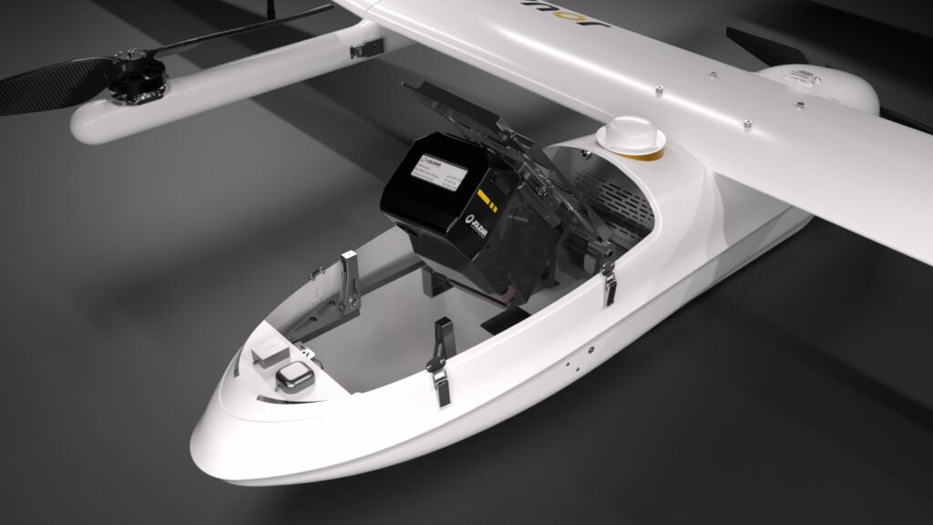
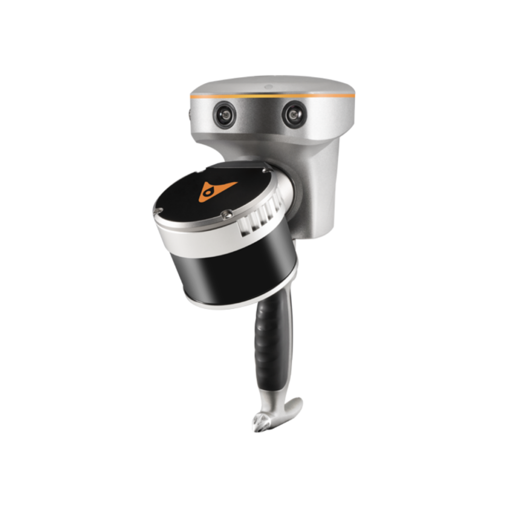
JOUAV has launched its latest LiDAR sensor, JoLiDAR-1000, for drones. 

The sensor expands JOUAV’s robust lineup of high-performance, cost-effective LiDAR sensors, driving continuous advancement in civilian unmanned aerial vehicle (UAV) applications such as GIS, surveying, and precision power line inspections.

“We are thrilled to introduce the JoLiDAR-1000, representing a significant leap forward in LiDAR technology for UAV applications,” said Lee, Product Manager at JOUAV. “This new product underscores our commitment to innovation and excellence in providing cutting-edge LiDAR drone solutions that empower our customers to achieve their goals more efficiently and effectively.”

The JoLiDAR-1000 features:

Advanced Technology: JoLiDAR-1000 utilizes a 1000m medium-range laser scanner, incorporating full-frequency RTK+IMU fusion technology and laser scanning technology for superior measurement accuracy.

Precision Measurement: Achieving an impressive measurement accuracy of 5mm with a repetition accuracy of 10mm, and a line scanning speed ranging from 10 to 300 lines/s, with a maximum of 7 returns.

Enhanced Detection: With a FOV of 100° and an angular resolution of 0.001°, JoLiDAR-1000 provides a range of 1000m, enabling high-precision detection of objects even at wider distances.

Compact Design: Featuring dimensions of 252mm×137mm×135mm and weighing only 1.9 kg, JoLiDAR-1000 boasts a compact structure with high integration, facilitating easy deployment and control.

Integrated Technologies: JoLiDAR-1000 integrates mature and highly reliable technologies, including GNSS high-precision positioning system, inertial navigation systems, high-speed data acquisition systems, time synchronization systems, and a 26MP RGB camera, enabling rapid and accurate data acquisition.

Moreover, with streamlined operation processes that eliminate the need for base station setup and ground control points, coupled with high-precision POS solution computation and point cloud fusion capabilities, JoLiDAR-1000 is ideal for a diverse range of applications, including terrain mapping, power line inspection, mining surveying, coastline measurement, emergency mapping, natural resource surveying, immersive 3D modeling, etc.

Posted by Joe Macey Connect & Contact

Latest Articles

Military Vehicles to Feature Small Tethered UAS from Elistair

Elistair has secured a €3 million contract to equip military vehicles with tethered UAS, enhancing real-time intelligence and operational awareness

Feb 13, 2025
Advancing Airspace Integration & Delivery Management Using Drones in Scotland

ANRA Technologies has helped advance drone-based medical deliveries in Scotland through the CAELUS project, enhancing airspace integration, BVLOS operations, and UTM systems

Feb 13, 2025
New Survey-Grade UAV LiDAR Systems Launched

At Geo Week 2025, GeoCue launched TV1 Lite and the TV1 LiDAR scanners for drones, aiming to bring precision and affordability to the forefront of the geospatial industry

Feb 13, 2025
XPONENTIAL Europe to Spotlight 5G Networks for Autonomous Systems

XPONENTIAL Europe 2025, taking place from 18-20 February in Düsseldorf, will highlight how 5G innovation enhances uncrewed systems and robotics, with Vodafone providing a private 5G campus network in Hall 1

Feb 13, 2025
Enhancing Security Through Real-Time Video Solutions

LiveU’s Joseph Yaker talks to UST about patented LRT (LiveU Reliable Transport) bonding technology that employs connections like 4G/5G cellular, LEO satellite, Wi-Fi, and Ethernet for highly resilient, and secure real-time video transmission

Feb 12, 2025
T-DRONES Introduces New VTOL UAV with Long-Endurance & High Payload Capacity

T-DRONES introduces the VTOL VA32, a versatile unmanned aerial vehicle built for long-duration flights, high payload capacity, and reliable performance in a variety of industrial applications

Feb 12, 2025

Featured Content

Ellipse Series Enhanced with Latest Firmware Upgrade

The new firmware update from SBG Systems integrates the latest World Magnetic Model (WMM) to improve navigation precision, even for first-generation Ellipse sensors

Feb 11, 2025
Advanced FOG-Based Inertial Sensing Solutions for Drones & Robotics

Aegiverse's products feature a multi-layered architecture that combines multiple elements into a compact module, providing significant, size, weight and cost reductions

Feb 06, 2025
Vertiq’s 81-08 G2 Module Added to DIU’s Blue UAS Framework

Vertiq's 81-08 G2 servo motor and control system for Group 2 sUAS has become the first motor and ESC combination to be approved under the U.S. government's Blue UAS Framework

Feb 05, 2025