


Fixed-Wing Mapping Drones
Discover cutting-edge solutions from 4 leading global suppliers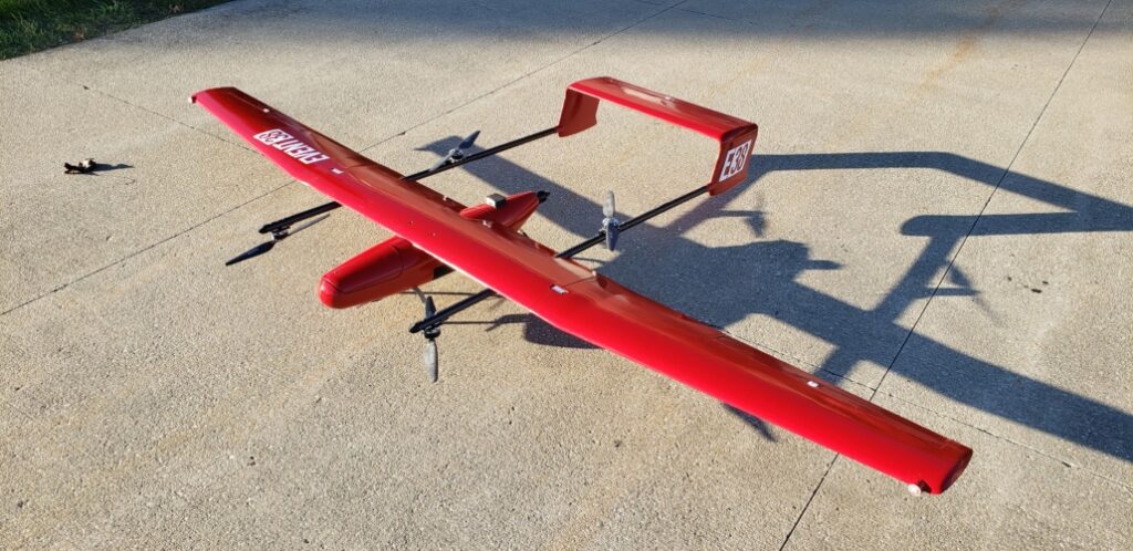
Event 38 Unmanned Systems has confirmed that its E400 fixed-wing mapping drone is now integrated with multispectral cameras from AgEagle. These cameras are ideal for a variety of applications such as research and resource management, and can be used for automatic detection of specific assets or features. Equipped with an AgEagle sensor, the E400 can perform fast, automated sweeps of large areas, especially those that may be difficult or impossible to navigate on foot.
The company has already sold two E400 drones with AgEagle cameras to prominent universities. The University of Alabama in Huntsville will use their E400 for flood inundation mapping (FIM), the rapid detection of surface water during and after flooding events. Their E400 will be integrated with the National Water Model (NWM), which is managed by the NOAA Office of Water Prediction. Kent State University has also purchased an E400 with AgEagle sensors for research.
Jeff Taylor, founder & CEO of Event 38, commented: “We’ve used AgEagle cameras with our drones in the past with tremendous results, so we’re thrilled to be integrating their products with our latest platform, the E400. Like us, they’re always exploring new technology and finding ways to make their products better. This latest integration will be our best joint project yet.”
Casey Calamaio, Research Engineer at Rotorcraft Systems Engineering and Simulation Center (RSESC) at the University of Alabama in Huntsville, noted: “The UAS Research Program at UAH is conducting this work as a new member of the recently established NOAA Cooperative Institute for Research to Operations in Hydrology (CIROH). This test bed project will consist of flood inundation modeling (FIM) research in the Tennessee Valley, with plans to reciprocate the remote sensing workflow to other regions of the country to support the verification and evaluation process for the National Water Model.”


