FIXAR & YellowScan Offer Integrated Aerial LiDAR Solution

The FIXAR 007 drone integration with YellowScan Mapper+ OEM aims to ensure fast and precise laser scanning data acquisition and processing By Caroline Rees / 02 Sep 2022

Drone LiDAR

Discover cutting-edge solutions from 4 leading global suppliers
SUPPLIER SPOTLIGHT
FIXAR 007 UAV
Follow UST

FIXAR has established a partnership with YellowScan in order to equip the outdoor FIXAR 007 Unmanned Aerial Vehicle (UAV) with the YellowScan Mapper+ OEM Light Detection and Ranging (LiDAR) mapping solution.

FIXAR 007 is an autonomous Vertical Take Off and Landing (VTOL) fixed-wing UAV designed to meet the needs of a wide variety of commercial and industrial applications, such as aerial mapping and inspections, aerial imaging, precision agriculture, oil and gas pipelines monitoring, surveillance, border control, and more. 

According to the company, its flagship model FIXAR 007 is a versatile drone customizable to integrate a range of sensors to increase data collection speed and agility and improve cost-efficiency up to 10 times in comparison with other in-class solutions.

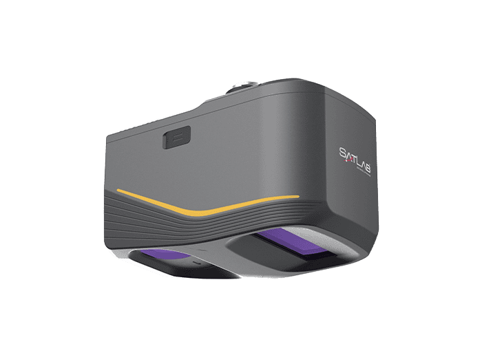
The YellowScan Mapper+ OEM is a lightweight integrated LiDAR system with long-range capabilities, advanced accuracy and high-end point density. FIXAR integration with YellowScan Mapper+ OEM aims to ensure fast and precise laser scanning data acquisition and processing by utilizing the combined quality features of both technologies. The georeferenced LiDAR point cloud generated will be processed to get accurate digital terrain or surface models used in many professional applications.

“YellowScan is happy to continue its tradition of working with the leading UAV developers from around the world to add LiDAR capabilities to their platforms,” said Julien Bo, Business developer at YellowScan. “Our Mapper+ OEM is an efficient and affordable solution that will allow FIXAR to offer the market a complete UAV LiDAR solution. We both share a passion to innovate and set the technology bar high for the benefit of our customers.”

“FIXAR is glad to work with such a professional team as YellowScan and be able to bring advanced laser scanning solutions to our customers around the globe,” added Vasily Lukashov, founder and CEO at FIXAR. “We witness the increasing demand for aerial LiDAR equipment capable of carrying out autonomous data collection missions. YellowScan Mapper+ OEM is an excellent fit for autonomous FIXAR 007 to jointly ease complex tasks in forestry, mining, energy, and utility sectors.”

Both companies expressed commitment to further collaboration to integrate upcoming FIXAR UAVs with YellowScan LiDAR sensors.

Posted by Caroline Rees Caroline co-founded Unmanned Systems Technology and has been at the forefront of the business ever since. With a Masters Degree in marketing Caroline has her finger on the pulse of all things unmanned and is committed to showcasing the very latest in unmanned technical innovation. Connect & Contact

Latest Articles

Low- & Zero-Emission Propulsion & Power Generation Solutions for UAVs

NEX Power's hybrid propulsion technologies are designed to enable next-generation applications such as UAM and heavy-lift cargo drones

Feb 07, 2025
Most Read Articles on UST This Week

Here’s our round-up of the five most read articles on UnmannedSystemsTechnology.com this week

Feb 07, 2025
Project OPTIMAS to Utilize Schiebel VTOL UAS for Advanced Optical Laser Communications

Project OPTIMAS and Schiebel are set to develop a secure, high-speed optical communication system using quantum encryption and laser technology for multi-domain defence and satellite connectivity

Feb 07, 2025
Gemini 1200id High-Resolution Sonar Optimized for Unmanned Underwater Operations

Tritech's Gemini 1200id sonar offers high-resolution imaging, advanced noise reduction, and dual-frequency capability, enhancing performance for unmanned underwater systems and mission-critical ROV operations

Feb 07, 2025
Dockstr to Offer SubC Imaging’s Underwater Cameras & Software Solutions

SubC Imaging has announced Dockstr as its new agent, extending access to its advanced underwater cameras, DVRs, and remote operation systems across key offshore sectors worldwide

Feb 07, 2025
New NDAA-Compliant FPV Drone Camera Released 

Unusual Machines has launched the NDAA-compliant Fat Shark Aura FPV Camera, offering high-performance, first-person view capabilities for commercial and defense applications

Feb 07, 2025

Featured Content

Vertiq’s 81-08 G2 Module Added to DIU’s Blue UAS Framework

Vertiq's 81-08 G2 servo motor and control system for Group 2 sUAS has become the first motor and ESC combination to be approved under the U.S. government's Blue UAS Framework

Feb 05, 2025
Compact Remote ID Receiver Released for Enhanced Drone Safety

Dronetag has introduced RIDER, a pocket-sized, drone-agnostic Remote ID receiver designed to improve airspace situational awareness and support commercial and public safety applications

Jan 30, 2025
New GCS Software Released for C100 Quadcopter

Performance Drone Works introduces PDW CORE, a comprehensive software bundle enhancing the C100 quadcopter's capabilities with a new UI, flight simulator, mission planner, ATAK integration, and fleet management tools

Jan 29, 2025
Advanced Signal Mapping Tool Released for Effective UAV Flight Planning

Elsight has launched HeatSight, a signal strength mapping tool that provides UAV operators with reliable cellular coverage data, improving flight planning efficiency and safety for BVLOS missions

Jan 28, 2025
Doodle Labs Unveils Mobile App for Managing Mesh Networks

Doodle Labs is introducing the Mesh Rider® Mobile App, providing intuitive tools for managing wireless mesh networks across devices such as ground control stations (GCS) and UAVs

Jan 23, 2025
Advanced FOG-Based Inertial Sensing Solutions for Drones & Robotics

Aegiverse's products feature a multi-layered architecture that combines multiple elements into a compact module, providing significant, size, weight and cost reductions

Jan 21, 2025