Bathymetric Mapping & Imaging LiDAR Unveiled

By Caroline Rees / 15 Jul 2021

Marine and Bathymetric LiDAR

Discover cutting-edge solutions from leading global suppliers
SUPPLIER SPOTLIGHT
Follow UST

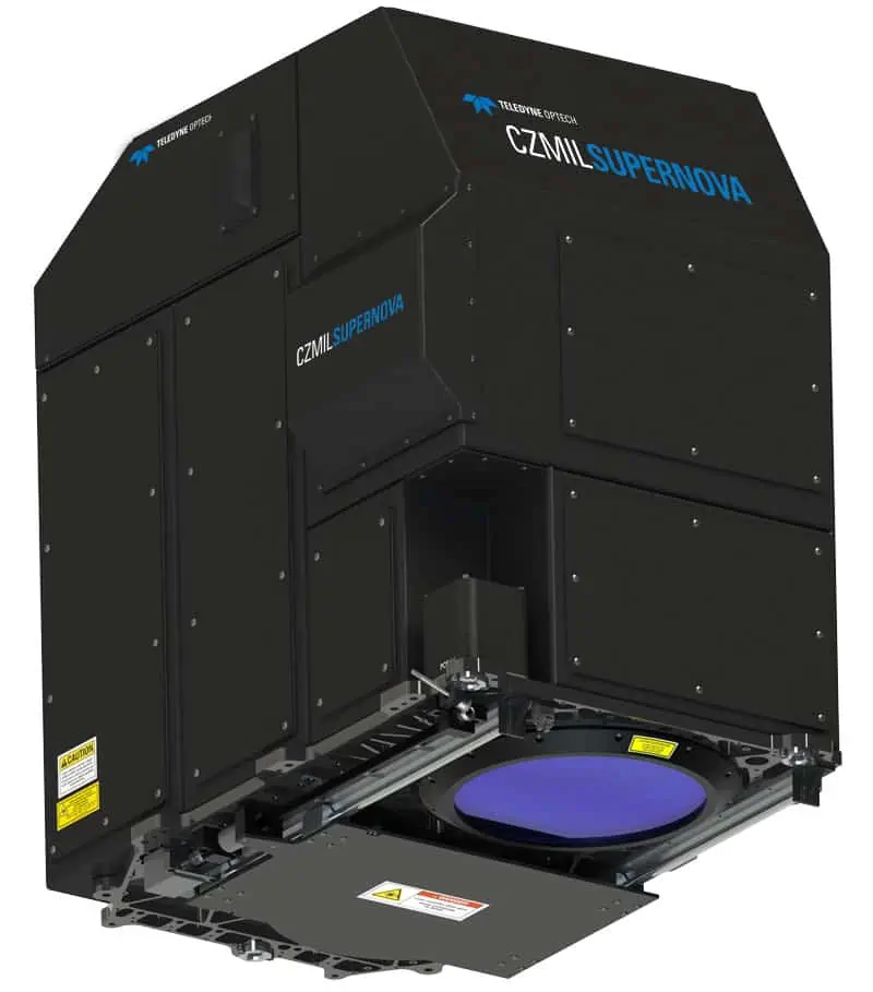
Teledyne Optech has released its third generation Coastal Zone Mapping and Imaging Lidar, the CZMIL SuperNova bathymetric lidar.

Powered by Teledyne CARIS processing software, the CZMIL SuperNova is equipped with a green laser for depth penetration up to 75 meters. 

Its SmartSpacing technology enables even and efficient point spacing, real-time processing capability for reduced post-processing time and configurable modes for maximising performance in different water environments.

The system provides a wide range of inputs for climate change modelling and is Ideal for inland water environments, base mapping for coastal zones and shoreline.

To complete the solution, data is processed in CARIS Base Editor software, which leverages AI techniques for land and water discrimination and noise classification. 

The processing tools open the door to a range of processing options from datum shifts to full waveform display and editing, to the creation of enhanced information products in a wide variety of formats.

“CZMIL SuperNova builds on over 30 years of experience with airborne green laser bathymetry,” said CZMIL SuperNova Product Manager Jennifer Aitken.

“The ability to configure the system on-the-fly and optimize data collection for local conditions has significant benefit. We are getting plenty of signal at 600 meters altitude and even higher, so our coverage area is increasing without sacrificing depth penetration.”

Posted by Caroline Rees Caroline co-founded Unmanned Systems Technology and has been at the forefront of the business ever since. With a Masters Degree in marketing Caroline has her finger on the pulse of all things unmanned and is committed to showcasing the very latest in unmanned technical innovation. Connect & Contact

Latest Articles

New AI Emission Detector for Autonomous Drones Enables Remote Methane Monitoring

Percepto has introduced an AI-powered emission detection system that combines autonomous drones and real-time analytics to streamline methane monitoring and regulatory compliance for oil and gas operators

Jun 20, 2025
CRP Technology Receives ISO 14001:2015 Environmental Certification for Additive Manufacturing

CRP Technology has obtained ISO 14001:2015 certification from DNV, covering its additive manufacturing processes and confirming alignment with international environmental management standards

Jun 20, 2025
Chess Dynamics Demonstrates Advanced AI Tracking in Challenging Field Trials

Chess Dynamics has demonstrated its advanced AI tracking technology in demanding multi-domain trials, showcasing reliable target tracking, classification and sensor performance in complex conditions

Jun 20, 2025
Marine Laboratory Advances Shallow Water Mapping with RIEGL Bathymetric LiDAR

Plymouth Marine Laboratory is advancing shallow water mapping using RIEGL's UAV-mounted bathymetric LiDAR, enabling high-resolution, low-impact environmental data collection and research

Jun 20, 2025
Evolito to Develop Electric Propulsion System in New Aerospace Collaboration

Evolito and VÆRIDION have partnered to develop electric propulsion technology for the Microliner aircraft, aiming to deliver improved propulsion efficiency and operational safety

Jun 19, 2025
New GA-ASI Collaboration Enhances AEW Capability on MQ-9B Platform

General Atomics and Saab are collaborating to equip the MQ-9B unmanned aircraft with advanced AEW&C capabilities, expanding cost-effective aerial surveillance options

Jun 19, 2025

Featured Content

Exail Showcases Integrated USV & AUV Operations in Collaborative Trial

Exail’s DriX USV and Ifremer’s Ulyx AUV were jointly deployed for the first time, demonstrating advanced cooperative capabilities in deep-sea exploration

Jun 19, 2025
HBK Updates RTK Service for Precise Positioning in Autonomous Systems

HBK has updated its SensorCloud RTK service, integrating with MicroStrain by HBK navigation systems to provide centimeter-level accuracy and simplified deployment for autonomous systems

Jun 17, 2025
MEMS DC Accelerometers from SDI Deliver Superior Performance for Unmanned Systems

SDI's MEMS DC accelerometers offer a robust solution for unmanned aerial, ground, and underwater vehicles, providing precise static and dynamic motion sensing, crucial for autonomous navigation, attitude feedback, and structural monitoring

Jun 12, 2025
Advancing Unmanned Systems Through Strategic Collaboration UST works with major OEMs to foster collaboration and increase engagement with SMEs, to accelerate innovation and drive unmanned systems capabilities forward.