


Discover World-Leading Unmanned and Autonomous Technologies
Discover cutting-edge solutions from leading global suppliers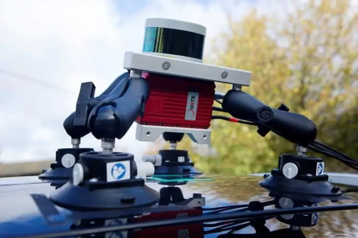
OxTS has released an article explaining how to use data to confirm the relative displacement and orientation between a LiDAR scanner and the INS (inertial navigation system), which are crucial for accurate georeferencing when producing a pointcloud. This quick and efficient data-driven method will provide the level of accuracy required for many mobile and UAV (unmanned aerial vehicle) mapping applications.
Read the full article on OxTS’ website
The article covers:
- How position error is affected by even small orientation errors
- How the relationship between the LiDAR and INS introduces an additional orientational uncertainty
- Using reflective targets to calibrate the rotation of the LiDAR with respect to the INS
- How OxTS Georeferencer software uses georeferenced data to calculate the rotation
In order to achieve a high-accuracy georeferenced pointcloud, the rotation between the LiDAR and the INS must be known to points of a degree. The most effective and efficient way to calibrate the hardware setup is to use the georeferenced LiDAR data itself in a data-driven method. To find out more, read the full article on OxTS’ website.


