Microdrones Releases New UAV Surveying Series Episodes

By Mike Ball / 26 Mar 2021

Smart Sourcing for Unmanned Systems

Discover cutting-edge solutions from leading global suppliers
SUPPLIER SPOTLIGHT
Follow UST

Microdrones LiDAR surveying

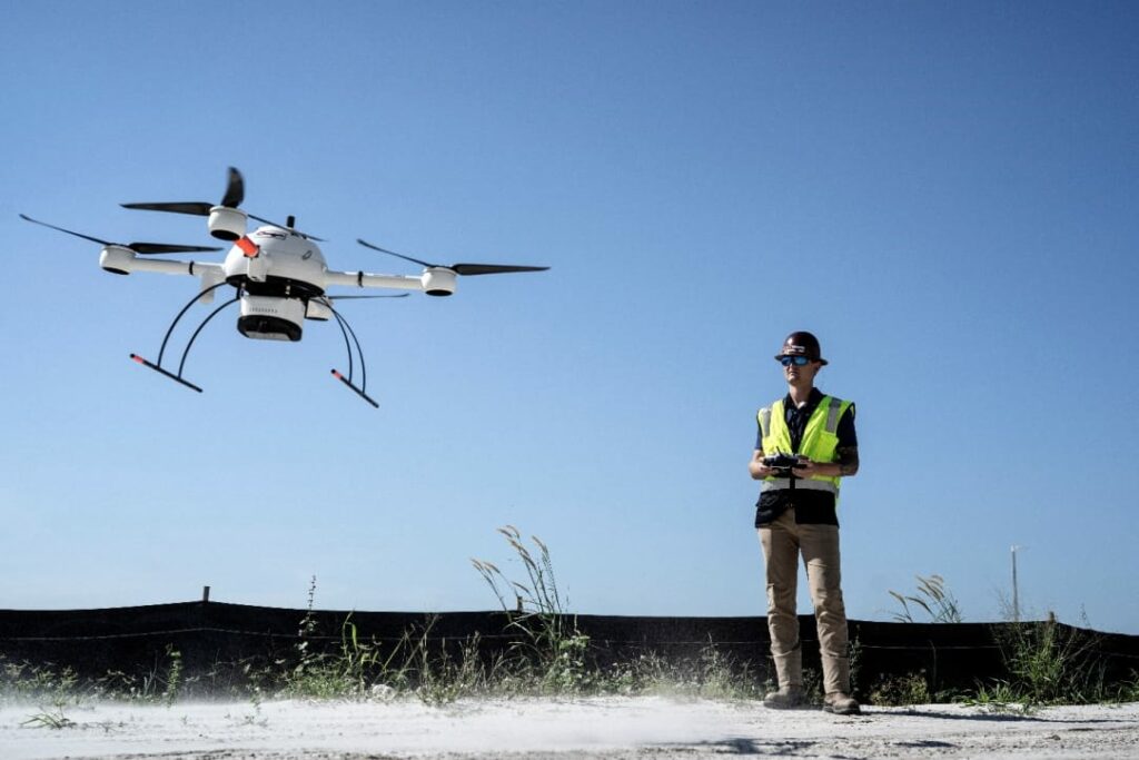
Microdrones has created three new episodes of its “Down to Earth” reality series, which focuses on the challenges and hazards faced by real UAV (unmanned aerial vehicle) surveying crews, as well as how they create real data deliverables. The new episodes are due to premiere on Wednesday, March 31, and viewers can register to watch at 9am ET, 6pm ET or 9am CET.

Register here to watch the next three episodes of the series, which include exclusive behind-the-scenes mission planning, data capture and analysis of the final deliverables narrated by the professionals involved in the project

The next 3 episodes of Down to Earth focus on Cougar Companies in Southwestern Florida as they use drone LiDAR surveying equipment to provide more detailed topographic surveys of construction sites. The unpredictable Florida weather poses problems for them as they try to collect data, confirm fill quantities, and stay on budget.

The first episode introduces Adam Murphree, Director of Technology for Cougar Companies, and highlights how the use of drone LiDAR technology gives the companies a competitive advantage. Episodes 2 and 3 follow Adam further as he contends with heavy equipment, active construction sites and heavy winds in order to successfully complete drone surveying missions.

Adam Murphree commented: “Drone LiDAR gives you the ability to get through trees and still get data from the surface, and it does it in a fraction of the photogrammetry processing time. That’s huge. A dataset that might take half a day to process with photogrammetry is done in 10 to 15 minutes with LiDAR.”

Bret Burghdurf, Marketing Director at Microdrones, said: “These next episodes of Down to Earth show how the Cougar Companies are taking advantage of drone Lidar technology to not only be more efficient, but to win more projects and grow their business. Being on site at the various construction jobs gives you a much better sense of the scope and size of the projects that the Cougar Companies are dealing with and how drone surveying equipment from Microdrones gives them an edge on their competition. But, producing these episodes definitely wasn’t a breeze, thanks to some blustery conditions. Dealing with the Florida weather made for some exciting episodes of Down to Earth.”

Posted by Mike Ball Mike Ball is our resident technical editor here at Unmanned Systems Technology. Combining his passion for teaching, advanced engineering and all things unmanned, Mike keeps a watchful eye over everything related to the unmanned technical sector. With over 10 years’ experience in the unmanned field and a degree in engineering, Mike’s been heading up our technical team here for the last 8 years. Connect & Contact

Latest Articles

Most Read Articles on UST This Week

Here’s our round-up of the five most read articles on UnmannedSystemsTechnology.com this week

Jul 11, 2025
Vertiq Speed Firmware v0.1.1 Now Available with Bug Fixes

Vertiq has released firmware v0.1.1 to correct a parameter bug affecting telemetry and 3D mode settings on select G1 and G2 modules

Jul 11, 2025
The Role of ROVs in Unmanned Marine Operations

Oceanbotics has answered the most common questions about ROVs, covering how they work, where they're used, and key capabilities

Jul 11, 2025
LiveU File Transfer Speeds Up Drone Data Delivery for Critical Missions

LiveU’s File Transfer enables rapid transmission of large drone data files, reducing delays and supporting faster decision-making in public safety and infrastructure operations.

Jul 11, 2025
Exploring Differences Between M9PLUS & M9 GNSS Antennas

Discover the key upgrades in Maxtena’s new M9PLUS GNSS antenna, including improved performance, signal purity, and multipath mitigation over the original M9

Jul 11, 2025
USAF Uses Inertial Labs Drone Lidar for Tree Obstruction Survey

The US Air Force successfully used Inertial Labs drone Lidar and cloud software to quickly map tree obstructions at Joint Base Lewis-McChord (JBLM), improving airfield safety

Jul 11, 2025

Featured Content

USAF Uses Inertial Labs Drone Lidar for Tree Obstruction Survey

The US Air Force successfully used Inertial Labs drone Lidar and cloud software to quickly map tree obstructions at Joint Base Lewis-McChord (JBLM), improving airfield safety

Jul 11, 2025
New UAV to Combine Solar Hydrogen & Battery Power for Extended Flight

XSun and H3 Dynamics are developing the first UAV powered by solar, hydrogen, and batteries, aiming to deliver zero-emission, long-endurance unmanned flight

Jul 07, 2025
Enhancing Mangrove Restoration Through 3D Printed Drone Design

Explore how Inverto Earth, in collaboration with HP Additive, is using sustainable 3D printing and drone technology to drive large-scale mangrove restoration and protect vulnerable coastal ecosystems

Jul 03, 2025
Advancing Unmanned Systems Through Strategic Collaboration UST works with major OEMs to foster collaboration and increase engagement with SMEs, to accelerate innovation and drive unmanned systems capabilities forward.