


Discover World-Leading Unmanned and Autonomous Technologies
Discover cutting-edge solutions from leading global suppliers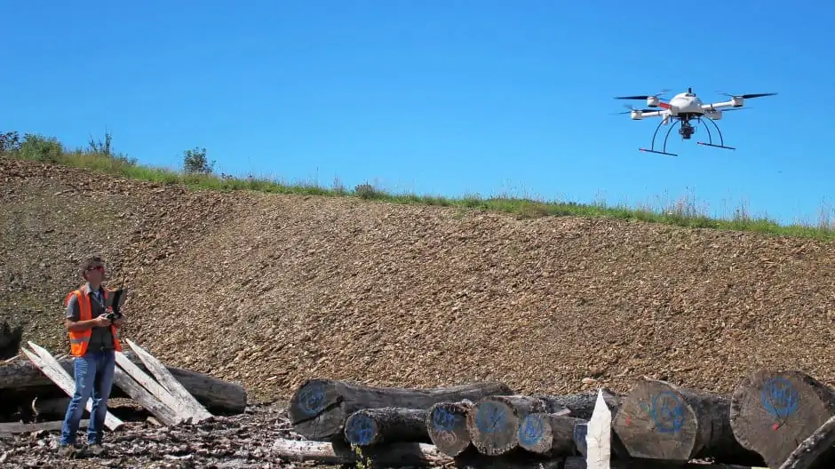
Microdrones’ unmanned aerial systems (UAS) solutions have been utilised by civil engineering firm Feldhaus for a variety of construction-related tasks, including site surveying, inventory management, progress monitoring, and aerial documentation.
The use of Microdrones systems, which pair a quadcopter drone with an advanced LiDAR or photogrammetric mapping and surveying payload, allows Feldhaus to expedite workflows, keep workers safe, and generate more efficient results for their customers. Providing high-accuracy measurement and highly detailed data, the sophisticated drone surveying equipment enables Feldhaus to be equipped for the digital future of documentation and measurement.
After aerial photographs are captured by the drone, a 3D terrain model and an orthophoto are generated from the data. The model can be used to determine exact areas, volumes and masses for construction projects, and this data can be supplied to the control systems of construction machines. This technology can be used for a variety of related applications, including earthworks and road construction, civil engineering, and mining.
UAS-based surveying is safer and faster than conventional methods, with the ability to work uninterruptedly as the drone captures data from above. In many applications, Feldhaus already expects sustainable improvements, such as landfill surveying, as well as slope fuses where networks and anchors have to be regularly measured.


