Microdrones Launches New 3D Imaging & Surveying Solutions

By Mike Ball / 27 Jun 2020

Smart Sourcing for Unmanned Systems

Discover cutting-edge solutions from leading global suppliers
SUPPLIER SPOTLIGHT
Follow UST

Microdrones long-range LiDAR survey UAS

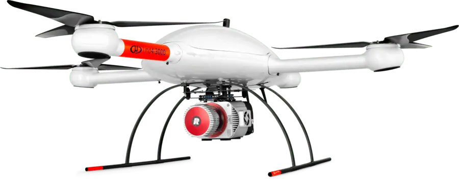
Microdrones has released four new fully integrated unmanned aerial systems for surveying applications, including solutions for obtaining 3D imagery. All four are available under the company’s recently-launched Microdrones as a Service (mdaaS) business model, which offers options for rental or purchase as well as unlimited or per-project data processing plans.

Vivien Heriard-Dubreuil, CEO of Microdrones, stated: “Customers have been looking for ways to acquire 3D and Oblique imagery data, and we wanted to offer fully integrated systems, software, workflow, maintenance and support for these applications. In addition, we are proud to present a new survey-grade LiDAR system that can capture data from greater flight altitudes, or extremely detailed data from lower altitudes.”

Frank Darmayan, Microdrones COO, comented: “These new systems, combined with our Microdrones as a Service business model, provide a complete technology ecosystem and product lineup that customers can adopt, adapt, upgrade and grow with.”

mdMapper3000DµoG 3D aaS is designed for high wall mapping and 3D modeling applications where traditional manned aerial 3D mapping systems are unable to get close enough to the target to capture the level of detail required. This system uses an array of five cameras with dual IMU direct georeferencing to capture all angles and surfaces, with everything integrated into the processing workflow in Microdrones’ mdInfinity software.

mdMapper1000DG 3D aaS provides similar 3D and high wall mapping functionality, but with single IMU direct georeferencing and a smaller drone.

mdMapper3000DµoG Oblique aaS adds a fully integrated payload gimbal to the dual-IMU direct georeferencing mdMapper3000Dµog system. This increases the abilities of the system to capture oblique imagery, making it ideal for both high wall mapping and mining photogrammetry applications.

mdLiDAR3000LR aaS is a long-range surveying system that allows users to either collect data from higher altitudes, or use the laser scanning payload to capture increased point densities when flying at lower altitudes.

Legrand added: “Demand for our products and mdaaS has been very strong. The B2B surveying, construction and building trades have been busy and eager to adopt new technology that makes them more effective. We’re pleased to have more opportunities and products to meet their demand and continue to lead the market for professional drone applications.”

Posted by Mike Ball Mike Ball is our resident technical editor here at Unmanned Systems Technology. Combining his passion for teaching, advanced engineering and all things unmanned, Mike keeps a watchful eye over everything related to the unmanned technical sector. With over 10 years’ experience in the unmanned field and a degree in engineering, Mike’s been heading up our technical team here for the last 8 years. Connect & Contact

Latest Articles

Most Read Articles on UST This Week

Here’s our round-up of the five most read articles on UnmannedSystemsTechnology.com this week

Feb 14, 2025
FlyingBasket to Discuss Drone Industry Challenges at XPO Europe

FlyingBasket CTO Matthias Moroder will join a panel at Xponential Europe to discuss the regulatory and market challenges hindering drone industry growth, and the importance of collaboration for wider adoption

Feb 14, 2025
Advanced EFI Engines for Commercial & Industrial Drones

INF Inject's 2- and 4-stroke EFI engines can be provided with a range of options such as alternators, starter-alternators and generators

Feb 14, 2025
SDO 50 UAV Completes Long-Distance BVLOS Pipeline Inspection

SwissDrones’ SDO 50 UAV has successfully carried out a 550-kilometer BVLOS pipeline inspection in Queensland, providing precise, actionable data while maintaining high safety standards

Feb 14, 2025
Enhancing Unmanned System Reliability with SCS Silicone Conformal Coatings

Specialty Coating Systems (SCS) provides advanced conformal coating solutions to protect unmanned systems’ electronics from extreme conditions, ensuring durability, reliability, and compliance with evolving industry standards

Feb 14, 2025
Explore Geospatial Tools with Blue Marble at XPONENTIAL Europe

Blue Marble Geographics will showcase advanced geospatial software at XPONENTIAL Europe 2025, featuring live demos of the Global Mapper Suite and advanced geospatial tools

Feb 14, 2025

Featured Content

Military Vehicles to Feature Small Tethered UAS from Elistair

Elistair has secured a €3 million contract to equip military vehicles with tethered UAS, enhancing real-time intelligence and operational awareness

Feb 13, 2025
Ellipse Series Enhanced with Latest Firmware Upgrade

The new firmware update from SBG Systems integrates the latest World Magnetic Model (WMM) to improve navigation precision, even for first-generation Ellipse sensors

Feb 11, 2025
Advanced FOG-Based Inertial Sensing Solutions for Drones & Robotics

Aegiverse's products feature a multi-layered architecture that combines multiple elements into a compact module, providing significant, size, weight and cost reductions

Feb 06, 2025