


Discover World-Leading Unmanned and Autonomous Technologies
Discover cutting-edge solutions from leading global suppliers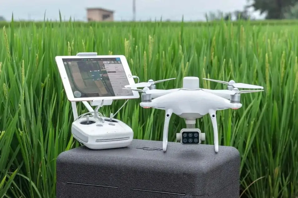
DJI has announced the launch of the P4 Multispectral, a fully integrated multispectral imaging drone designed for precision agriculture and environmental management applications. Based on the Phantom drone airframe, the P4 Multispectral features a gimbal-stabilized imaging system combining data from six separate sensors (one RGB camera and a multispectral camera array with five narrow band sensors, including red edge and near infrared), and utilises an additional integrated spectral sunlight sensor to maximize the accuracy and consistency of data collection during missions flown at different times of day.
The P4 Multispectral is designed to measure the health of crops, from individual plants to entire fields, and detect weeds, insects and a variety of soil conditions. It gives agriculture professionals unique insights into vegetation stress, soil composition as well as water salinity and contamination.
With a 7km maximum transmission range and a maximum 27 minutes of flight time per battery, the P4 Multispectral uses the OcuSync transmission system for reduced signal interference and enhanced video transmission. The system works seamlessly with DJI’s Ground Station Pro flight planning app, allowing users to easily switch between real-time views of the RGB video camera and Normalized Difference Vegetation Index (NDVI) output. Each image contains real-time, accurate positioning data for providing centimeter-level measurements and the best possible photogrammetric results, thanks to the integrated RTK positioning module and TimeSync system.
The drone is compatible with standard industry workflows such as flight programming, mapping, and analytics software. Data can be imported into analytical software such as DJI Terra, Pix4D Mapper or DroneDeploy, to create outputs such as vegetation index maps. RTK positioning accuracy can be improved without an internet connection by using DJI’s D-RTK 2 High-Precision GNSS Mobile Station, which supports all major global satellite navigation systems, or by using a third-party network RTK via an iPad with an internet connection.
Jan Gasparic, Director of Strategic Partnerships at DJI, commented: “P4 Multispectral has the promise to transform the agriculture and land management industries by collecting precise plant-level data without having to send personnel into the field for manual surveys. By combining multispectral imaging into a trusted, efficient and affordable tool, DJI is making this transformative technology more accessible to professionals around the world who are pioneering the adoption of drones in their industries.”


