Article: The Future of Soft GNSS

By Mike Ball / 14 Aug 2019

Smart Sourcing for Unmanned Systems

Discover cutting-edge solutions from leading global suppliers
SUPPLIER SPOTLIGHT
Follow UST

Trimble Soft GNSS articleTrimble Integrated Technologies, a manufacturer of high-precision positioning and mapping solutions for UAVs and other robotic systems, has released an article detailing the future of Soft GNSS, or software-defined GNSS technology.

Download the article from Trimble’s website

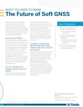
The article outlines:

  • What Soft GNSS is and how users can acquire it
  • Why the industry is shifting towards Soft GNSS
  • The transition process from traditional practices to Soft GNSS

To find out more about Soft GNSS and how it may affect precision positioning applications, download the article from Trimble’s website here.

Posted by Mike Ball Mike Ball is our resident technical editor here at Unmanned Systems Technology. Combining his passion for teaching, advanced engineering and all things unmanned, Mike keeps a watchful eye over everything related to the unmanned technical sector. With over 10 years’ experience in the unmanned field and a degree in engineering, Mike’s been heading up our technical team here for the last 8 years. Connect & Contact

Latest Articles

Cellen Expands UAV Mission Capabilities with Hydrogen Fuel Cell Technology

Cellen outlines how its H2‑6 hydrogen-powered drone delivers long-endurance flight and zero-emission performance, overcoming battery limitations and enabling reliable, low-impact operations in sensitive or remote environments

Jul 15, 2025
Tulip Tech Extends Autonomous Drone Missions with Lithium Metal Technology

Tulip Tech and Tective have partnered to extend the ReFly drone’s range and endurance using advanced Lithium Metal battery technology

Jul 15, 2025
UAV Navigation to Supply Flight Control System for Fixed-Wing UAV Platform

UAV Navigation collaborates with SE Aviation to provide the DRIADE UAV with a VECTOR-600 flight control system enabling autonomous reconnaissance and wildfire response missions

Jul 15, 2025
AlarisPro Empowers UAS Operators to Meet Federal Mandates with Safety & Compliance Tools

AlarisPro describes how their Fleet Management Platform is positioned to help UAS operators prepare for BVLOS certifications under the new Executive Order

Jul 15, 2025
Police Department Utilizes Drones to Map Crash & Crime Scenes

Discover how Windham Police use drones and Blue Marble Geographics’ GIS tools to enhance crash investigations, speed up processing, and improve scene accuracy

Jul 15, 2025
SPECTRUM300 Mission-Ready Imaging for Small UAV Platforms

Explore Blitz Technology SPECTRUM300, a 330g dual-sensor gimbal delivering full HD EO and thermal imaging, built for lightweight UAVs and demanding ISR missions

Jul 15, 2025

Featured Content

SBG Systems Evaluates INS Performance in GNSS-Denied Marine Applications

SBG Systems evaluates the performance of its INS solutions in GNSS-denied marine environments, comparing system accuracy with and without DVL and warm-up support

Jul 14, 2025
USAF Uses Inertial Labs Drone Lidar for Tree Obstruction Survey

The US Air Force successfully used Inertial Labs drone Lidar and cloud software to quickly map tree obstructions at Joint Base Lewis-McChord (JBLM), improving airfield safety

Jul 11, 2025
New UAV to Combine Solar Hydrogen & Battery Power for Extended Flight

XSun and H3 Dynamics are developing the first UAV powered by solar, hydrogen, and batteries, aiming to deliver zero-emission, long-endurance unmanned flight

Jul 07, 2025
Advancing Unmanned Systems Through Strategic Collaboration UST works with major OEMs to foster collaboration and increase engagement with SMEs, to accelerate innovation and drive unmanned systems capabilities forward.