senseFly Integrates with Trimble’s Aerial Photogrammetry Module

By Caroline Rees / 05 Apr 2018

Drone Photogrammetry Software

Discover cutting-edge solutions from leading global suppliers
SUPPLIER SPOTLIGHT
Follow UST

senseFly drone software integration with Trimble

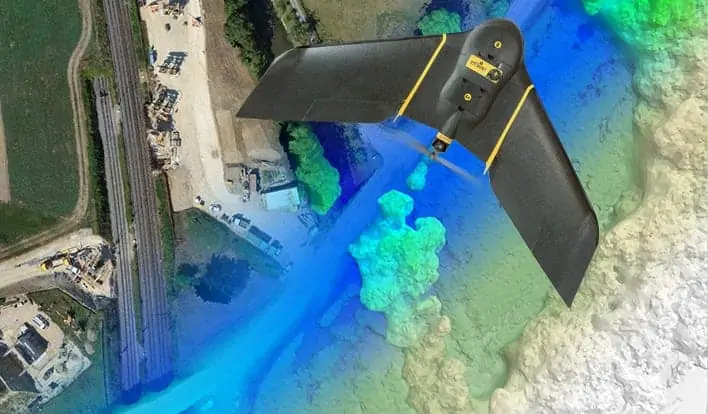
senseFly, a producer of professional drone solutions, has announced a new software integration with Trimble, which optimizes the drone mapping workflow for geospatial professionals.

The new integration between the company’s software ensures the smoothest possible end-to-end mapping drone (UAS) workflow. senseFly operators can now, within their drone’s recently launched eMotion 3.5 software, transform a senseFly S.O.D.A. camera’s georeferenced imagery into an automatically-collated project (in .jxl format). This enables the simple, one-click import of drone imagery into the Trimble® Business Center Aerial Photogrammetry module without the need for manual project creation and organization of images.

The senseFly-to-Trimble mapping workflow becomes as simple as:

  • Planning & monitoring a senseFly S.O.D.A.-based drone flight (in eMotion 3.5)
  • Downloading the drone’s images for one-click georeferencing in eMotion 3.5 (Flight Data Manager)
  • Clicking to create a .jxl format mapping project
  • Opening a project within the Trimble Business Center Aerial Photogrammetry module
  • Processing the drone’s imagery to generate orthophotos, contour maps, point clouds, digital surface models (DSMs) & feature maps
  • Analyzing & acting upon the data

“Making work easier and more efficient for geospatial professionals is the goal that drives every solution we develop,” said Jean-Christophe Zufferey, senseFly’s Co-Founder and CEO. “Therefore, we are excited to collaborate with Trimble on more tightly integrating our solutions, since enhancements such as this new eMotion-to-Trimble Business Center workflow do exactly that, ensuring that the transition from data collection to acting upon this data is as seamless as possible.”

The senseFly S.O.D.A. is the first camera to be built for professional drone photogrammetry work. This 1-inch, 20-megapixel RGB camera captures amazingly sharp aerial images, across a range of light conditions, allowing senseFly fixed-wing drone operators to produce detailed, vivid orthomosaics and ultra-accurate 3D digital surface models. senseFly S.O.D.A. is compatible with most senseFly fixed wing mapping drones, including the large-coverage eBee Plus.

In addition to producing powerful photogrammetric deliverables, Trimble Business Center allows surveyors and other geospatial professionals to combine aerial photography with data collected from GNSS receivers, total stations, 3D laser scanners and more, for a complete field-to-finish workflow. By easily combining imagery from unmanned aerial systems with ground-based survey data, users can visualize their project from both aerial and terrestrial perspectives, measure points within the images and create 3D models of the infrastructure and terrain.

Find suppliers of drone mapping software >

Posted by Caroline Rees Caroline co-founded Unmanned Systems Technology and has been at the forefront of the business ever since. With a Masters Degree in marketing Caroline has her finger on the pulse of all things unmanned and is committed to showcasing the very latest in unmanned technical innovation. Connect & Contact

Latest Articles

UAVOS’ Rotor Blades Complete Advanced Overload & Environmental Testing

UAVOS, in partnership with ALTER, conducted overload and environmental testing on helicopter rotor blades, displaying blade reliability, structural integrity and safety

Jul 11, 2025
Robosys’ Voyager AI Autonomy Suite Integrated Onboard New USV

Robosys Automation’s Voyager AI Autonomy Suite has been integrated onboard Uncrewed Survey Solutions' new USS Accession USV, enhancing autonomous marine operations for survey and monitoring

Jul 10, 2025
Textron USV Demonstrates MUM-T Capability in FLEX25 Exercise

Textron Systems demonstrated its TSUNAMI™ USV during FLEX25 in El Salvador, supporting SOUTHCOM and regional partners in counter-narcotics operations

Jul 10, 2025
OceanAlpha’s L25 USV Showcases Successful Autonomous Marine Survey Capabilities

OceanAlpha’s L25 USV has demonstrated innovative autonomous survey operations during the vessel's first Malaysian public display at Port Klang, June 2025

Jul 10, 2025
Maintaining Airport Operations Amid Rising Drone Risks

Airports face growing drone threats, and D-Fend Solutions’ EnforceAir counter-drone system provides real-time detection and mitigation to protect safety and ensure operational continuity

Jul 10, 2025
Voyis Strengthens ROV Camera Platform with New Service Programs

Voyis has launched its Voyis Academy and Voyis Protect programs to sustain the Discovery Stereo Vision System's long-term reliability and subsea optical excellence

Jul 10, 2025

Featured Content

New UAV to Combine Solar Hydrogen & Battery Power for Extended Flight

XSun and H3 Dynamics are developing the first UAV powered by solar, hydrogen, and batteries, aiming to deliver zero-emission, long-endurance unmanned flight

Jul 07, 2025
Enhancing Mangrove Restoration Through 3D Printed Drone Design

Explore how Inverto Earth, in collaboration with HP Additive, is using sustainable 3D printing and drone technology to drive large-scale mangrove restoration and protect vulnerable coastal ecosystems

Jul 03, 2025
Partnership Combines Drone Swarms & Situational Awareness to Boost Wildfire Response

Kongsberg Geospatial and FireSwarm Solutions have partnered to integrate autonomous drone swarms with real-time situational awareness for faster, smarter wildfire response

Jun 30, 2025
Advancing Unmanned Systems Through Strategic Collaboration UST works with major OEMs to foster collaboration and increase engagement with SMEs, to accelerate innovation and drive unmanned systems capabilities forward.