Lockheed Martin Unveils Multi-UAV Control Software

By Mike Ball / 20 Feb 2018

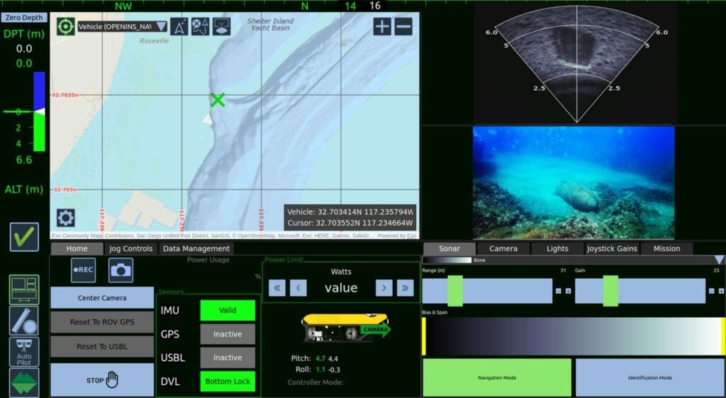
Navigation & Control Software

Discover cutting-edge solutions from 9 leading global suppliers
SUPPLIER SPOTLIGHT
Follow UST

Lockheed Martin VCSi control software

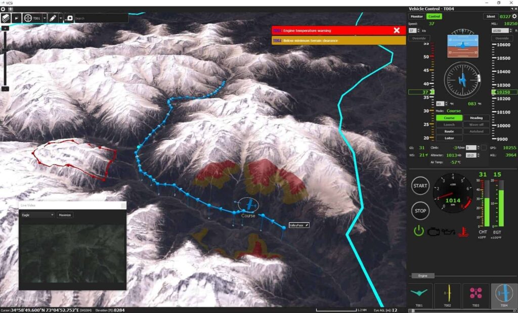
Lockheed Martin has announced the launch of VCSi, a new vehicle control software, as the culmination of more than two decades of experience and 1.5 million hours of operational use. The commercial software, which enables operators to simultaneously control dozens of unmanned vehicles and conduct information, surveillance and reconnaissance missions, will be unveiled during the Unmanned Systems Exhibition and Conference in Abu Dhabi.

“VCSi is a safe and reliable software platform that can be adapted to any vehicle – from one you can hold in your hand, to a 50,000-pound machine; from a vehicle that flies for a few minutes, to a vehicle that flies for months at a time,” said John Molberg, business development manager, Lockheed Martin CDL Systems. “The user can integrate as many vehicles as required to complete their missions, including boats, quadcopters, fixed-wing aircraft or even high-altitude pseudo satellites. Across commercial or military missions, VCSi is adaptable to the challenge and further extends the power of the human-machine team.”

VCSi’s major enhancements include:

Multi-Vehicle: Control interfaces to allow for true 1:n control of dissimilar vehicles anywhere on earth
Intuitive: Lockheed Martin further advanced its fly-by-mouse interface to enable easier training and reduce operator/analyst task loads
Modular: Offers a robust plug-in architecture, which allows for custom content to be added by the user or selected from pre-existing modules
International: Commercial software, made in Canada and free of export restrictions

VCSi is designed around the NATO Standardization Agreement known as STANAG 4586, which supports unmanned vehicle interoperability. Users can build attachments or plug-ins beyond 4586 to customize the VCSi software, which also supports multiple languages and non-Latin scripts. VCSi provides advanced 3D visualization of vehicles and airspace, and it is at the forefront of integration into unmanned traffic management systems.

This year marks the 25th anniversary of the VCS unmanned control product family, which has accumulated more than 1.5 million flight hours by operators controlling 40 different vehicles across several dozen companies. Lockheed Martin software has been simultaneously flying, on average, at least six unmanned aircraft during every hour of the last 25 years, completing missions as diverse as reconnaissance, inspection, mapping and targeting.

Posted by Mike Ball Mike Ball is our resident technical editor here at Unmanned Systems Technology. Combining his passion for teaching, advanced engineering and all things unmanned, Mike keeps a watchful eye over everything related to the unmanned technical sector. With over 10 years’ experience in the unmanned field and a degree in engineering, Mike’s been heading up our technical team here for the last 8 years. Connect & Contact

Latest Articles

Unmanned Helicopter & Camera Solutions to Showcase at LAAD Defence & Security

ZIYAN and HONPHO are set to showcase the Shadow S3 unmanned helicopter and the EO System stabilised camera solution at the LAAD Defence & Security 2025 exhibition in Brazil

Mar 28, 2025
The Role of Surface Preparation for Parylene Coating Adhesion

HZO explains how proper surface preparation is vital for achieving strong adhesion in Parylene coatings, ensuring long-term performance and durability in unmanned applications

Mar 28, 2025
Ascend Engineering Discusses Companion Computer Integration in Unmanned Aerial Systems

Ascend Engineering’s white paper explores integrating companion computers into drones, highlighting hardware selection, key capabilities, and implementation strategies

Mar 28, 2025
Most Read Articles on UST This Week

Here’s our round-up of the five most read articles on UnmannedSystemsTechnology.com this week

Mar 28, 2025
Continuous Deep Sea Observation Achieved with SubC Imaging Technology

SubC Imaging details how its camera and lighting system enabled an 18-month unmanned deep-sea monitoring deployment off Vancouver Island, capturing continuous footage and environmental data

Mar 28, 2025
Precision RTK GNSS Positioning for UAVs & Unmanned Systems

RTKdata provides access to a world-leading RTK corrections data network with over 12,000 base stations in more than 140 countries

Mar 27, 2025

Featured Content

Be Part of the World’s Largest Business Accelerator for Uncrewed Systems: Applications Now Open

GENIUS NY, a drone and robotics accelerator program, is now accepting applications from tech startups focused on uncrewed aerial systems, to automation and Advanced Air Mobility (AAM)

Mar 25, 2025
How IONA Reaches the Last Mile Through Smart Product Development

In this webinar, learn from Drone Industry Insights about scaling production and supply chain challenges, strategies from Arena by PTC to optimize product development, and how IONA Drones are advancing last-mile delivery

Mar 18, 2025
Nokia Talks to UST about 4G/5G Connected Drone-in-a-Box Advancements

How Nokia is revolutionizing drone connectivity with 4G and 5G, and advancing autonomous operations with the cutting-edge drone-in-a-box solution; Nokia Drone Networks

Mar 16, 2025
Advancing Unmanned Systems Through Strategic Collaboration UST works with major OEMs to foster collaboration and increase engagement with SMEs, to accelerate innovation and drive unmanned systems capabilities forward.