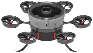
GeoDigital, a spatial data and analytics company, FLōT Systems, an unmanned aerial vehicle (UAV)-based technology company, and Environmental Consultants Inc. (ECI), a vegetation utility management firm, have formed a partnership to bring utilities remote asset inspection capabilities via UAVs. The program combines high-resolution imagery collected by FLōT Systems’ beyond line-of-sight capable UAV, analytics and location-based work management software from GeoDigital, and virtual inspection of those images with utility vegetation and asset management expertise from ECI.
For the first time, utilities will be able to assess critical infrastructure on both electric distribution and transmission facilities, as well as on pipelines, by using UAVs to pinpoint possible risks to their infrastructure. In doing so, utilities can improve service reliability, increase employee and public safety and best ensure regulatory compliance.
“We believe UAS will become an invaluable tool in helping utilities manage their infrastructure and the environment around it,” said FLōT Systems’ CEO Chris Vallier. “As specialists in the utility industry, we have been developing the ability to utilize long-range unmanned aircrafts to more safely and efficiently collect higher value facility information than with traditional methods.” With respect to the regulatory environment, Mr. Vallier goes on to say, “We understand how to operate within the current regulatory framework while helping our clients prepare for full-scale commercial activity in the near future.”
“By combining UAV collection and utility inspection expertise with GeoDigital’s virtual asset inspection software, utilities can now enhance their inspection programs by deriving actionable insights from big geospatial data,” said Chris Warrington, President and CEO at GeoDigital. “Virtual inspections use geospatial data, which can now be collected more frequently and safely, so utilities can prioritize remote asset maintenance and repairs using up-to-date data. This geospatially-precise work planning increases reliability and enables safer, more efficient field crew deployments. By going to digital inspections and having a history of all work activity, utilities can achieve significant process improvements and cost savings.”
“Because vegetation and equipment-caused failures are among the top causes of electric distribution system interruptions, our team has focused on providing virtual facility and vegetation inspections as our first end-to-end solution,” said Jim Downie, Executive Vice President of ECI. “For example, imagery collected to virtually identify high-risk trees or equipment maintenance needs can be tracked back to the field using GeoDigital location-based work management software. This is just the first example of the common vision of ECI, GeoDigital and FLōT to enable informed digital decisions that drive real returns for electric and gas utilities and their customers. We anticipate the business case for UAV and other remote inspection methods will further optimize utility engineering and vegetation management by taking advantage of LiDAR and other sensing technologies in the not-too-distant future.”


