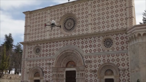
 Italian UAV manufacturer, Aermatica, has conducted the first authorised UAV flight in an urban environment in Italy. The flight was part of a survey, led by Prof. Donatella Dominici from the University of L’Aquila, to assess the structural damage of a Unesco Heritage church that was damaged in a recent earthquake.
Watch the video:
Footage and data from Aermatica’s ANTEOS RPA will be used to create three dimensional models of the Basilica di S.M. di Collemaggio which will help to identify any future structural repairs.
Data from the survey will build a database of metric and cartographic qualities. This database will be interrogated using algorithms and queries under GIS applications in order to disseminate already elaborated data with web-GIS platforms.
Optical and thermal sensors will help to build a geo-referenced thermal model, containing structural information.


