Remotely Operated Vehicles (ROV)
Discover cutting-edge solutions from 4 leading global suppliers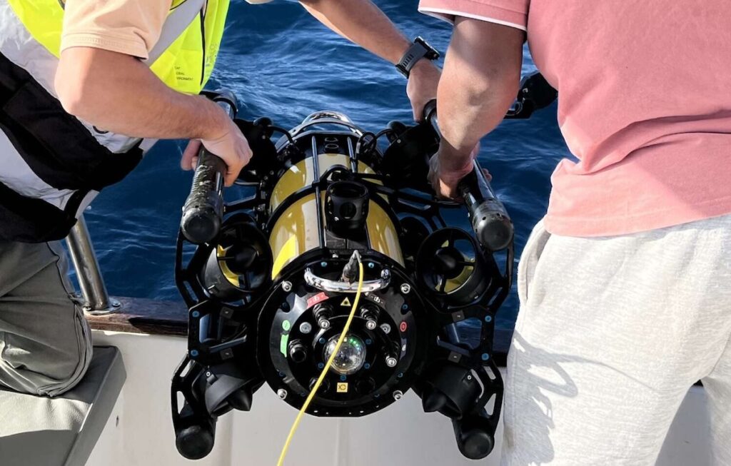
The Boxfish Alpha ROV is being used by Leaf Global Environmental Services PLC (LGES) to support marine environmental surveys at depths and in conditions that can restrict scientific diving. By incorporating Boxfish Robotics‘ ROV into existing survey procedures, the Saudi-based environmental consultancy can expand underwater observations while retaining the scientific oversight needed for environmental assessment. Read more >>
Established in 2018 with an emphasis on environmental stewardship, LGES contributes to the Saudi Green Initiative (SGI) and works to protect sensitive marine ecosystems while supporting sustainable coastal and marine development.
Its Marine Department includes marine scientists, oceanographers, engineers, and certified scientific divers with substantial practical experience. Activities include coral transplantation and restoration, benthic habitat investigations, seagrass assessments, marine ecological monitoring, protected species observations, and marine data acquisition employing ROV and remote sensing technologies.
Addressing Depth and Operational Constraints
Marine environmental projects can extend into water depths where conventional scientific diving is increasingly restricted by safe operating limits, available bottom time, currents, and other operational considerations. Survey programs must nevertheless produce structured and repeatable observations that provide suitable visual information for habitat mapping, environmental baselines, and regulatory documentation.
For LGES, this creates several practical requirements. Surveys need to reach beyond depths suitable for divers while preserving data quality, and visual transects must remain controlled and stable under changing current conditions. Positional awareness and repeatability are also necessary during habitat investigations, while collected imagery must integrate effectively with GIS-based environmental processes.
Equipment deployment presents another consideration, particularly because survey systems need to be launched and recovered efficiently aboard the relatively small vessels commonly employed for this work.
Extending Environmental Surveys with the Boxfish Alpha ROV
Since introducing the Boxfish Alpha ROV, LGES has expanded monitoring into locations where depth, water movement, or surrounding infrastructure can limit scientific diving.
With an operational depth capability of up to 300 meters, the ROV allows observations to continue substantially below diver-safe ranges. Scientific personnel retain direct control of the survey, enabling structured underwater investigations while avoiding additional exposure of divers to these conditions.
This capability allows the ROV to complement rather than replace other environmental survey methods. Scientific diving, direct in-situ measurements, and ROV observations can be combined according to the requirements and operating conditions of an individual project.
Repeatable Video Transects for Habitat Surveys
LGES uses the Boxfish Alpha ROV to perform video transect surveys, providing a consistent method for recording seabed conditions across the area under investigation.
Controlled visual transects improve comparison between observations and assist scientists in distinguishing changes in habitat, seabed substrate, and biological characteristics. The resulting imagery also provides additional spatial context for habitat maps and helps limit uncertainty when information is reviewed after field operations.
Visual information collected by the ROV can subsequently form part of GIS-based environmental workflows, connecting underwater observations with the wider spatial datasets used during environmental assessment.
Applications Across Marine Survey Programs
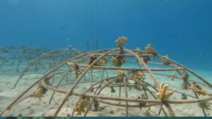
The Boxfish Alpha ROV has been deployed by LGES for several environmental monitoring applications. These include benthic habitat characterization, evaluation of coral condition and health, and investigations conducted near marine infrastructure.
The system is particularly applicable to the intermediate depth range between conventional diving operations and surveys that would otherwise require larger deep-water ROV equipment.
Evangelos Papadimitriou, Oceanographer | MSc | MBA, Marine Operations Manager – LGES, commented, “Boxfish Alpha ROV provides an effective solution for transitional depth ranges, where diver based surveys become constrained by safety and efficiency considerations, and where larger deep water ROV systems may be operationally or economically impractical.”
Combining ROV observations with scientific diving and additional in-situ measurements enables LGES to connect shallow-water investigations with monitoring at greater depths. This approach broadens spatial survey coverage while reducing personnel exposure and providing consistent datasets for environmental assessments and longer-term monitoring programs.
ROV Deployment from Survey Vessels
The physical and operational characteristics of the Boxfish Alpha ROV also allow LGES to deploy it aboard the small and medium-sized vessels commonly employed during its marine projects.
Stable operation in variable currents supports controlled underwater observations across different survey environments. The ROV’s robustness also contributes to dependable data acquisition under the range of site conditions encountered during field programs.
Efficient launch and recovery are particularly relevant when surveys involve multiple locations or when vessel time needs to be carefully managed.
Strengthening Environmental Survey Evidence
Access to underwater areas that cannot safely or practically be investigated by divers provides LGES with additional visual evidence for baseline habitat characterization.
Continuous ROV imagery can complement quantitative environmental measurements and scientific diving observations, creating a more complete record of conditions across a survey area. This information can reduce uncertainty during subsequent analysis and improve the spatial coherence of environmental datasets.
The resulting visual record also provides supporting evidence for environmental documentation supplied to regulators, project clients, and other stakeholders.
Integrating ROV Data Throughout the Survey Process
Incorporating the Boxfish Alpha ROV into LGES workflows supports several phases of environmental monitoring, including survey preparation, offshore operations, data acquisition, analysis, and reporting.
LGES combines observations made by scientific divers and direct environmental measurements with continuous geo-referenced video transects collected by the ROV. Bringing these information sources together provides a structured framework for assessing marine environments across different depths and operating conditions.
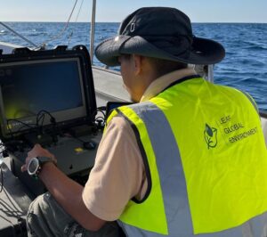
Live imagery from the ROV also gives survey personnel information while fieldwork is underway. Teams can modify survey plans according to observed conditions and direct additional effort toward locations carrying greater scientific or regulatory significance.
This operational flexibility can reduce unnecessary vessel time, assist coordination among field personnel, and enable technical decisions to be made during the survey rather than solely during subsequent analysis.
Papadimitriou added,“The Boxfish Alpha ROV functions as a core survey instrument, supporting defensible environmental assessments, efficient field operations, and informed technical decision-making throughout the full survey lifecycle.”
By combining continuous underwater imagery with quantitative measurements, LGES can maintain a visual record alongside other environmental evidence gathered during a project. The Boxfish Alpha ROV therefore provides an additional survey capability for monitoring areas beyond practical diving limits while supporting the consistent data collection required for marine environmental assessment and reporting.
Read Improving Environmental Monitoring with Boxfish ROV here.