


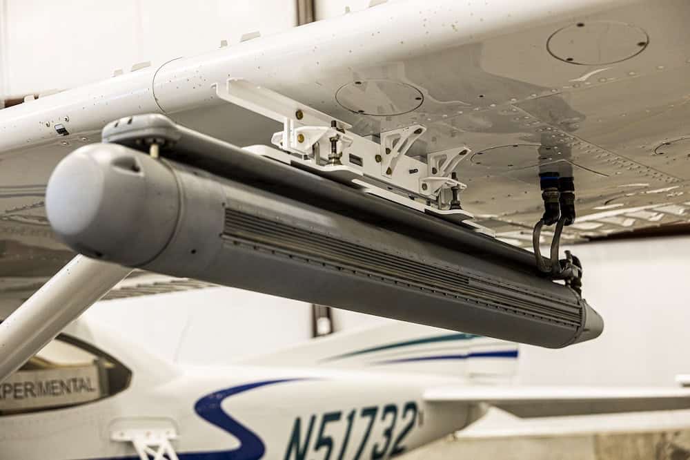
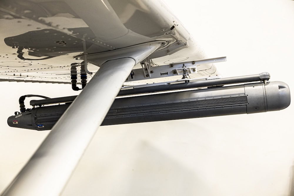
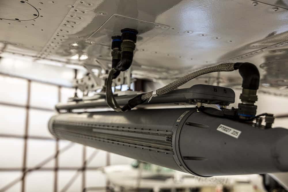
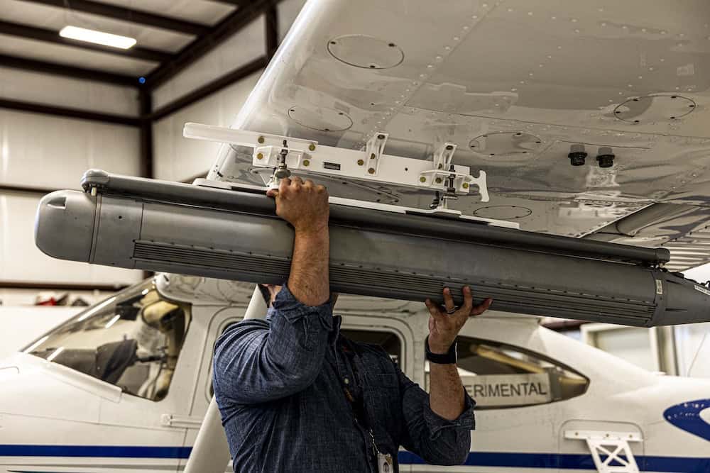
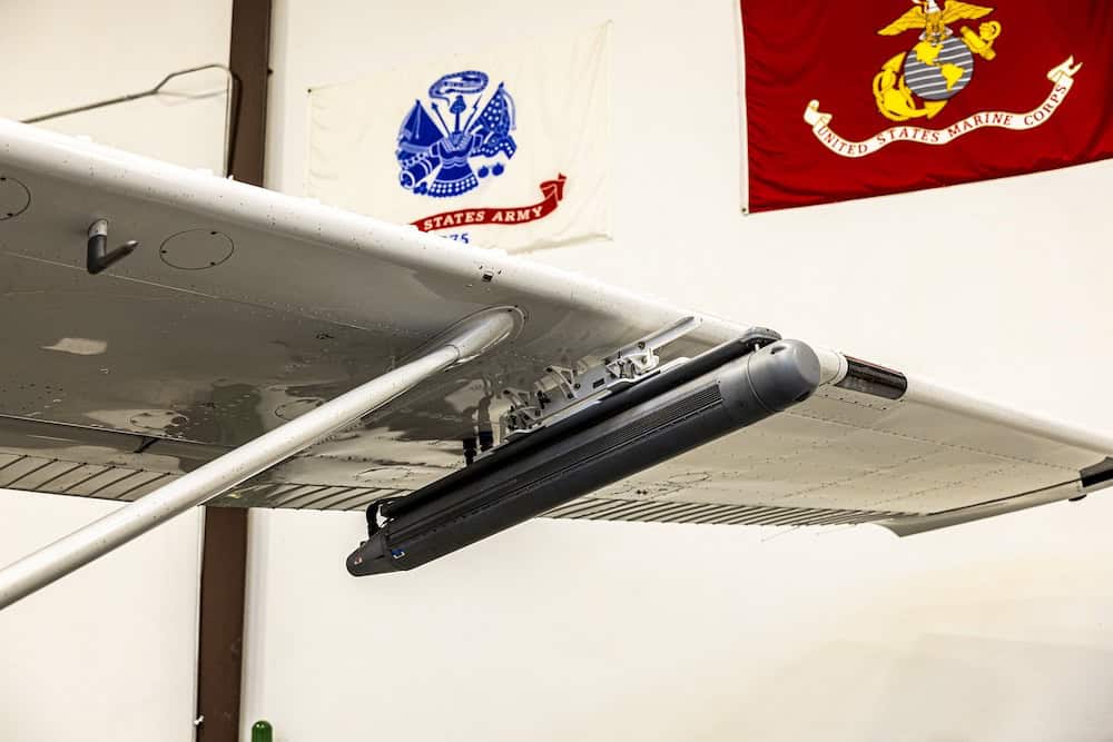
NSP-8 is a Ku-band, multi-channel, airborne multimode SAR/MTI radar developed for high-altitude strategic ISR across Group 4–5 UAS and crewed aircraft. Weighing 25.8 lbs (11.7 kg) and operating at configurable 300 W, 28 VDC power, the single-pod system integrates a high-precision IMU to enable stable, deep-look SAR imaging at standoff ranges up to 72 km.
The radar delivers SAR resolutions from 0.1 to 10 meters and supports stripmap, spotlight, and wide-area modes, along with coherent and non-coherent change detection (CCD/MCD). Ground Moving Target Indication (GMTI), Dismount Moving Target Indication (DMTI), Maritime Moving Target Indication (MMTI), and inverse SAR (ISAR) classification extend detection and tracking performance to 39 km for vehicles and up to 225 nautical miles for maritime surveillance and geolocation.
Designed for all-weather, day-and-night operations in ground and maritime environments, NSP-8 enables specialized ISR missions, wildland fire monitoring, coastal mapping, railroad and pipeline monitoring, counter-narcotics operations, sea ice detection, and search and rescue. Cursor-on-target cueing, Ethernet connectivity, and compatibility with airborne or ground processing servers support integration into established command-and-control ecosystems, including LISA 3D™ and radar control APIs.
Standard data outputs such as KML, complex NITF, STANAG 4607, and STANAG 4676 facilitate interoperability with existing PED infrastructures. Built to MIL-STD-810G environmental standards and qualified to TRL 8, NSP-8 provides extended coverage rates of up to 23,000 square nautical miles per hour at 150 KTAS for maritime moving target operations.
Specifications:
| Dimensions (D x L x H) | 5.4 in (13.7 cm) x 58.8 in (149.4 cm) x 6.8 in (17.3 cm) |
| Weight | 25.8 lbs (11.7 kg) |
| Power | 300 configurable, 28 VDC |
| Range Resolution | 0.1, 0.3, 0.5, 1, 2, 5, 10 m |
| SAR Imaging Max Range | 72 km |
| GMTI Vehicle Detection Range | 39 km |
| Maritime Surveillance Range |
Detection & geolocation (SAR): 225 nm (415 km) Detecting & tracking (MMTI): 159 nm (295 km) Classification (ISAR): 130 nm (240 km) |


