The latest UAS / UAV news for Autonomous and Unmanned Aerial Vehicles. Articles on commercial UAV, tactical drones and unmanned aerial systems, product launches and technological advances in UAV design and manufacture
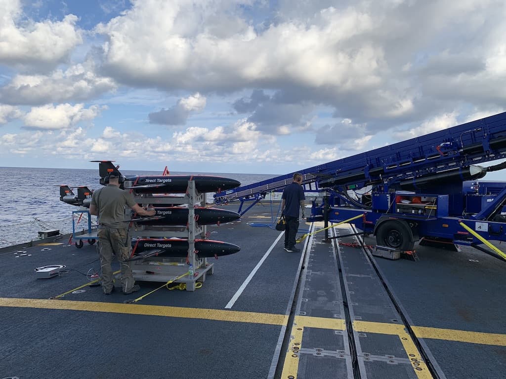
The agreement includes the Do-DT45neo, a next-gen high-speed aerial target for land, naval and air force markets, featuring aerodynamic improvements and new engines
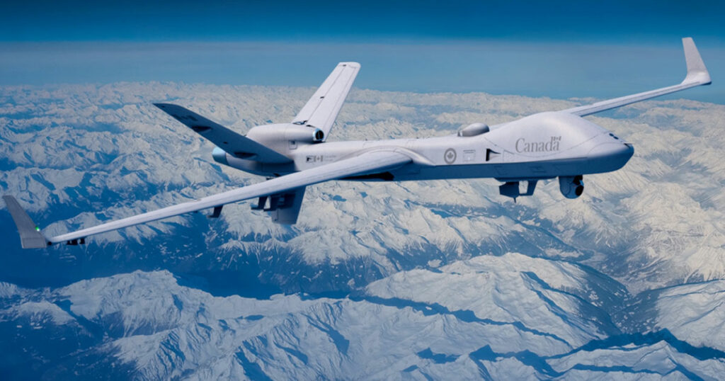
The Government of Canada has ordered the MQ-9B SkyGuardian from GA-ASI. The long-endurance Remotely Piloted Aircraft System is well suited to operating safety across Canada's vast territory and challenging weather conditions
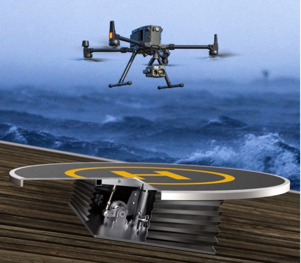
STABLE has been awarded funds by The Research Council of Norway to establish safe landing and take-off platforms for VTOL drones involved in the offshore wind industry
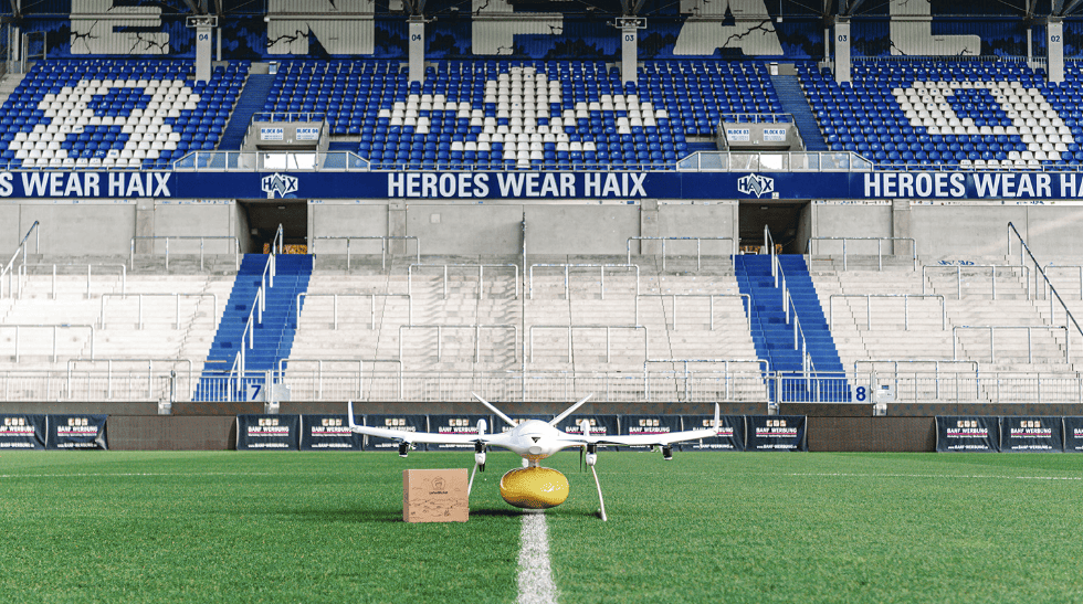
Residents of two Michelstadt districts can order SV Darmstadt 98 products online and these are then flown by Wingcopter drones to fixed points just outside the villages and transported to the customer's front door
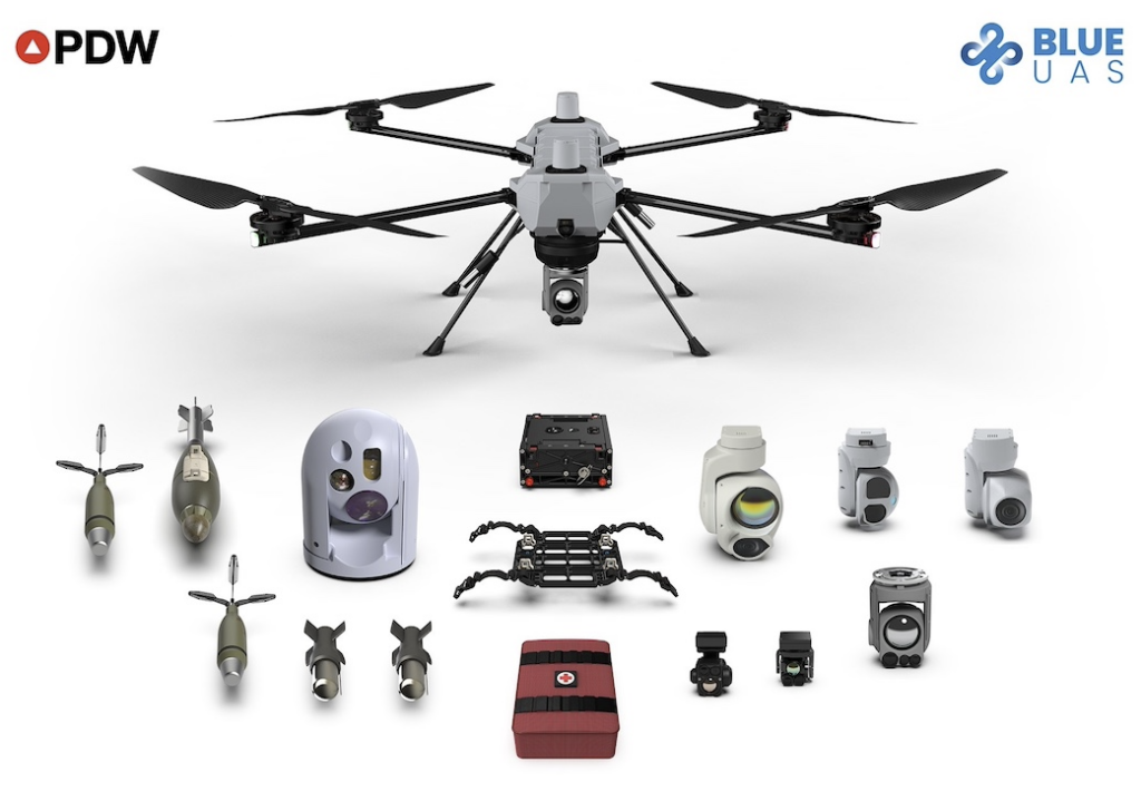
The Blue UAS list is a program developed by the Defense Innovation Unit (DIU) of the Department of Defense (DoD), designed to rapidly vet and scale commercial UAS technology
Contracted by the Oklahoma Aerospace Institute for Research and Education (OAIRE), uAvionix will deploy Command and Control (C2) and Detect & Avoid (DAA) services that enable uncrewed Beyond Visual Line of Sight (BVLOS) operations between nodes on the Skyway
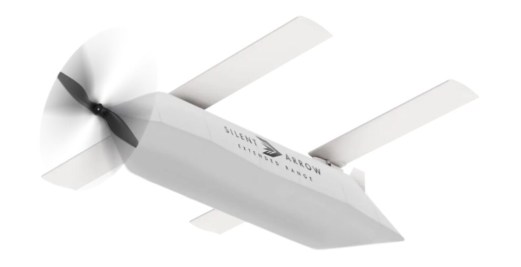
Silent Arrow® has been awarded a AFWERX contract to develop the CLS-300 with propulsion system to carry 1,000 pounds of payload over 300 nautical miles in contested environments
The camp in Toronto, Canada, is designed for people who do not have any formal education or experience in aviation and aerospace with participants learning through practical exercises and simulation workshops
The DigiCity is part of the NLR Drone Centre, which includes its own workplace, a surfaced landing strip of over 320 metres, and a closed airspace zone above the premises
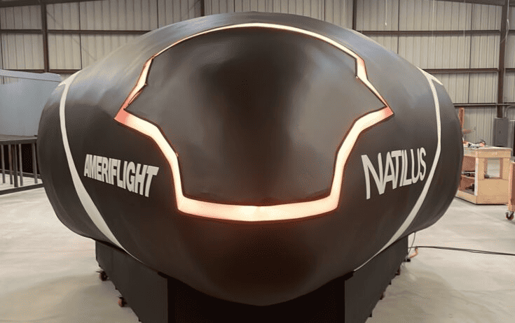
The Natilus Pilot Operations Desk (POD) is designed to train remote pilots of drones and is expected to reduce operational costs for Natilus autonomous aircraft customers
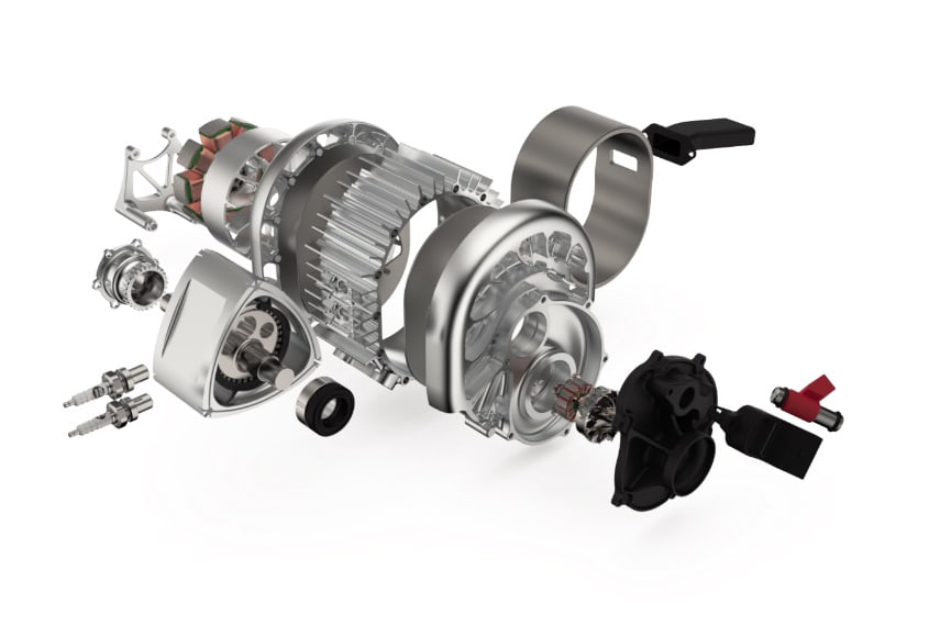
Ideal for aerospace applications Sapphire Windows by Meller Optics are suitable for providing front surface optics protection in guidance and vision systems
Nokia Drone Networks has launched in North America following a successful collaboration with Rohde & Schwarz to secure Federal Communications Commission certification
The new drone delivery network aims to connect 13 hospitals with Europe’s largest hospital laboratory Labor Berlin to support transportation of more than six million lab samples per year
ResilienX and VI&E have signed an MOU to collaborate on the Wittman Regional Airport eVTOL vertiport project, combining innovative eVTOL technology and IASMS solution
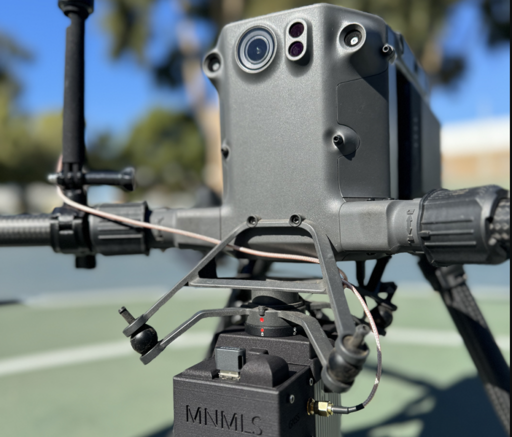
The Mad Nadir Mapping LiDAR System (MNMLS) contains a tactical grade Inertial Measurement Unit (IMU) coupled with a multi-frequency GNSS receiver, with these two combined components making up the highly accurate Inertial Navigation System (INS)
In collaboration with BayesMap, Inertial Labs has announced the PCMasterPro software update for the high-accuracy LiDAR point cloud generation solution RESEPI
Dronetag is set to receive funding from the Defence Innovation Accelerator for the North Atlantic (DIANA) to advance its cutting-edge technologies, specifically designed for enhancing safety and efficiency in the European airspace
The integration of LINIA's automated flight route software with Xer Technologies' X8 unmanned aerial vehicle (UAV) platform significantly enhances the efficiency and productivity of drone-based inspections
Project OperA (Operate Anywhere), expected to be completed in 2026, will develop and validate several solutions for the safe accommodation of Advanced Air Mobility (AAM) vehicles in flight
Onboard Detection and Avoidance Radar Tracking (oDART) leverages micro radar technologies that have been specifically developed for low altitude flight onboard uncrewed aerial systems (UAS) and will adapt and introduce these into crewed aircraft
Advancing Unmanned Systems Through Strategic Collaboration
UST works with major OEMs to foster collaboration and increase engagement with SMEs, to accelerate innovation and drive unmanned systems capabilities forward.