


Drone LiDAR
Discover cutting-edge solutions from 4 leading global suppliers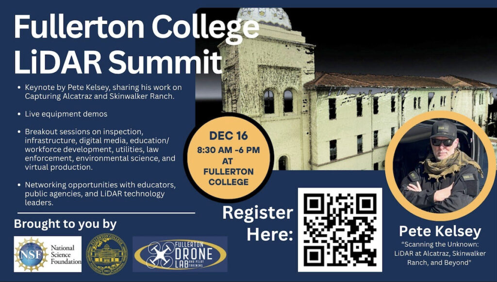
The Fullerton Drone Lab at Fullerton College will host the LiDAR Summit 2025 on Tuesday, December 16, bringing together leaders in LiDAR technology, education, and industry to explore the latest advancements and real-world applications of 3D geospatial data.
The LiDAR Summit will explore the future of LiDAR in infrastructure, environmental monitoring, film production, and public safety. It will include technology demonstrations from leading LiDAR manufacturers, including Wingtra, Leica Geosystems, and YellowScan.
There will be panels and presentations from end users in utilities, law enforcement, conservation, and the film industry. The event will also offer breakout sessions on workforce development, digital media tools, and drone-based LiDAR scanning, and will include participation from major software and data processing companies such as DroneDeploy and Esri.
The highlight of this one-day summit will be the keynote address by Pete Kelsey, founder of VCTO Labs LLC and a renowned expert in 3D reality capture.
Kelsey will share behind-the-scenes insights from two of his most notable projects: “Capturing Alcatraz,” a digital preservation initiative using high-resolution LiDAR and photogrammetry, and his work on the enigmatic Skinwalker Ranch, where advanced scanning technologies are being used to explore scientific and cultural mysteries.
Jay Seidel, Director of the Drone Technology Program at Fullerton College, commented, “LiDAR technology is transforming the way we see and interact with the world. This summit will showcase how LiDAR is being applied in everything from city planning and infrastructure inspection to environmental restoration, cinematic virtual production, and forensic crime scene reconstruction.”
Expected attendees include public safety officials, city and county planners, GIS and digital media professionals, surveyors, educators, and students, forming a strong cross-sector gathering of stakeholders dedicated to advancing spatial data technologies.
The LiDAR Summit is free and open to the public with an RSVP, and sponsorship and exhibitor opportunities are available.
To find out more information and register, visit Eventbrite, or contact Jay Seidel >>


