


Coaxial Drones
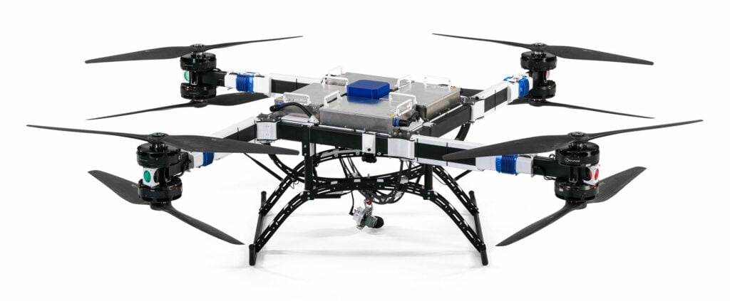
Discover cutting-edge solutions from 6 leading global suppliersThe integration of the MicaSense RedEdge-P™ multispectral camera is now complete and available for order on both of Ascent AeroSystems‘ rugged Spirit™ and new Spartan™ coaxial UAV platforms, delivering advanced agricultural and environmental intelligence in a quick-connect, easy-to-deploy package.

The MicaSense Series RedEdge-P is a multispectral and panchromatic sensor designed to provide highly accurate vegetation data through five narrow multispectral bands and a high-resolution panchromatic imager.
With seamless integration to Ascent’s modular coaxial platforms, operators can now capture sharper imagery, process results faster and make more informed management decisions across a wide range of applications.
The completed integration comes less than four months after Ascent and AgEagle, announced their strategic collaboration to pair the high-resolution RedEdge-P multispectral sensor with Ascent’s high-performance, all-weather UAV platforms.
Peter Fuchs, Co-Founder and CEO of Ascent AeroSystems, said, “Farmers, researchers, and environmental managers need tools that deliver reliable, actionable intelligence without slowing down operations. With the RedEdge-P integration available on both Spirit and Spartan, we’re offering operators a turnkey, NDAA-compliant solution that combines world-class sensing with reliable flight performance and class-leading endurance.”
Bill Irby, AgEagle CEO, added, “The collaboration between Ascent AeroSystems and AgEagle has produced systems that allows operators to streamline their operations. We are committed to pushing the boundaries of remote sensing technology, boosting productivity and driving operational efficiencies in agriculture and beyond. Together, we’ve delivered greater capability to the unmanned systems marketplace.”
The cylindrical coaxial design, IP56-rated all-weather protection, and extended endurance of Ascent’s Spirit and Spartan platforms make them ideally suited for agricultural surveys, environmental monitoring, and research missions requiring both durability and precision data.


