


Weather Stations
Discover cutting-edge solutions from leading global suppliers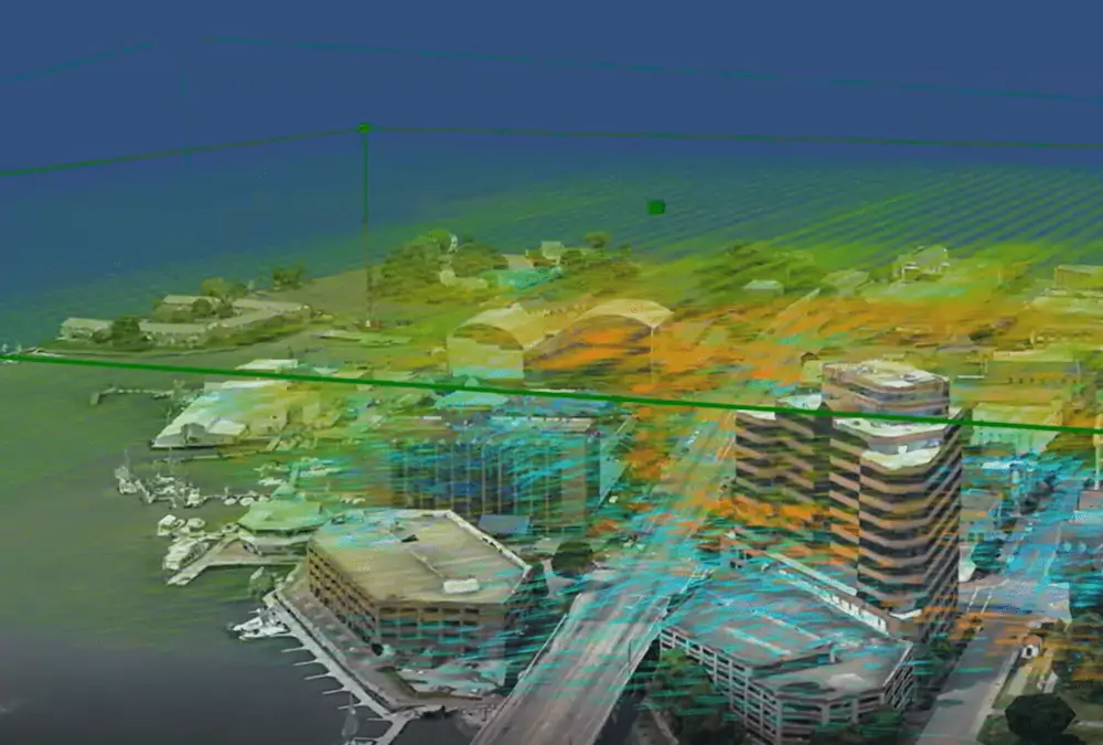
TruWeather Solutions (TWS) has been awarded and is at the inception of a NASA funded Phase II (750,000) Small Business Innovation Research (SBIR) contract for Urban Weather Sensing Infrastructure Testbed in Hampton, Virginia, US.
TruWeather, along with key industry partners Hampton University and the City of Hampton, VA, will develop a NASA-funded urban weather testbed to demonstrate delivery of more granular weather data and forecast services for low altitude urban and suburban flight to enable weather aware Unmanned Aerial Systems (UAS) Beyond-Visual-Line-Of-Sight (BVLOS) operations and the Advanced Air Mobility (AAM) industry.
The Hampton testbed aims to advance next-generation weather services required to safely scale profitable UAS and AAM services. The project will take place in a diverse and challenging weather environment. TruWeather’s goal is to offer a robust urban wind and weather measurement, behavior, and Wind Hazard Information Location (WHILS) prediction service that is scalable to any urban area in the world, delivering Elevated Weather Intelligence via software-as-a-service.
TruWeather is partnering with world class science, technology and engineering companies and university researchers to close weather data voids and overcome traditional modeling and computer processing commercialization hurdles.
According to the company, the TruWeather difference is in the ground-based weather sensor systems that collect a greater amount of weather measurements with high enough spatial coverage and rapid refresh in the low altitude environment.
Two innovative MetroWeather Doppler Lidars, from Kyoto-based venture MetroWeather, Inc., will provide ‘MRI-like’ wind and potential cloud height information covering over 30-40 area miles and up to 6,000 feet above the ground. The test bed will integrate observations from these lidars, 30 ground sensors, satellite data and potentially a radar to provide services that will provide greater certainty about where and when it is safe for AAM vehicles to operate. The testbed and future systems will inform which routes will provide the most advantageous weather and inform locations selection for terminal operations.
TruWeather believes the service will enable improvement of UAS and e-VTOL power management, payload weight estimates, travel times and flight separation services to improve airspace traffic management and vertiport throughput allowing more aircraft to arrive and depart safely.
The TruWeather services, once fully developed and operational, are planned to be commercially used by The Longbow Group in its PEGASUS Urban Airspace Monitoring and Control Center (UAMCC) to offer UAS and e-VTOL traffic management and vertiport services in Hampton Roads and beyond.
TruWeather continues to expand its portfolio of tools and expertise to enable safe UAS and AAM operations with a consortium of partners and entrepreneurs including ResilienX, Spire Global, MetroWeather (Japan), Daniel H. Wagner Associates’, WeatherFlow-Tempest, The Longbow Group, and the Hampton University Severe Weather Research Center. TruWeather and its partners are working toward the creation of the testbed and enabling the installation of 30 micro-weather stations in the downtown Hampton district.
The SBIR program and the support of NASA makes this possible. The program is very competitive and provides funding for companies to solve problems, accelerate science, and bring new products or services to market.
“We need an adaptive, affordable sensor array to complement weather satellites and weather radar technology and to provide more accurate data to train machine learning models to reliably provide the operational picture required to safely navigate the urban airspace,” said Don Berchoff, TruWeather CEO and former National Weather Service Director for Science and Technology. “We are taking a broader view of this work and also examining how cities can use urban micro weather data collection as part of SMART City initiatives to serve air quality and green energy building management, emergency services and other functions within a city that are impacted by micro-weather on a street-by-street level.
“Through its relationship with NASA LaRC (Langley Research Center), Hampton has been in the forefront of innovation, and is a national hub for unmanned systems,” said Hampton Mayor, Donnie Tuck. “We are proud to partner with TruWeather as they develop and hone cutting-edge weather technology.”

Find suppliers of Wind Sensors, Weather Stations and Meteorology Equipment for Unmanned Systems >>


