New Drone Construction Survey Solution Introduced

By Mike Ball / 06 Jun 2021
Follow UST

Drone construction site survey

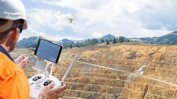
Propeller Aero and Wingtra have partnered to develop a new site data collection and 3D mapping solution designed specifically for the construction and earthworks industry. The new solution pairs the Propeller drone data visualization and analytics platform with the WingtraOne vertical takeoff and landing (VTOL) drone, allowing construction professionals to quickly and esily collect survey-grade data across their entire worksite.

Surveyors place Propeller AeroPoints (smart ground control points) on the worksite, then fly the WingtraOne drone to collect the required survey data. Survey images are uploaded to Propeller’s cloud-based platform where the fully automated geotagging and photogrammetry processing is completed within 24 hours of submission on the platform.

The integrated solution reduces risk and improves efficiency by serving as a reliable, single source for survey data and progress. Unlike traditional survey methods, which require manual, error-prone data collection, surveyors can easily fly their site on a regular basis to collect and process survey data.

Personnel across the entire worksite can view geographically accurate, realistic 3D site models and track, inspect, and report on job progress and productivity. This increased accuracy and reliability has been shown to reduce conflict, more quickly resolve disputes, and drive more pre-construction bid precision.

Jack Nachazel, Customer Success Engineer at Propeller Aero, commented: “Many Propeller customers are flying massive mines, road and railway projects, and other large sites, and are seeing the value of VTOL drones for their operations. Our partnership with Wingtra meets a significant demand in the industry for more efficient and highly accurate survey data that supports not only time and cost savings, but also reliable data you can trust.”

Julian Surber, Product Manager at Wingtra, said: “Improving accuracy, reliability, and efficiency for survey data is imperative for our customers. Partnering with Propeller to provide a complete solution with the WingtraOne drone, AeroPoints, and Propeller’s PPK data processing and visualization is the right step toward better serving our customers.”

Find suppliers & manufacturers of Survey UAV’s >>

Posted by Mike Ball Mike Ball is our resident technical editor here at Unmanned Systems Technology. Combining his passion for teaching, advanced engineering and all things unmanned, Mike keeps a watchful eye over everything related to the unmanned technical sector. With over 10 years’ experience in the unmanned field and a degree in engineering, Mike’s been heading up our technical team here for the last 8 years. Connect & Contact

Latest Articles

Advanced Navigation: Enhancing Precision Agriculture with Autonomous Systems & AI

Advanced Navigation outlines how its expertise in AI, INS, and GNSS technology enhances autonomous farming by addressing labor shortages, improving efficiency, and enabling precision agriculture for higher yields

Jan 20, 2025
Amprius Boosts Battery Performance for Electric Mobility Applications with SiCore

Amprius Technologies’ new SiCore™ cell chemistry that is part of its growing SiCore product platform designed to boost battery performance for electric mobility applications

Jan 20, 2025
ParaZero’s HALO Precision Airdrop System Demonstrates Success in Test

ParaZero Technologies has successfully completed a key test for its HALO Precision Airdrop System, showcasing its ability to deliver sensitive supplies safely and accurately under challenging conditions

Jan 20, 2025
Exploring Land Navigation Systems: From Inertial to Hybrid Solutions

LITEF discusses the evolution, challenges, and counter-measures in military navigation technology

Jan 20, 2025
Most Read Articles on UST This Week

Here’s our round-up of the five most read articles on UnmannedSystemsTechnology.com this week

Jan 18, 2025
New High-Precision VTOL UAV LiDAR Scanning Solution

Ventus-Tech Robotics' tailsitter VTOL UAV has been integrated with the Yellowscan Mapper+ OEM payload

Jan 17, 2025

Featured Content

“Surveillance as a Service” UAV Solution Launched

Volatus Aerospace’s “Surveillance as a Service" solution will use drone technology to provide secure, multi-modal surveillance for faster response times and actionable intelligence

Jan 16, 2025
Aurora & SkyGrid Advance Airspace Management Solutions for UAVs

Aurora Flight Sciences and SkyGrid are set to enhance Advanced Air Mobility (AAM) by collaborating on systems for integrating UAVs into the national airspace

Jan 14, 2025
New Safety System Unveiled for Anzu Raptor Drones

ParaZero has launched the SafeAir Raptor, a parachute safety system for Anzu Robotics’ Raptor and Raptor T drone models that complies with ASTM F3322-22 standards

Jan 08, 2025
How ANELLO’s Disruptive SiPhOG™ Technology is Shaping the Future of Precision Navigation

UST sits down with Dr. Mario Paniccia, CEO at ANELLO Photonics, to learn how Silicon Photonics Optical Gyroscope technology is empowering autonomous systems with cutting-edge navigation solutions

Jan 06, 2025
XPONENTIAL Europe Highlights Autonomous Robotics for Perimeter Security

XPONENTIAL Europe, held in Düsseldorf from 18-20 February 2025, will focus on uncrewed systems and highlight their use for protecting critical infrastructure

Jan 02, 2025
Software-Defined Networking Capability Selected for Attritable Autonomous Systems

Viasat will provide its NetAgility SDN system in support of the US DoD's Replicator initiative

Dec 24, 2024