Microdrones: Meet our new longer range LiDAR, the mdLiDAR1000LR

Webinar Details
  • Hosted by Microdrones
  • October 7, 2021 - Available on Demand
  • mdLiDAR1000LR

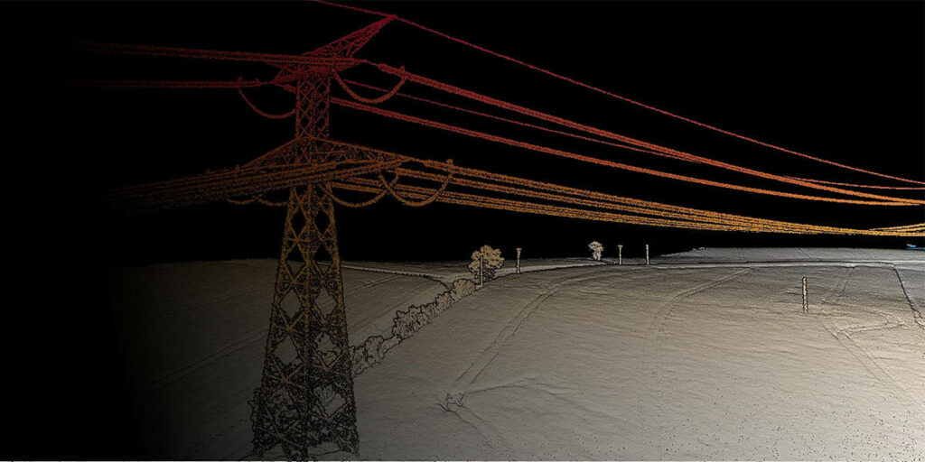
    The GE industrial drone line adds an impressive new product to the existing Microdrones technology portfolio. The mdLiDAR1000LR system helps professionals collect data from a longer range, (especially helpful when working in steep or treacherous terrain) while covering more area per flight.

    mdLiDAR1000LR means longer range. You’ll cover more ground from above. This translates to more efficiency than ever – the survey equipment, software, workflow, training and support that you need to be productive in the field – with convenient Microdrones as a Service (mdaaS) plans.

    See how data produced by the new mdLiDAR1000LR can help you work more efficiently, accurately, safely and profitably.

    In this webinar we will cover:

    • System details and technical specs
    • The Microdrones workflow
    • Planning considerations
    • Precision & accuracy
    • Data processing & sample dataset
    Posted by Caroline Rees Caroline co-founded Unmanned Systems Technology and has been at the forefront of the business ever since. With a Masters Degree in marketing Caroline has her finger on the pulse of all things unmanned and is committed to showcasing the very latest in unmanned technical innovation. Connect & Contact

    Featured Content

    New UAV to Combine Solar Hydrogen & Battery Power for Extended Flight

    XSun and H3 Dynamics are developing the first UAV powered by solar, hydrogen, and batteries, aiming to deliver zero-emission, long-endurance unmanned flight

    Jul 07, 2025
    Enhancing Mangrove Restoration Through 3D Printed Drone Design

    Explore how Inverto Earth, in collaboration with HP Additive, is using sustainable 3D printing and drone technology to drive large-scale mangrove restoration and protect vulnerable coastal ecosystems

    Jul 03, 2025
    Partnership Combines Drone Swarms & Situational Awareness to Boost Wildfire Response

    Kongsberg Geospatial and FireSwarm Solutions have partnered to integrate autonomous drone swarms with real-time situational awareness for faster, smarter wildfire response

    Jun 30, 2025
    Advancing Unmanned Systems Through Strategic Collaboration UST works with major OEMs to foster collaboration and increase engagement with SMEs, to accelerate innovation and drive unmanned systems capabilities forward.