


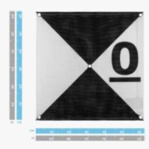
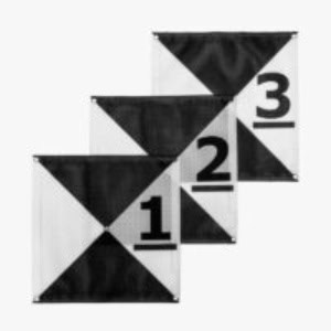
Designed to optimize geospatial accuracy in drone mapping operations, these Ground Control Points (GCPs) deliver a durable, high-visibility reference system for photogrammetric alignment. Constructed from resilient polyester mesh with an anti-reflective matte surface, each target features a high-contrast iron cross pattern, center passthrough, and corner eyelets for secure anchoring on varied terrain. Their lightweight build ensures rapid deployment, while foldability enhances portability across field sites.
Engineered for maximum visual clarity and positional precision, the center bull’s-eye aligns seamlessly with aerial imagery workflows, allowing accurate geo-referencing even in glare-prone or inclement environments. Numbered 0–9 and easy to identify in flight data, these weather-resistant targets integrate easily with GNSS workflows, improving survey fidelity without adding workflow complexity.
Specifications:
| Color | Black and white |
| Numbers | 0-9 |
| Surface Finish | Anti-reflective matte |
| Center Type | Center passthrough |
| Pattern | Iron cross (harlequin cross) |
| Anchoring | 4 corner eyelets |
| Size | 61.5 cm x 61.5 cm |


