


Discover World-Leading Unmanned and Autonomous Technologies
Discover cutting-edge solutions from leading global suppliers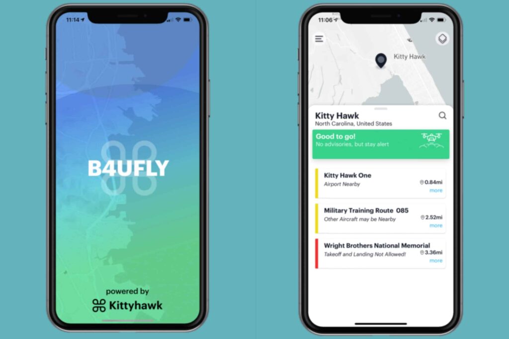
Kittyhawk and the Federal Aviation Administration (FAA) have announced the introduction of a new version of B4UFLY, the free mobile app that lets drone operators check the status of airspace prior to flight. Available for iOS and Android, the app determines what airspace restrictions are in effect at any location in the United States, in real-time.
B4UFLY is a key tool in the safe integration of unmanned aircraft systems (UAS) into the National Airspace System (NAS) that empowers recreational, commercial, and government drone operators with the situational awareness to fly safely and responsibly every time. More than 700,000 people have used B4UFLY since its original launch in 2016. B4UFLY is provided through a partnership between the FAA and Kittyhawk at no cost to taxpayers.
The new app leverages Dynamic Airspace, Kittyhawk’s patented airspace controller for managing real-time flight restrictions, authorizations, and guidance. B4UFLY programmatically consumes FAA data sources for controlled airspace, special use airspace, critical infrastructure, airports, national parks, military training routes, and temporary flight restrictions.
Based on location, B4UFLY provides simple, easy to understand airspace guidance that includes Good to Go, Warning and Do Not Fly. The app also provides links to helpful UAS educational content, safety resources, and LAANC, the FAA’s Low Altitude Authorization and Notification Capability for obtaining authorizations to fly in controlled airspace.
“B4UFLY is a hallmark of our commitment to ensuring drones are safely integrated into the NAS. Our partnership on B4UFLY with Kittyhawk represents the kind of public-private partnership that is essential to advance this burgeoning industry. As the skies become more crowded and UAS operations become more complex, basic airspace situational awareness, especially for the newest of fliers, will be essential,” said Jay Merkle, Executive Director, FAA UAS Integration Office.
“Kittyhawk was the birthplace of manned aviation and we’re proud to continue that legacy of innovation with the new B4UFLY app,” said Jon Hegranes, Kittyhawk CEO and Founder. “While the Wright brothers had a vast and soft landing area, drone pilots face sometimes complex rules and restrictions that can change quickly. Our goal with B4UFLY is to make knowing when and how you should fly simple, quick, and reliable.”
Future development of B4UFLY will include new capabilities for weather, Remote ID and additional data layers for uses in public safety, natural disasters and emergency response.


