


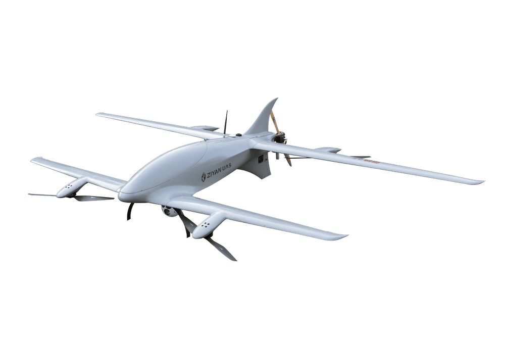
Hybrid VTOL Fixed-Wing UAV
Discover cutting-edge solutions from leading global suppliers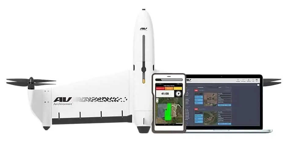
AeroVironment has announced the introduction of the next generation of its Quantix VTOL hybrid drone and the AeroVironment Decision Support System (AV DSS) for precision agriculture. Enhancements across the Quantix & AV DSS ecosystem deliver a combination of new features, performance improvements and product package offerings – designed to meet the needs of individual growers, precision ag service providers and large-scale farming operations.
“The response from growers to Quantix & AV DSS across the country has been very positive,” says Jeff Rodrian, director, Commercial Information Solutions, AeroVironment. “The ag community values a powerfully simple to use drone and data analytics ecosystem that captures field data quickly, and quantifies it in a format they can act on immediately.”
Featuring an innovative VTOL (vertical takeoff and landing) hybrid design, Quantix is purpose-built for crop scouting and can survey up to 400 acres in 45 minutes. During flight, integrated sensors capture high-resolution color and multispectral imagery via dual 18MP cameras. On-board processing delivers true color and NDVI imagery on the included operating tablet as soon as the drone lands, allowing growers to ground-truth issues while still in the field. For more detailed analysis, Quantix seamlessly integrates with AV DSS to perform advanced image processing and data analytics including True Color, NDVI, GNDVI, canopy coverage, anomaly detection and more, providing users with deeper insights into plant emergence, vegetative health, inputs and resource management.
“We worked closely with our customers to develop the next generation of Quantix & AV DSS and deliver the actionable intelligence that today’s growers need to drive their business forward and maximize every acre,” added Rodrian.
Quantix & AV DSS include a number of new features, performance improvements and safety enhancements designed to optimize the user experience – on the ground, in the field and in the air:
Variable Rate Layer – Users can now view, download or import a Variable Rate Layer into a wide-range of Farm Management Software to create geo-referenced application maps and prescriptions for use with variable rate controllers and hardware systems
John Deere Operations Center Connected – With single click data transfer, Variable Rate maps can be exported from AV DSS into John Deere Operations Center. John Deere Operations Center users can also easily import field boundaries into AV DSS to create geo-referenced locations for future Quantix flights
Quick Resolution Imagery – In areas with slower internet connection, users can select Quick resolution imagery, decreasing total upload and processing time by 50%, while still performing AV DSS’ full suite of data analytics
Plant Count Beta Trial – AV DSS users will soon be able to participate in a Plant Count Beta Trial program at no additional cost. Utilizing machine learning and advance image recognition algorithms, this on-demand data product will provide growers with access to data analytics that quantify stand count and plant emergence
Quantix & AV DSS will now be available in three product packages, allowing customers to find a solution that’s right for their business. Each product package includes the ready-to-fly Quantix hybrid drone, and access to AV DSS data analytics platform.
Find Suppliers of Hybrid VTOL UAV Manufactures
“Whether you’re a grower looking to put aerial drone data analytics to work on your farm, an enterprise ag business or an ag services provider looking to begin scouting fields and scaling your business, our goal is to provide flexible packages that meet your needs and budget,” says Rodrian.
Quantix & AV DSS Bundle provides the entire hardware and software ecosystem and includes a 3-year subscription to AV DSS online data analytics platform with unlimited data storage
Quantix Enterprise Bundle, developed for large-scale farming operations, providing pay-as-you-fly flexibility with a per-acre image processing fee, unlimited data storage and no monthly AV DSS subscription fee
Quantix Professional Package, ideal for Ag Service Providers, offering a turnkey “Franchise-in-a-box” solution with everything needed to start scouting fields and building a business. This package includes a monthly subscription to AV DSS that provides access to exclusive Client Management and publishing tools, and a per acre image processing fee


