


Discover World-Leading Unmanned and Autonomous Technologies
Discover cutting-edge solutions from leading global suppliers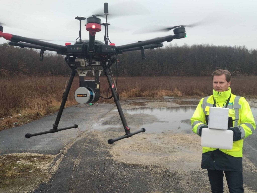
Velodyne Lidar has announced that the YellowScan Surveyor unmanned aerial vehicle (UAV) surveying solution has utilized Velodyne’s sensor technology to generate precise mapping data for an infrastructure construction project on one of Central Europe’s busiest roadways. YellowScan Surveyor improves upon previous time-intensive manual surveying processes by providing a more efficient method for collecting landscape data with increased precision and detail.
The project was conducted by Ventus-Tech using YellowScan Surveyor to collect data along a 47-kilometer segment of the M1 highway (E60, E65, E75) in northwestern Hungary. The data, gathered by 88 UAV flights over one month, enabled engineers to design a plan to expand the highway from 2+2 lanes to 3+3 lanes. YellowScan Surveyor includes Velodyne Lidar’s Puck, a compact and versatile sensor that delivers a high-resolution surround view image to accurately measure and analyze any landscape.
“YellowScan Surveyor is truly a turnkey solution for advanced applications such as highways, allowing organizations to avoid costly, dangerous manual surveys,” said Pierre d’Hauteville, Principal, YellowScan. “Using Velodyne’s lidar technology allows us to provide the highest level of data accuracy, density, and produce real-time georeferenced point cloud data.”
On this project, YellowScan Surveyor, equipped with Velodyne’s Puck sensor, provided 100 data points per square meter with accuracy within 5 centimeters. This level of precise detail is especially important when redesigning roadways, because widening a road requires consideration of existing infrastructure, drainage networks, and vegetation. The project is in the design, planning and approval stage, with final design expected to be approved by mid-2019 and construction to be finished by 2022.
“Industry leaders rely on Velodyne’s rich computer perception data to provide the highest performing surveying systems with the lowest complexity,” said Mike Jellen, President and CCO, Velodyne Lidar. “YellowScan has a robust, fully integrated system designed to meet the needs of demanding survey and terrain applications. YellowScan Surveyor can be easily adapted to any drone, generating data when and where customers need it.”
“YellowScan Surveyor allowed us to conduct a fast, efficient survey with minimal interruption to traffic and supply very detailed 3D data that accurately depicted the landscape,” said Balint Vanek, Ph.D., CTO, Ventus-Tech. “The customer support delivered by YellowScan was incredibly good. They provided extremely valuable support to help us conduct such a complex and large project.”


