Indonesian Navy Deploys Drone-Based Magnetic Measurement Solution

By Mike Ball / 25 Sep 2018

Smart Sourcing for Unmanned Systems

Discover cutting-edge solutions from leading global suppliers
SUPPLIER SPOTLIGHT
Follow UST

ECA Group magnetic imaging solution

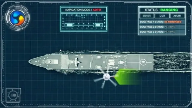
ECA Group has announced that the Indonesian Navy has deployed the company’s new drone-based solution for checking the magnetic signature of a vessel in order to assess its vulnerability against underwater mines and other threats. STERNA is the first UAV (unmanned aerial vehicle)-based portable aerial magnetic solution used by a navy in operational conditions.

STERNA is based on ECA Group’s IT180 drone platform, a compact, high-performance VTOL mini-UAV. The system incorporates a magnetometer and digitizer, which are part of a set-up used for degaussing systems in compliance with NATO standards. STERNA is able to measure the magnetic signature of vessels.

To perform a magnetic measurement using a drone the key points are:

  • Use the normal of the magnetic vector instead of the three axis relative components
  • Know how to compensate for the drone’s own magnetism
  • Know how to correct sensor errors

The last two points are ensured through an algorithm and calibration figures which have proven their efficiency on real vessel measurements. Consistent magnetic signatures have been computed from these measurements, applying sensor data optimisation and carrier effect compensation and recalculating the components using a multi-dipolar model (plane of dipoles at the sea surface). ECA Group’s solution was also able to measure coil effects of a degaussing system.

STERNA can be used for different types of magnetic measurements, such as measuring submarines with Magnetic Anomaly Detection, with the height of flight chosen to be in the simple dipolar area of the submarine but close enough to obtain a signal. Direct computation of MAD risk requires at least three runs to check the vessel’s magnetic signature (with or without a degaussing system), with the height of flight chosen to avoid vessel’s superstructure and local magnetic effects but close enough to obtain a signal .

Using the IT180 UAV, the measurement of a vessel’s magnetic signature was completed in less than one hour under operational conditions, while traditional methods require immobilisation of the vessel over a period of several days.

“Using the latest technology certainly has an impact on effectiveness and efficiency without reducing the purpose and the objective of the test, so using STERNA will be much faster than the old method and will provide us with more accurate results,” said Colonel Anis Kelaikan, Indonesian Ministry of Defence.

“Further developments have been done and will be continued in order to optimize its performances for operations at sea,” commented Guénaël Guillerme, CEO of ECA Group. “The IT180 UAV mini-drone navalisation project is in ECA Group R&D roadmap for Naval Forces. It should bring a new carrier called IT200N by 2020.”

Posted by Mike Ball Mike Ball is our resident technical editor here at Unmanned Systems Technology. Combining his passion for teaching, advanced engineering and all things unmanned, Mike keeps a watchful eye over everything related to the unmanned technical sector. With over 10 years’ experience in the unmanned field and a degree in engineering, Mike’s been heading up our technical team here for the last 8 years. Connect & Contact

Latest Articles

Low- & Zero-Emission Propulsion & Power Generation Solutions for UAVs

NEX Power's hybrid propulsion technologies are designed to enable next-generation applications such as UAM and heavy-lift cargo drones

Feb 07, 2025
Most Read Articles on UST This Week

Here’s our round-up of the five most read articles on UnmannedSystemsTechnology.com this week

Feb 07, 2025
Project OPTIMAS to Utilize Schiebel VTOL UAS for Advanced Optical Laser Communications

Project OPTIMAS and Schiebel are set to develop a secure, high-speed optical communication system using quantum encryption and laser technology for multi-domain defence and satellite connectivity

Feb 07, 2025
Gemini 1200id High-Resolution Sonar Optimized for Unmanned Underwater Operations

Tritech's Gemini 1200id sonar offers high-resolution imaging, advanced noise reduction, and dual-frequency capability, enhancing performance for unmanned underwater systems and mission-critical ROV operations

Feb 07, 2025
Dockstr to Offer SubC Imaging’s Underwater Cameras & Software Solutions

SubC Imaging has announced Dockstr as its new agent, extending access to its advanced underwater cameras, DVRs, and remote operation systems across key offshore sectors worldwide

Feb 07, 2025
New NDAA-Compliant FPV Drone Camera Released 

Unusual Machines has launched the NDAA-compliant Fat Shark Aura FPV Camera, offering high-performance, first-person view capabilities for commercial and defense applications

Feb 07, 2025

Featured Content

Vertiq’s 81-08 G2 Module Added to DIU’s Blue UAS Framework

Vertiq's 81-08 G2 servo motor and control system for Group 2 sUAS has become the first motor and ESC combination to be approved under the U.S. government's Blue UAS Framework

Feb 05, 2025
Compact Remote ID Receiver Released for Enhanced Drone Safety

Dronetag has introduced RIDER, a pocket-sized, drone-agnostic Remote ID receiver designed to improve airspace situational awareness and support commercial and public safety applications

Jan 30, 2025
New GCS Software Released for C100 Quadcopter

Performance Drone Works introduces PDW CORE, a comprehensive software bundle enhancing the C100 quadcopter's capabilities with a new UI, flight simulator, mission planner, ATAK integration, and fleet management tools

Jan 29, 2025
Advanced Signal Mapping Tool Released for Effective UAV Flight Planning

Elsight has launched HeatSight, a signal strength mapping tool that provides UAV operators with reliable cellular coverage data, improving flight planning efficiency and safety for BVLOS missions

Jan 28, 2025
Doodle Labs Unveils Mobile App for Managing Mesh Networks

Doodle Labs is introducing the Mesh Rider® Mobile App, providing intuitive tools for managing wireless mesh networks across devices such as ground control stations (GCS) and UAVs

Jan 23, 2025
Advanced FOG-Based Inertial Sensing Solutions for Drones & Robotics

Aegiverse's products feature a multi-layered architecture that combines multiple elements into a compact module, providing significant, size, weight and cost reductions

Jan 21, 2025