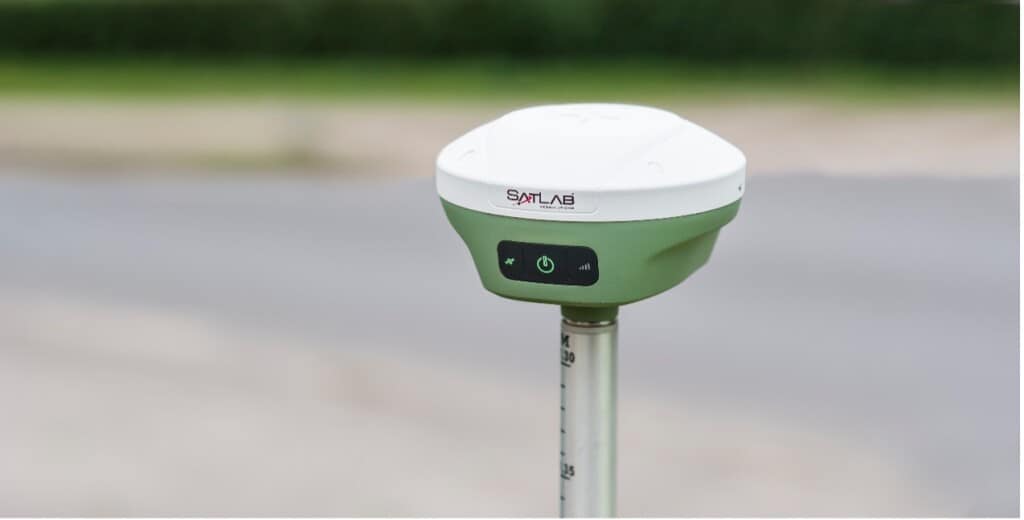
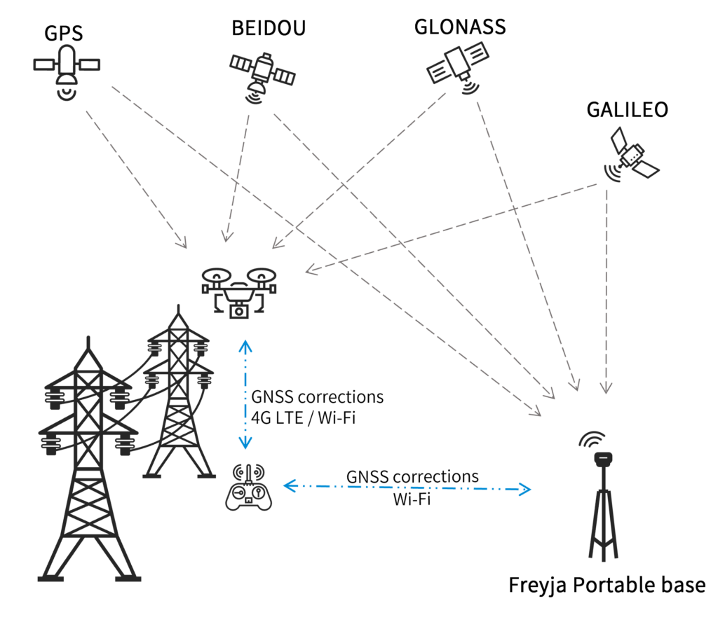
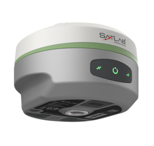
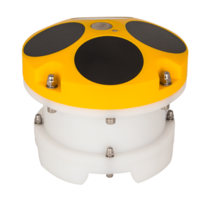
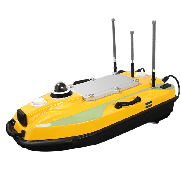
SatLab Geosolutions is a leading developer of high-precision RTK GNSS positioning solutions, handheld SLAM scanners, marine & water resources products, and total stations. With more than 40 years of experience in the GNSS industry and a strong focus on research and development, the company delivers innovative solutions to mapping and surveying professionals around the world.
Swedish engineering and technology
Surveyors and geospatial professionals depend on the most accurate and precise measurements to deliver successful outcomes. At SatLab Geosolutions, we pride ourselves on creating solutions that meet these needs with Swedish engineering and technology. We ensure that all our products meet our rigorous standards for quality checking and assurance, delivering innovative and reliable technology from the moment you begin work.
GNSS RTK Receivers
Freyja GNSS RTK Receiver
Versatile RTK-capable UAV base station
Freyja is an advanced RTK-capable GNSS receiver that is ideal for deployment as a UAV base station for professional mapping and surveying applications. Delivering highly reliable GNSS corrections for the utmost in accuracy, the full-constellation and full-frequency receiver is an indispensable tool for surveyors in the field.
Weighing just 800g, the rugged receiver is easy to carry and deploy and provides a battery life of over 12 hours. The unit’s state-of-the-art built-in antenna features enhanced anti-interference capabilities and tracking at low elevation angles. Advanced tilt compensation algorithms and a high-performance 9-axis IMU guarantee stable results even under difficult conditions.
Learn more: Freyja GNSS RTK Receiver
Eyr GNSS RTK System
GNSS receiver with dual cameras for survey & stakeout
The Eyr is an advanced RTK-capable GNSS receiver featuring two built-in HD cameras for data gathering at a distance, making it ideal for stakeouts, building elevation survey, and applications in dangerous or difficult-to-reach areas.
The integrated multi-protocol radio transceiver is compatible with multiple sources of RTK data, and provides a typical operating range of 7km outdoors.
Eyr’s state-of-the-art hardware enables stronger tracking of GNSS satellites, as well as enhanced anti-jamming and interference suppression capabilities.
Learn more: Eyr GNSS RTK System
GS-1 GNSS Sensor
Full-constellation single/dual-antenna GNSS receiver for drones & robotics
The GS-1 is a full-constellation and full-frequency GNSS receiver, designed as a universal and cost-effective positioning solution and supporting both single- and dual-antenna operations.
Featuring a powerful CPU and integrated Linux operating system, the receiver can be configured through a built-in web server. Communications options include WiFi, Bluetooth, 4G, and RS232 serial, and high-precision positioning data can be transmitted through all these simultaneously.
Learn more: GS-1 GNSS Sensor
3D Scanners
Cygnus Handheld SLAM Scanner
Mobile 3D scanner for precise point cloud acquisition
Cygnus is a mobile laser scanner for high-accuracy point cloud data gathering and 3D modelling, featuring state-of-the-art SLAM (Simultaneous Localization And Mapping) technology and algorithms. Data processing can be performed in the field thanks to real-time decoding software, and exported immediately once the scan is complete.
The versatile system can be easily mounted to UAVs and mobile mapping vehicles, and is ideal for a wide range of applications including construction survey, environmental monitoring, and modelling of indoor and GNSS-denied environments.
Learn more: Cygnus Handheld SLAM Scanner
Handheld Controllers
TBA Rugged Tablet
Industrial-grade handheld tablet for field use
The TBA is an Android-powered handheld tablet for convenient and intuitive control of UAVs and unmanned systems in the field. Featuring a 10-inch sunlight-readable screen, the rugged portable GCS (ground control station) has been designed to withstand harsh environmental conditions to IP67 and MIL-STD-810G standards.
The tablet includes built-in 3G and 4G LTE cellular connectivity with voice telephony support. An optional high-precision GNSS-enabled version is available for professional GIS applications.
Learn more: TBA Rugged Tablet
Marine & Water Resources
Njord GNSS Receiver
Multi-constellation receiver for marine applications
The Njord is a multi-frequency, multi-constellation GNSS receiver designed to provide precise positioning and heading for marine applications such as USVs. Corrections can be received via L-band, and communications options include UHF radio, cellular, Wi-Fi, Bluetooth, USB and Ethernet.
The receiver features three hours of reserve emergency power, allowing it to enter standby mode if work is interrupted unexpectedly by loss of external power.
Learn more: Njord GNSS Receiver
HydroScan Side Scan Sonar
Towed sonar with dual-frequency capability
The HydroScan is a towed side scan sonar system that uses simultaneous dual-frequency scanning to provide clear underwater imaging, switching freely between continuous waveform and chirp modes. An ultra narrow beam angle of 0.2° allows resolution of up to 1.25cm, making it easier to recognize smaller objects.
Frequency options include 100, 400 and 900 kHz. HydroScan is ideal for a wide range of applications including cable and pipeline survey, mine countermeasures, dredging, archaeology, search and recovery, and more.
Learn more: HydroScan Side Scan Sonar
HydroFlow ACDP
Current profiling system with flexible deployment
The HydroFlow is an Acoustic Doppler Current Profiler that can be mounted on a variety of unmanned marine platforms, including USVs, UUVs and buoys, to provide an accurate and easy to use discharge and flow monitoring system.
Using sophisticated broadband signal processing technology, the HydroFlow ADCP provides enhanced anti-noise performance and measurement accuracy of up to 0.25% ± 0.25cm/s.
Learn more: HydroFlow ACDP
Applications
UAV Mapping
Our GNSS solutions are ideal for carrying out high-accuracy aerial photogrammetry missions with UAVs, gathering precise geotagged imagery for the creation of orthophotos, maps and other products.
Drone-Based Surveys
Satlabs GNSS and RTK surveying equipment enables efficient data gathering in challenging environments, allowing surveyors to accurately measure stockpile volumes, create 3D LiDAR models, plan construction and mining operations, and more.