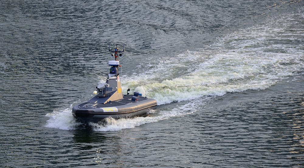
FarSounder is a leading developer of 3D forward looking sonar (FLS) technology, a valuable underwater navigation tool for USVs (unmanned surface vessels) and AUVs (autonomous underwater vehicles).
Their advanced underwater navigation sonar systems feature an extremely fast update rate that provides the entire 3D image within a single ping. FLS 3D data is highly reliable for the detection of hazards, obstacles and shallows, enhancing safety and navigation capabilities. The systems are also integratable with a vessel’s navigation controller.
Their advanced underwater sonar systems provide highly reliable detection of hazards, obstacles and shallows, enhancing safety and navigation capabilities.
Argos navigation sonar systems feature unique phased array technology with an extremely fast update rate that provides the entire 3D image within a single ping, eliminating wait time. This rapid refresh also means that results are unaffected by multipath interference, roll & pitch, surface effects, and vessel motions.
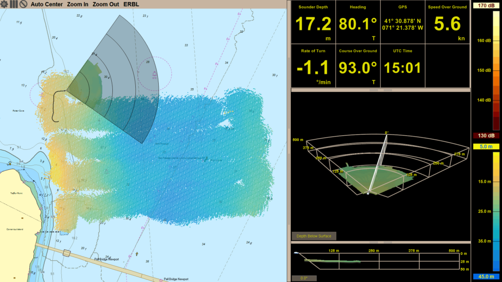
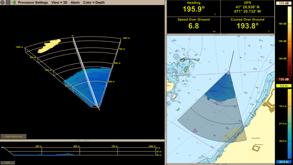
Data can be displayed on both an intuitive 3D display and as an overlay on nautical charts including S57/S63 and C-MAP Professional charts, providing an easy-to-understand interface that allows USVs to be piloted through unknown and uncharted waters. The built-in Local History Mapping capability allows users to build a colour-coded 3D map of the seafloor where the vessel has recently sailed. All Argos systems also allow users to define and set automated visual and audible alarms.
There is also an option for projects wanting to use the bathymetric data collected by the system in survey applications. Therefore, in addition to underwater navigation, the data can be exported to QPS Qinsy survey software to monitor bathymetry and detected hazards in Qinsy. Users will be able to incorporate bathymetric data collected using FarSounder’s forward looking sonar capability into their workflow.
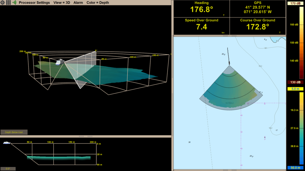
Intuitive 3D Display
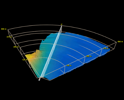
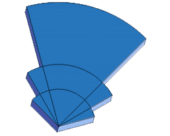
3-dimensional image ahead of a vessel at navigationally significant ranges
Sonar Over Charts
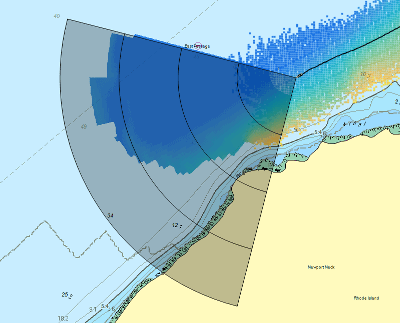
They paint a clear picture by displaying FLS data on top of a nautical chart
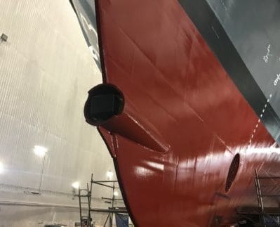
Fixed Installation
Installation design is fixed with no moving parts, suitable for many types of vessels
Fixed Update Rate
Phased array technology enables FarSounder’s sonars to generate the entire 3D image with a single ping
Our easily-integrated navigation sonar systems are ideal for both new-build and retrofitted systems, and are suitable for vessels both with and without bulbs.
3D Sonar Solutions
Argos 350 Forward Looking Sonar System
Navigation sonar for USVs
90° up to 350m range
The Argos 350 Forward Looking Sonar System is designed for vessels ranging in length from 18 to 40+ metres (60 to 130+ feet). With the ability to detect hazards and obstacles at distances of up to 350 metres ahead, it is operational at speeds up to 18 knots.
Performing a simple survey
The system provides USV operators with all the real time sonar information they need to confidently navigate reefs, shallow wrecks, icebergs and a variety of other challenging marine environments. In addition to obstacle avoidance, the 3D sonar data is crucial for a wide range of mapping and survey applications.
The Argos 350 can be installed in two different ways to suit the needs of a range of USV, AUV and unmanned vessels – an easy fixed installation, or a hoist installation in a 10-inch diameter sea chest.
The Argos 500 3D FLS provides reliable detection of shallows and underwater obstacles, hazards and targets at distances of up to 500m in front of the vessel. It can be operated on boats moving at speeds of up to 20 knots.
The system is ideal for mid-size USVs that require high-accuracy collision avoidance capabilities, or the ability to easily and conveniently map shallow underwater environments.
Short Range Seafloor Bottom Contour
Featuring a transducer with no moving parts, the Argos 500 is easily integrated into the hulls of both new-build and retrofitted vessels, and can also be built into custom third-party hoists.
120° up to 200m range 90° up to 500m range 60° up to 1000m range
The Argos 1000 is our most powerful Forward Looking Sonar system, providing reliable collision avoidance and hazard detection 1000 metres (0.5 nautical miles) in front of the vessel at operating speeds up to 25 knots.
The system is ideal for both current and future large unmanned surface vessels (USV), allowing these platforms to overcome the limitations of traditional navigation methods and allow operating crews to pilot the vessel through challenging environments with significantly reduced risk of collision.
Shoreline Detected at Long Range
The Argos 1000’s transducer has no moving parts, allowing it to be easily integrated into a variety of hull shapes on both new-build and retrofitted vessels. It can also be built into custom third-party hoists to suit specific user requirements.
Watch an introduction to the Argos 3D Forward Looking Navigation Sonar Systems:
Click the image to watch the video on YouTube
Learn more about the components of the system and how they function, as well as the most common features of FarSounder’s SonaSoft™ processing software.
When you submit this form, your personal data will be transferred to the company who will respond to you directly. See our Privacy Policy for details on how we process your data and your rights.