


Overview
Ground Control Software
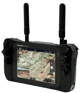
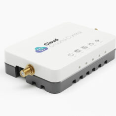
Drone Ground Controller with Software by Auterion
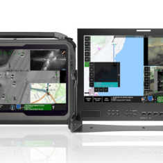
Ground control station (GCS) software for UAVs (unmanned aerial vehicles), UGVs (unmanned ground vehicles) and other robotic platforms provides pilots and payload operators with a wide range of command and control functions. It may be installed on an Android, Windows or Linux-based device such as a smartphone, tablet or laptop, or on specially developed GCS hardware. Software used for sensitive or mission-critical applications may be certified to NATO STANAG 4586 standard.
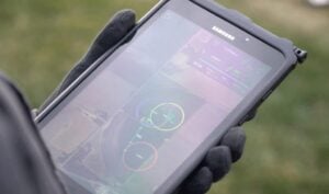
GCS software can allow an operator to control a drone or robot directly, and many UAV software platforms are set up as “virtual cockpits” with representations of actual instruments and displays that may be encountered in aircraft. The software may also overlay real-time feeds from sensors and payloads such as video cameras and EO/IR gimbals, as well as provide indicators of critical parameters such as altitude, battery life, and fuel remaining.
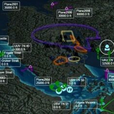
Autonomous & Real Time Control Software
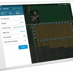
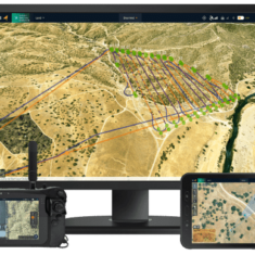
In addition to real-time control, GCS software may allow the operator to set parameters for autonomous operation, and provide compatibility with leading drone autopilots. Capabilities can include defining flight plans and setting waypoints or specific areas to be surveyed. GCS mission planners may be based around a 2D or 3D map, which in addition to altitude and topography may provide other information such as no-fly zones and temporary restrictions.
SwiftCore UAV GCS Software by Black Swift Technologies
Once autonomous behaviours have been defined, drone ground control software can provide a real time picture of the vehicle’s status and its progress through the mission. The software may be specialized for particular applications, such as mapping, surveying or search and rescue, or specific payloads such as LiDAR, other imaging systems, or environmental sensors that detect gases and chemicals, magnetic flux and other parameters. A telemetry player feature may be available that allows operators to replay the mission for further insights and analysis.
Ground Control Software Integration
UAV ground control station software may also allow geotagging of images captured by the drone, using information from the vehicle’s onboard GNSS receiver. The GCS software may also be integrated with post-processing software, allowing operators to quickly produce deliverables from the captured data.
Products (6)


Related Articles

Platinum Partners
Gold Partners
Silver Partners


 Join Thousands of Unmanned Systems Professionals
Create a UST Pro account to get full website access, the weekly eBrief and exclusive event discounts.
Join Thousands of Unmanned Systems Professionals
Create a UST Pro account to get full website access, the weekly eBrief and exclusive event discounts.


