


The European GNSS Agency (GSA) has announced that its Skyopener project has tested the benefits of multi-frequency GNSS and EGNOS for unmanned aerial systems (UAS)/Remotely Piloted Aircraft Systems (RPAS), revealing gains in terms of availability, accuracy and robustness. The project aims to pave the way towards increased use of UAS in civil applications.
There is increasing demand to operate RPAS over long distances due to their potential for a wide range of civil applications. However, regulation regarding RPAS use in civil airspace does not yet allow Beyond Visual Line of Sight (BVLOS) operations, and remotely piloted aircraft are currently not allowed to fly in non-segregated civil airspace and are not yet widely used for civil and commercial applications.
This is something that Skyopener aims to change. The project is developing operational processes that will reduce all categories of risks associated with RPAS and allow an Air Navigation Service Provider (ANSP) to manage very low level RPAS operations. Thanks to the benefits it offers in terms of improved integrity and positioning accuracy, EGNSS (GALILEO and EGNOS) will play a central role in these processes.
Through these operational processes, Skyopener will contribute to the roadmap for the integration of civil RPAS into non-segregated airspace, which will have a huge impact on the service applications that can be offered by these aircraft.
“Systems that enable RPAS to fly safely, in compliance with regulations, will enable market access and significantly reduce the cost of insurance premiums for RPAS operators, making a wide range of RPAS applications more commercially attractive and widely used,” said Marc Pollina, CEO of Skyopener consortium member M3 Systems.
A test conducted by the project into the benefits of multi-frequency GNSS and EGNOS has delivered excellent results. The test found that the use of GPS and Galileo in L1/E1 and L5/E5 multi-frequency combinations provides improved availability, better accuracy and greater robustness against interference, as interference with one frequency band has no effect on the second.
What’s more, EGNOS helps meet increasingly stringent requirements for robust navigation, continuity, accuracy and availability, which is further complemented by Galileo’s multi-constellation capacity and integration with other sensors such as inertial or vision sensors, for example.
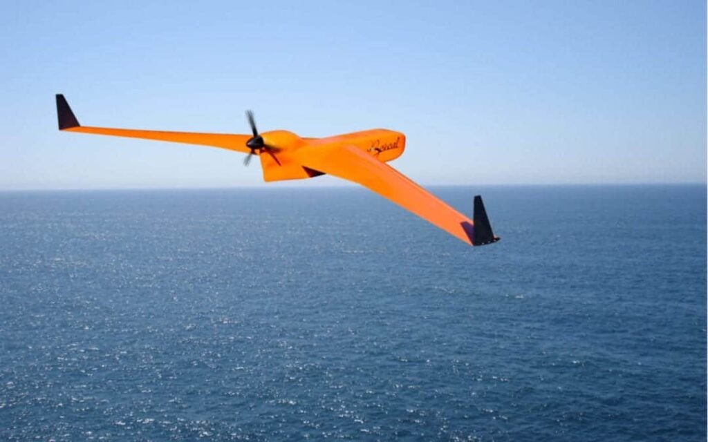
The Boreal drone used in the project is a fixed wing system that operates over a long range (over 100 km) in BVLOS, with EGNOS and GALILEO enhancing navigation by improving positioning integrity and accuracy. In addition the RPAS is equipped with a newly developed Communication and Navigation Surveillance (CNS), which combines use of GNSS, SatCom and special security measures.
GNSS technologies are essential for RPAS. The primary need is obviously for navigation, since the RPAS use GNSS waypoints to follow the trajectory defined in their mission. However, GNSS also addresses other key needs, such as ‘geofencing’ to ensure that the RPAS keep within the mission parameters (‘fences’), and surveillance to enable adequate tracking by the operator and civil aviation authority.
GNSS also enables high-accuracy and, ultimately, automated landing and the geo-referencing of collected data. These benefits will increase in the future, with the Galileo authentication service reducing the risk of threats, and PPP data correction on E6 providing better geo-referencing.
SOURCE: European GNSS Agency