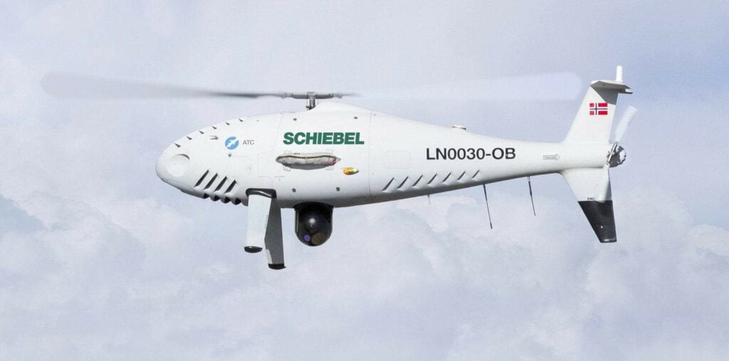
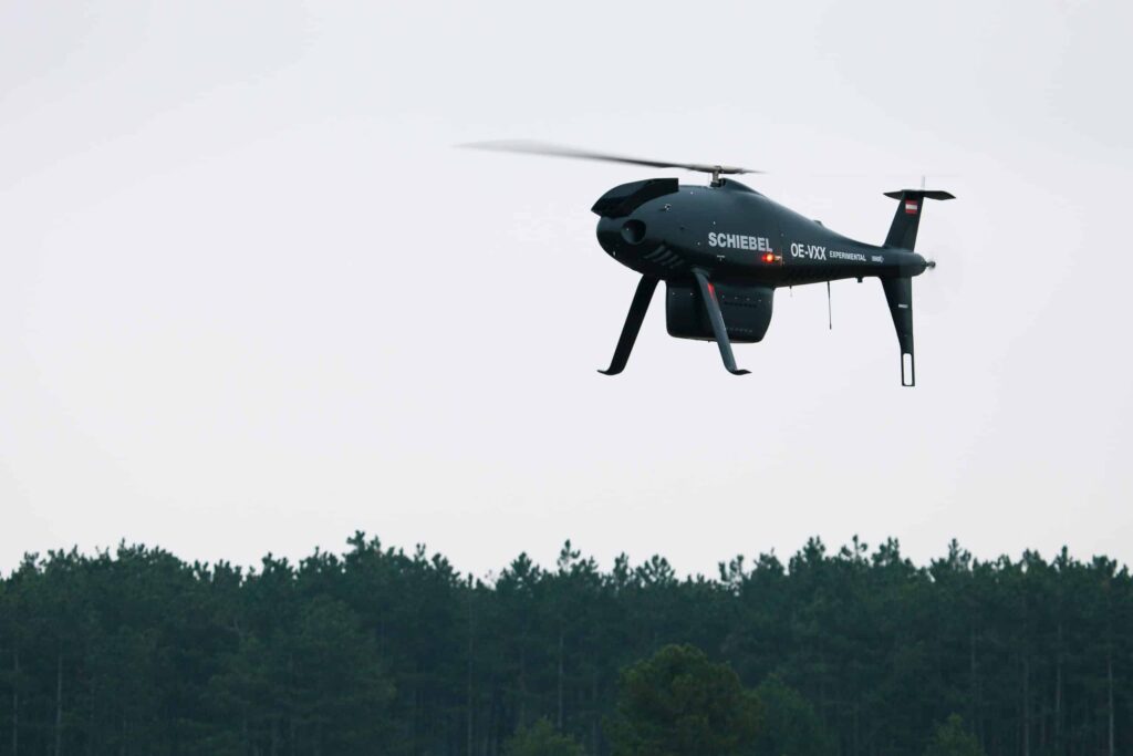
Schiebel is a global provider of state-of-the-art mine detection equipment and the internationally-renowned CAMCOPTER® S-100 Unmanned Air System (UAS). Our proven vertical takeoff and landing (VTOL) unmanned helicopter is designed to undertake a wide variety of both civilian and military applications under the most challenging of conditions.
CAMCOPTER® S-100
Civil and Military VTOL UAS
The Schiebel CAMCOPTER® S-100 is a high-performance VTOL UAS that is capable of operating day or night in harsh weather conditions. It offers proven, reliable performance, long operational ranges, accurate navigation and high data-rate communications capabilities.
Operators can assume direct control via the flight unit or pre-program the aircraft for autonomous operation with a series of GPS waypoints. The CAMCOPTER® S-100 is fitted with dually redundant Inertial Navigation Systems (INS) and Global Positioning Systems (GPS), resulting in highly accurate navigation and reliable, solid stability.
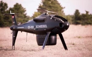
With no need for a prepared take off/landing area or launch and recovery equipment, the CAMCOPTER® S-100 is quick and easy to deploy in the field. Payload imagery, data and status information are all transmitted to the Ground Control Station in real time.
Specifications:
Performance
Maximum airspeed (VNE)
130 kn (240 km/h) IAS
Dash speed
120 kn (222 km/h) IAS
Loiter speed
55 kn (102 km/h) IAS for maximum endurance
Endurance
>6 h with 34 kg (75 lbs) payload plus optional external fuel tank extending endurance to >10 h
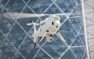
The CAMCOPTER® S-100 is a highly flexible modular system that can be fitted with payloads to serve a wide variety of missions. Capable of fielding a 50kg (110 lbs) payload capacity, the aircraft features two payload bays, an auxiliary electronics bay, two side payload hard points and the ability to fit underslung loads.
With such extensive platform expansion capabilities and the ability to field multiple sensors, the CAMCOPTER® S-100’s potential includes gathering images with an EO/IR camera, detection and identification of electronic signatures with an ESM payload and simultaneous real-time SAR radar use, all in the same system.
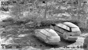
Electro-Optical/Infrared (EO/IR)
Electro-Optical/Infrared (EO/IR) gimbals provide advanced wide-area situational awareness and intelligence gathering through collection, identification, categorization and geo-location of static and moving objects of interest.
It provides real-time, high-definition video to commanders and decision makers for uninterrupted surveillance of borders, urban areas, activity and events both by day and night.
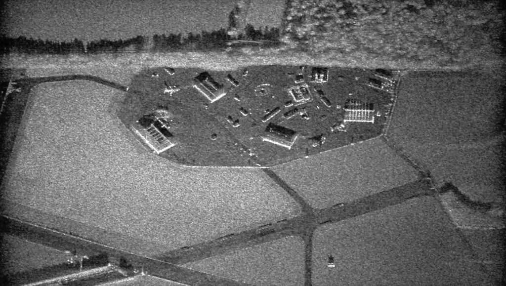
Synthetic Aperture Radar (SAR)
Synthetic Aperture Radar (SAR) is a radar system that uses the flight path of the platform to simulate an extremely large antenna or aperture electronically and generates high-resolution remote sensing imagery.
SAR creates images of an object, which can be 2D or 3D representations of the object. High-resolution SAR provides true, all-weather ground mapping and surveillance imaging, as well as Ground Moving Target Indication (GMTI).
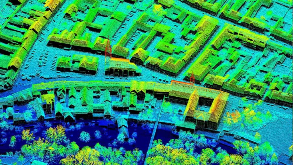
Laser Imaging Detection and Ranging (LIDAR)
Laser Imaging Detection and Ranging (LIDAR) is a remote sensing technology that measures distance by illuminating a target with laser and analyzing the reflected light.
LIDAR for 3D geographic survey systems provides geologists and mapping professionals with the ability to examine both natural and man-made environments with more accuracy, precision and flexibility, and to produce highly accurate maps and digital elevation models for use in geographic information systems.
Signals intelligence (SIGINT)
Signals intelligence (SIGINT) is intelligence gathering by interception of signals, whether it be communication between people (communications intelligence, abbreviated to COMINT) or electronic signals not directly used in communication.
It provides wide-area situational awareness and intelligence gathering by means of collection, identification, categorization and geo-location of complex emitters. Airborne COMINT significantly improves the efficiency of monitoring and intelligence missions.
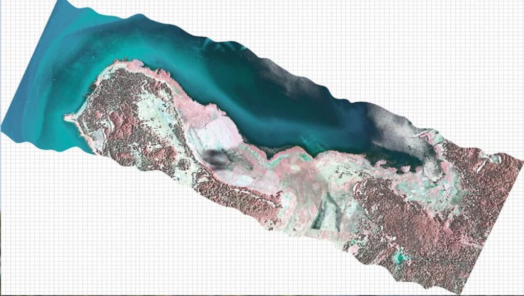
Hyperspectral imaging
Hyperspectral imaging is used to collect and process information from across the electromagnetic spectrum.
Hyperspectral sensors are ideal for mapping large geographic areas quickly and accurately, showing mineral resources development on the surface of the earth. The maps may subsequently be used to assess the relative abundance of minerals and their importance in the local geological context.
The CAMCOPTER® S-100 provides flexibility, versatility and persistence, making it a key asset for maritime and land-based civilian operations. From search and rescue missions to enhancing the creativity of a film director or monitoring power lines, the S-100’s intuitive and accessible technology makes it an ideal choice for a diverse range of users.
Search and Rescue
Timely surveillance of vast areas is critical for successful search and rescue operations. The CAMCOPTER® S-100 provides NGOs, disaster-relief personnel and first responders with an aerial perspective that enables them to more effectively and efficiently deploy and coordinate resources immediately. Easy deployment and day and night operation using real-time, full-motion video from both high-definition color-video and infrared cameras make the S-100 an effective tool for search and rescue operations.
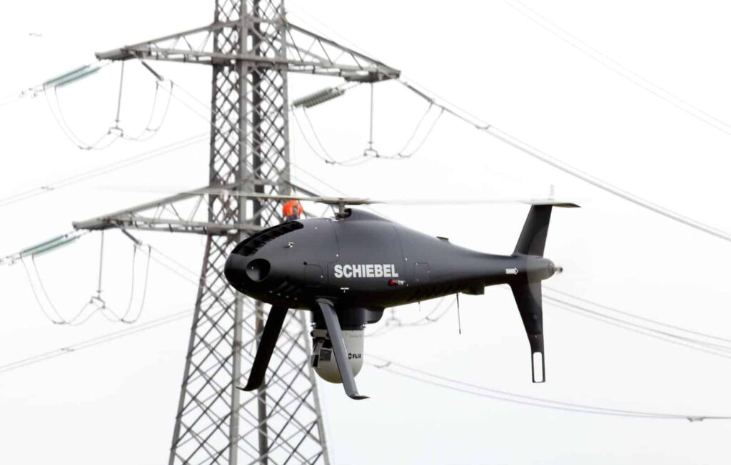
Supply Line Surveillance
Efficiency of conventional power line surveillance can be improved by using unmanned helicopters. It minimizes disruption by allowing the infrastructure to remain live during the inspection and brings considerable advantages in geographically challenging terrain, improvement in health and safety and reduction of inspection costs.
Airborne Laser Scanning
Airborne laser scanning requires highly accurate, rapid and repetitive surveying of large areas such as forests, agriculture, inshore waters and urban areas. Fitting the S-100 VTOL drone with a precision laser scanner allows for swift and accurate mapping of remote areas and proves valuable in applications such as mapping, resource exploration and urban planning.
Aerial Cinematography
The CAMCOPTER® S-100 can carry a variety of cameras capable of providing the highest-definition video. Its ability to hover and precisely maneuver for extended periods results in a truly stable platform and provides increased artistic freedom. The S-100 also has a smaller aerial footprint and is far less invasive than manned platforms, offering greater opportunities to film in more sensitive environments.
CBR Mapping
The S-100 provides an ideal platform for collecting and measuring atmospheric samples, whether they be chemical, biological or radiological (CBR). When equipped with LIDAR and color video sensors, the S-100’s ability to hover and move slowly with high navigational accuracy enables the accurate 3-dimensional mapping of CBR clouds and provides valuable information for geographers, resource extraction companies, infrastructure planners and inspectors as well as disaster response organizations.
Anti-Smuggling Operations
The demand for ever more robust border control continues to grow, especially in more difficult, austere, geographically complex environments where conventional approaches are not always effective. The CAMCOPTER® S-100 has been proven to deliver real-time information for decision makers and border patrol personnel, making the aircraft an indispensable asset in operations against contraband, drug, human or arms trafficking and organized crime.
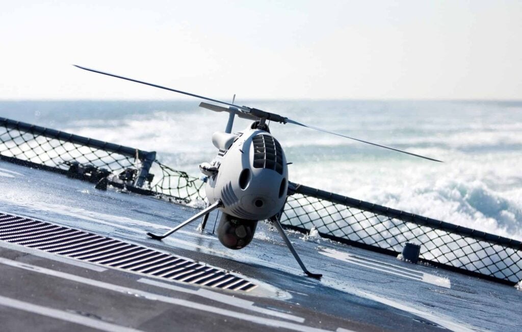
Coastal Patrol
Diminishing budgets and resources are moving ship design away from the large capital ships of the past to smaller, more cost-effective solutions where operation of conventional manned helicopters becomes considerably more difficult. Deploying a tactical rotary UAS such as the CAMCOPTER® S-100 can provide critical ISR capability. Due to its minimal footprint, the S-100 is able to operate from the decks of even small-sized ships.
The CAMCOPTER® S-100 enhances VTOL military capabilities and delivers intelligent and flexible solutions for a wide range of missions. Operational from austere sites and rapidly reconfigurable in support of different operational needs, the S-100 VTOL UAV remains close to the center of effort, on land or at sea.
Multi-Sensor VTOL Surveillance
The S-100 is the only UAS in its class that is able to carry multiple sensors simultaneously, thereby significantly extending the surveillance horizon and situational awareness of naval commanders and decision makers. The provided data is crucial to understanding the dynamic challenges of the maritime environment.
All-Oceans Solution
The S-100 has flown from 30+ different vessels in all of the world’s oceans and has proven its maritime capabilities with thousands of flight hours and takeoffs and landings. The military VTOL UAV features a fully automated shipboard landing system and successful flight-testing was conducted at wind speeds of 4 knots and sea states greater than 3.
Long-Range Reconnaissance
The unique CAMCOPTER® S-100 UAS delivers long-range real-time reconnaissance up to 200 km, satisfying a wide range of user requirements. Schiebel’s ground-control user interface offers field-proven mission planning and execution capabilities. It provides easy access and allows swift integration with higher levels of command and control systems, including payload data distribution and processing.
Flexible ISR Missions
Focused, timely ISR is an essential component of modern military operations. Featuring a whole range of payload options and highly flexible secure networking capabilities, the S-100 enables maximum efficiency in data collection and analysis. Combined with its small footprint and ability to operate from austere sites, this makes the CAMCOPTER® an ideal intelligence, surveillance and reconnaissance asset for a wide range of military and security operations.
Mission Support
Equipped with an EO/IR camera, loudspeakers and a leaflet-dropping container, the CAMCOPTER® S-100 extends decision-makers’ capability into a wide range of peace-support and stabilization operations.
When you submit this form, your personal data will be transferred to the company who will respond to you directly. See our Privacy Policy for details on how we process your data and your rights.