RIEGL is a leading developer and manufacturer of state-of-the-art, professional solutions for UAV (Unmanned Aerial Vehicle) and drone-based LiDAR surveying.
Our powerful LiDAR sensors and laser scanning systems provide reliable, high-quality data for a wide variety of commercial and civil LiDAR surveying applications, including forestry, construction, mining, topography, corridor mapping and hydrographic surveys.
LiDAR Sensors for UAV Surveying & Corridor Mapping
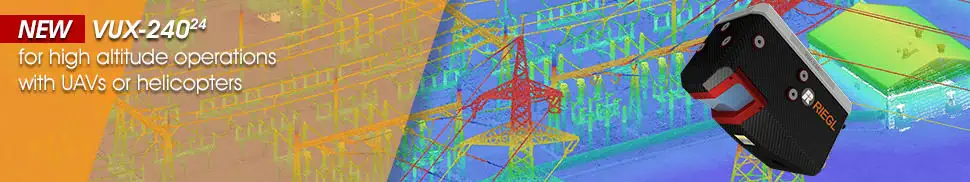
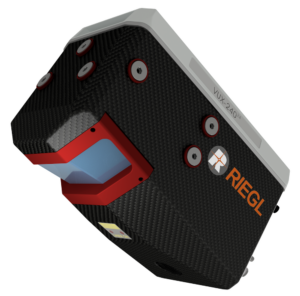
NEW RIEGL VUX-24024
Lightweight Laser Scanner for high altitude operations with UAVs
The RIEGL VUX-24024 is a lightweight airborne laser scanner designed for fixed-wing and multirotor UAVs as well as unmanned helicopters. With scan speeds of up to 600 lines per second, the system can efficiently and accurately cover large areas even from fast-moving UAVs.
A 75-degree field of view and ultra-fast data acquisition rate of up to 2.4 MHz makes the sensor ideally suited for high point density corridor mapping applications.
RIEGL’s state-of-the-art Waveform-LiDAR technology provides echo digitization, online waveform processing, and multi-target capability for penetrating even dense foliage.
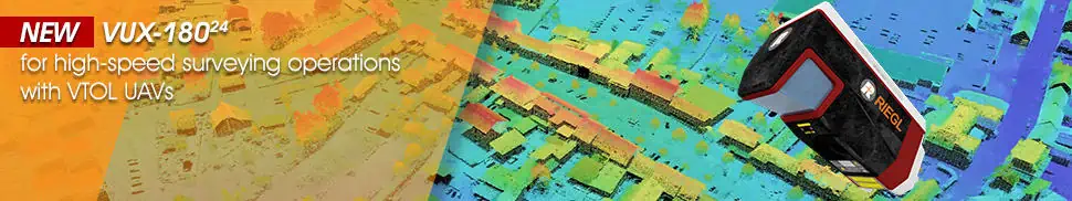
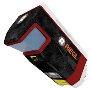
Lidar scanner for high-speed surveying applications with VTOL UAVs
The RIEGL VUX-18024 is a lightweight UAV LiDAR scanner that provides a 75-degree field of view, pulse repetition rate of up to 2.4 MHz, and scan speed of up to 800 lines/second. Thanks to these impressive features, the airborne laser scanner is ideal for high-speed survey and corridor mapping as well as other applications requiring optimal line and point distribution.
The versatile scanner provides 2 TB of internal data storage as well as a removable CFast card, and provides interfaces for connecting to up to five optional external cameras as well as external GNSS/inertial sensors. It is available as a standalone unit or as part of several fully-integrated UAV-based scanning solutions.
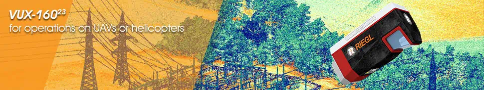
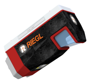
High-point-density laser scanner for operations on UAVs
The RIEGL VUX-160²³ is a versatile UAV LiDAR scanner with a 100-degree field of view and incredibly fast data acquisition rate of up to 2.4 MHz. Delivering up to 400 scan lines and 2 million effective measurements per second on the ground, it is ideal for fixed-wing UAV corridor mapping.
The system’s measuring beam consecutively scans in three different directions – strictly vertical down, +10° forward oblique, and -10° backward oblique – providing data capture with an unrivalled completeness, even in challenging environments with vertical surfaces and narrow canyons. With a multi-target capability of up to 32 targets per pulse, the scanner penetrates even dense vegetation.
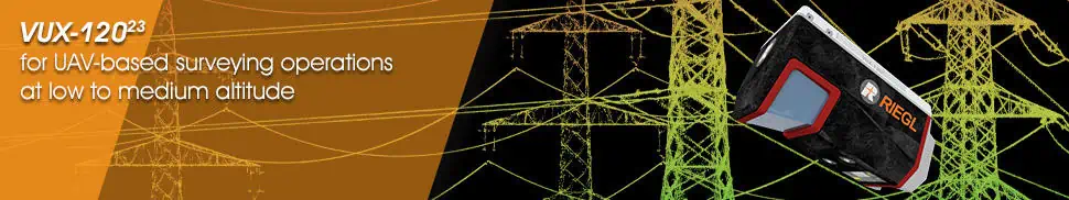
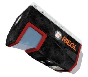
Laser scanner for UAV-based surveying operations at low to medium altitude
The RIEGL VUX-120²³ is a versatile UAV LiDAR scanner with a 100-degree field of view and incredibly fast data acquisition rate of up to 2.4 MHz. Delivering up to 400 scan lines and 2 million effective measurements per second on the ground, it is ideal for fixed-wing UAV corridor mapping.
The system’s measuring beam consecutively scans in three different directions – strictly vertical down, +10° forward oblique, and -10° backward oblique – providing data capture with an unrivalled completeness, even in challenging environments with vertical surfaces and narrow canyons. With a multi-target capability of up to 32 targets per pulse, the scanner penetrates even dense vegetation.
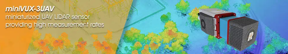
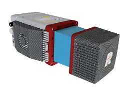
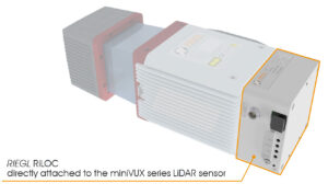
Miniaturized UAV LiDAR sensor providing high measurement rates
The RIEGL miniVUX-3UAV is a compact, lightweight laser scanner designed for the SWaP requirements of UAVs. With a selectable pulse repetition rate of up to 300 kHz, a field of view of up to 360°, and up to 200,000 measurements per second, it provides a high-density point pattern for acquisition of small details.
Unique Waveform-LiDAR technology enables echo digitization and online waveform processing, with multi-target resolution for penetrating even dense foliage. The wavelength of the miniVUX-3UAV has been optimized for the measurement of snowy and icy terrain.
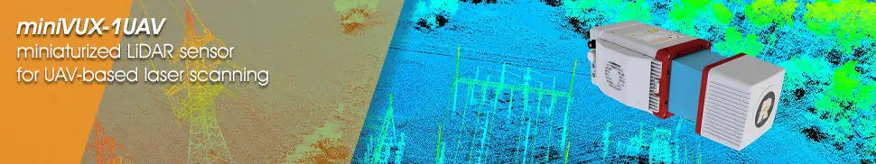
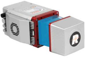
Miniaturized LiDAR sensor for UAV-based laser scanning
The RIEGL miniVUX-1UAV is an extremely lightweight laser scanner specially designed for integration into UAVs. Featuring a robust aluminium housing, the system has a small footprint that makes it ideal for unmanned platforms with restricted layouts or payload capacities.
The sensor is capable of up to 100,000 measurements per second and up to 100 scans per second with a 360-degree field of view. RIEGL’s unique Waveform-LiDAR technology allows echo digitization and online waveform processing, with multi-target resolution for penetrating even dense foliage. The wavelength of the miniVUX-1UAV is also optimized for the measurement of snowy and icy terrain.
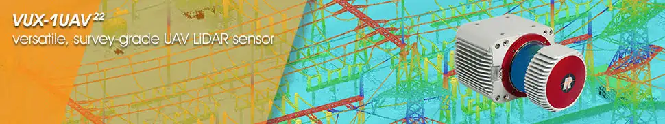
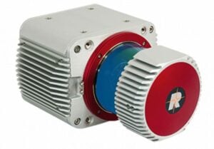
The RIEGL VUX-1UAV22 is a survey-grade LiDAR sensor, with a rugged compact design that allows it to be easily mounted to UAVs in any orientation and even under extensive SWaP constraints.
The measurement rate of up to 1200 kHz and 360-degree field of view provide superior measurement performance and practically unrestricted data acquisition.
In addition to the stand-alone LiDAR sensor, RIEGL provides the RIEGL VUX-SYS, a complete airborne laser scanning system comprising the RIEGL VUX-1UAV22, an appropriate IMU/GNSS unit, a dedicated control unit, and up to four digital cameras. This user-friendly, application- and installation-oriented solution is ready for flexible use in UAS/UAV/RPAS, helicopter, gyrocopter, and ultra-light aircraft.
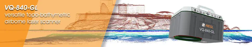
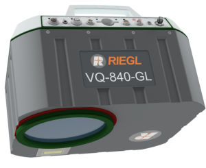
The RIEGL VQ-840-GL is a high-performance laser scanner for combined airborne topographic and bathymetric surveying. Lightweight materials and state-of-the-art design have resulted in a weight of less than 10 kg (22 lbs), making the system ideal for UAV integration.
The scanner uses a visible green laser that can penetrate water, allowing measurement of submerged targets. Digitized echo waveforms can be stored on a removable data storage card for later full waveform analysis, allowing users to capture targets with complex multiple-echo signals. The unit can also be integrated with an inertial navigation sensor and a high-resolution digital camera for further accuracy and functionality.
The RIEGL VQ-840-GL is ideal for a range of applications, including coastline and shallow-water mapping, engineering surveys, and river surveys.
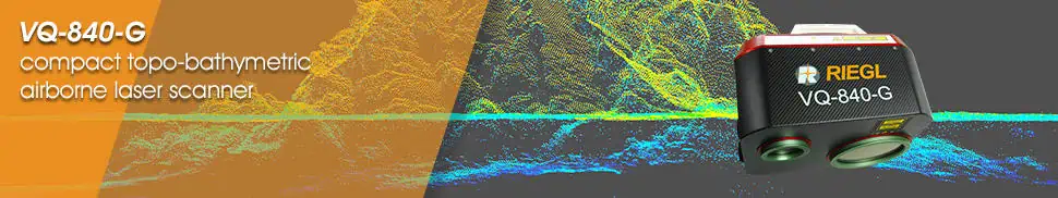
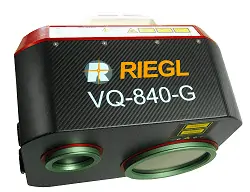
The RIEGL VQ-840-G is a compact and lightweight laser scanner for combined bathymetric and topographic surveying. The system is offered with an optionally integrated and factory-calibrated GNSS/IMU system and can be complemented with an optional camera or IR rangefinder. The VQ-840-G can be installed on various platforms including UAVs.
A visible green laser provides water penetration for high-resolution surveying of underwater topography and measurement of submerged targets. A measurement rate of up to 200 kHz and high scanning speed of up to 100 scans/sec provides superior spatial resolution, and the system offers concurrent full waveform storage of all measurements for subsequent analysis.
The VQ-840-G is ideal for a wide range of applications, including coastline and shallow water mapping, surveying for hydraulic engineering, and hydro-archaeological surveys.
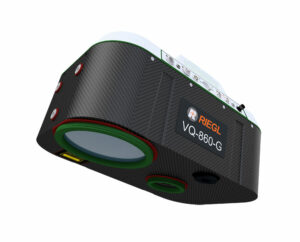
Airborne laser scanner with enhanced depth performance
The RIEGL VQ-860-G airborne laser scanner is designed for high-resolution surveying of inland and near-shore waters, and can penetrate up to 3 Secchi depths at an altitude of 75 metres. The system incorporates a digital RGB camera for colorization, as well as an optional fully-integrated GNSS/INS.
The compact unit weighs 15kg, making it suitable for larger drone platforms. It has been designed with a rugged mechanical structure and a dust- and splash- proof enclosure for long-term operation in challenging environments.
The RIEGL VQ-860-G is ideal for a wide range of applications including coastline and river mapping, hydraulic engineering survey, and hydroarchaeology.
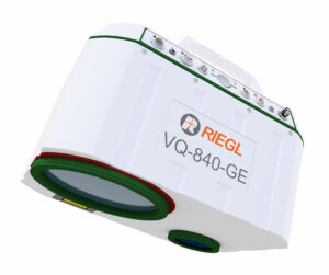
Fully integrated laser scanner for combined topographic & bathymetric survey
The RIEGL VQ-840-GE airborne laser scanner is a lightweight and compact unit designed for UAV-based combined topographic and bathymetric surveying, and can penetrate up to 2 Secchi depths at an altitude of 75 metres. The system utilizes a narrow visible green laser beam for measurement of submerged targets, and can be optionally equipped with a digital RGB camera for colorization, as well as a fully-integrated GNSS/INS.
The robust unit weighs just 9.5 kg, and has been designed with a rugged mechanical structure and a dust- and splash- proof enclosure for long-term operation in challenging environments.
The RIEGL VQ-840-GE is ideal for a wide range of applications including coastline and shallow-water mapping, reservoir survey, and river hydrology.
When you submit this form, your personal data will be transferred to the company who will respond to you directly. See our Privacy Policy for details on how we process your data and your rights.